


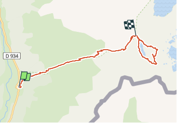

10.6 km | 19.3 km-effort


User


FREE GPS app for hiking
 SityTrail
IGN / Geographical institutes
SityTrail World
The world is yours!
Trail Walking of 8.2 km to be discovered at New Aquitaine, Pyrénées-Atlantiques, Laruns. This trail is proposed by patetl.
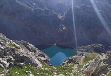
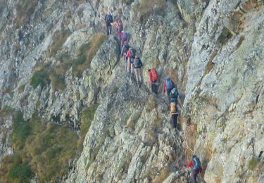
rando montagne au départ du caillou de soques. passage par pointe du lac d arrious. passage d orteig , main courante, le pic puis retour par petit col et tour du lac d arrious. puis retour col et descente sur le caillou.

Walking
Walking
Walking
Walking
On foot

Walking

Walking

Walking
Walking