Trail Walking Savignac-les-Ormeaux - D36 - GR 10 - Photo
 loic09
loic09

User

© OpenStreetMap contributors
Length
Length
15.9 km
Max alt
Max alt
2427 m
Uphill gradient
Uphill gradient
1270 m
Km-Effort
Km-Effort  
34 km
Min alt
Min alt
1060 m
Downhill gradient
Downhill gradient
1597 m
Boucle
Boucle
No
Creation date :
2014-12-10 00:00:00.0
Updated on :
2014-12-10 00:00:00.0

(0 Reviews)

Walking
Walking
6h35
Difficulty : Medium

Scan this QR Code to open this trail in the SityTrail application

FREE GPS app for hiking

Logo SityTrail SityTrail

IGN / Geographical institutes

Download SityTrail from the App Store Download SityTrail from Google Play

Logo SityTrail SityTrail World

The world is yours!

Download SityTrail from the App Store Download SityTrail from Google Play Download SityTrail on Huawei AppGallery

About

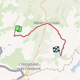
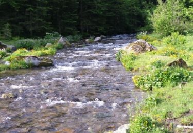
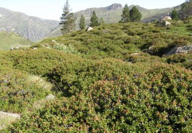
Trail Walking of 15.9 km to be discovered at Occitania, Ariège, Savignac-les-Ormeaux. This trail is proposed by loic09.

Description

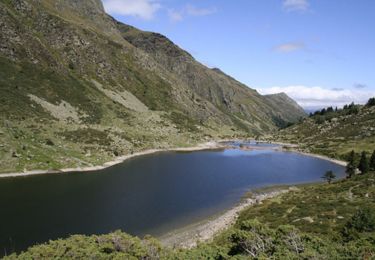
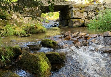
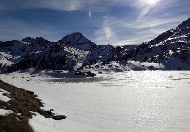
Crète de La Lhasse/Refuge des Bezines

Elevation profile

Points of interest

Point of interest Mérens-les-Vals -  - Photo
loic09
MÉRENS-LES-VALS 

Positioning

Country:
France
Region :
Occitania
Department/Province :
Ariège
Municipality :
Savignac-les-Ormeaux
Location:
Unknown
Start:(UTM)
398815 ; 4721295 (31T) N.

Trails nearby

Trail Walking Mérens-les-Vals - Etang de Comte - Merens les Vals - Photo
Walking
tracegps

Walking

Medium
(1)
Mérens-les-Vals, Occitania, Ariège, France
6.8 km | 10.7 km-effort
2h 15min
Yes
Trail Walking Aston - GR10-4 - Photo
Walking
GUIDE
viaul

Walking

Difficult
(1)
Aston, Occitania, Ariège, France
12.1 km | 18.7 km-effort
3h 34min
No
Trail Walking Aston - Etangs de Fontargenta - Photo
Walking
sebdepuje

Walking

Medium
(1)
Aston, Occitania, Ariège, France
10.9 km | 19.4 km-effort
Unknown
Yes
Trail Walking Savignac-les-Ormeaux - 2022 TRANSPYRÉNÉENNE : Auberge de Ruhle - Mèrens les Vals ( Auberge du N’abréger) - Photo
Walking
LEGUE

Walking

Medium
Savignac-les-Ormeaux, Occitania, Ariège, France
11.8 km | 19.8 km-effort
3h 27min
No
Trail Walking Aston - etang de Montaut - Photo
Walking
rolandariege

Walking

Easy
Aston, Occitania, Ariège, France
10.9 km | 19.4 km-effort
5h 32min
Yes
Trail Walking Mérens-les-Vals - le lac Couart - Photo
Walking
MarieFrancoise

Walking

Difficult
Mérens-les-Vals, Occitania, Ariège, France
15 km | 26 km-effort
7h 33min
Yes
Trail Walking Aston - Ariège - refuge du ruhle - Photo
Walking
tracegps

Walking

Medium
Aston, Occitania, Ariège, France
18.6 km | 31 km-effort
13h 0min
Yes
Trail Walking L'Hospitalet-près-l'Andorre - L'hospitalet-Pres-l'Andorre - Photo
Walking
AdrienB

Walking

Medium
L'Hospitalet-près-l'Andorre, Occitania, Ariège, France
3.9 km | 5.8 km-effort
1h 41min
No
Trail Walking Ax-les-Thermes - plateau du saquet ax les thermes - Photo
Walking
gamille67

Walking

Medium
Ax-les-Thermes, Occitania, Ariège, France
18.1 km | 27 km-effort
4h 13min
No


Close
My subscriptions