Trail Touring skiing Hauteluce - Rocher des enclaves et montagne d'outray - Photo

Rocher des enclaves et montagne d'outray

 nadd73
nadd73

User

© OpenStreetMap contributors
Length
Length
14 km
Max alt
Max alt
2300 m
Uphill gradient
Uphill gradient
1442 m
Km-Effort
Km-Effort  
33 km
Min alt
Min alt
1155 m
Downhill gradient
Downhill gradient
1443 m
Boucle
Boucle
Yes
Creation date :
2022-01-13 08:45:43.567
Updated on :
2022-01-13 19:12:36.827

(0 Reviews)

Touring skiing
Touring skiing
6h04
Difficulty : Medium

Scan this QR Code to open this trail in the SityTrail application

FREE GPS app for hiking

Logo SityTrail SityTrail

IGN / Geographical institutes

Download SityTrail from the App Store Download SityTrail from Google Play

Logo SityTrail SityTrail World

The world is yours!

Download SityTrail from the App Store Download SityTrail from Google Play Download SityTrail on Huawei AppGallery

About

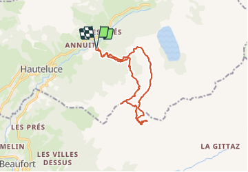
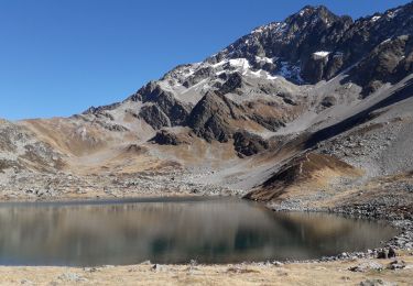
Trail Touring skiing of 14 km to be discovered at Auvergne-Rhône-Alpes, Savoy, Hauteluce. This trail is proposed by nadd73.

Description

Départ des Granges.
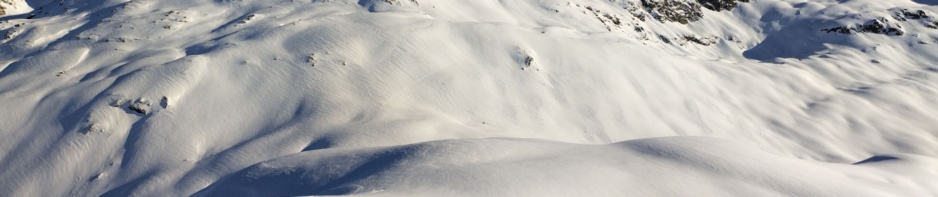
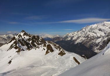
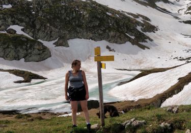
le Rocher des enclaves n'était pas tracé. je suis montée au dessus du col mais la neige et la pente m'ont fait renoncer. Après une descente je suis montée ailleurs, moins raide mais la neige était plaquée donc descente, montée à la montagne d'outray et une descente face Nord géniale, en poudre. Vers le ruisseau c'ést sanglier.

Elevation profile

Photos

Positioning

Country:
France
Region :
Auvergne-Rhône-Alpes
Department/Province :
Savoy
Municipality :
Hauteluce
Location:
Unknown
Start:(UTM)
314359 ; 5069907 (32T) N.

Trails nearby

Trail Walking Hauteluce - SityTrail - col de la fenêtre  - Photo
Walking
bob2023

Walking

Medium
(1)
Hauteluce, Auvergne-Rhône-Alpes, Savoy, France
7.8 km | 12.4 km-effort
2h 34min
Yes
Trail Walking Hauteluce - Hauteluce - Photo
Walking
albertville

Walking

Very easy
(2)
Hauteluce, Auvergne-Rhône-Alpes, Savoy, France
4.1 km | 7.4 km-effort
1h 54min
Yes
Trail Walking Hauteluce - Mont Clocher - Photo
Walking
aglagla5

Walking

Very easy
(2)
Hauteluce, Auvergne-Rhône-Alpes, Savoy, France
7.3 km | 10.4 km-effort
1h 47min
Yes
Trail Walking Hauteluce - val d arly mont clocher - Photo
Walking
anniediot

Walking

Very easy
(1)
Hauteluce, Auvergne-Rhône-Alpes, Savoy, France
9.6 km | 13.4 km-effort
3h 35min
Yes
Trail Touring skiing Hauteluce - Col de cicle en passant par un couloir et col de la fenêtre  - Photo
Touring skiing
nadd73

Touring skiing

Medium
Hauteluce, Auvergne-Rhône-Alpes, Savoy, France
19 km | 33 km-effort
5h 33min
Yes
Trail Walking Les Contamines-Montjoie - lacs Jovet par le col de la fenêtre  - Photo
Walking
fafa74

Walking

Difficult
Les Contamines-Montjoie, Auvergne-Rhône-Alpes, Upper Savoy, France
16.9 km | 30 km-effort
5h 32min
Yes
Trail Walking Beaufort - Plan du Mont - Outray - Col du Sallestet - Lac Noir - Plan des Mouillés Nord - Parking du Sapin - la Journée - Plan du Mont - Photo
Walking
bill73

Walking

Very difficult
Beaufort, Auvergne-Rhône-Alpes, Savoy, France
26 km | 43 km-effort
4h 48min
No
Trail Walking Hauteluce - Mont Clocher - Photo
Walking
christian06

Walking

Very easy
Hauteluce, Auvergne-Rhône-Alpes, Savoy, France
7.8 km | 10.6 km-effort
2h 23min
No
Trail Walking Hauteluce - Barrage de la Girotte - Photo
Walking
sereton

Walking

Easy
Hauteluce, Auvergne-Rhône-Alpes, Savoy, France
8.7 km | 14.5 km-effort
2h 46min
Yes


Close
My subscriptions