


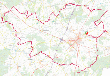
11.7 km | 13.9 km-effort


Tous les sentiers balisés d’Europe PRO


FREE GPS app for hiking
 SityTrail
IGN / Geographical institutes
SityTrail World
The world is yours!
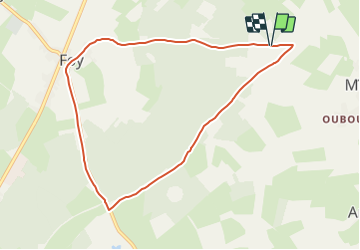
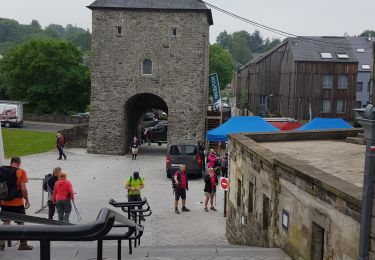
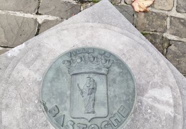
Trail On foot of 7.9 km to be discovered at Wallonia, Luxembourg, Bastogne. This trail is proposed by SityTrail - itinéraires balisés pédestres.
Trail created by Syndicat d'Iniative de Bastogne.
Symbol: Losange vert


Walking
Walking
Walking

On foot

On foot
On foot

On foot
On foot
Walking
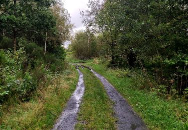
Mooie wandeling maar veel over de weg. Dat is jammer