


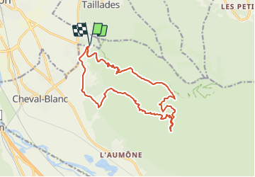

16.7 km | 27 km-effort


User


FREE GPS app for hiking
 SityTrail
IGN / Geographical institutes
SityTrail World
The world is yours!
Trail Mountain bike of 17.7 km to be discovered at Provence-Alpes-Côte d'Azur, Vaucluse, Cheval-Blanc. This trail is proposed by denel.
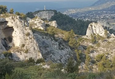
Grande montée goudronnée de 45 mns bien cardio régulière puis descente goudronnée tranquille qui débouche sur un beau single dans la forêt assez caillouteux mais facile sans grosse difficulté et pour finir on rentre en longeant le canal

Walking

Cycle

Cycle

Cycle

Walking

Walking

Walking
Walking

Mountain bike