Trail Cycle Cavaillon - Parcours n°1 - Cavaillon - Photo

Randonnées de Vélo Loisir Provence GUIDE+

© OpenStreetMap contributors
Length
Length
33 km
Max alt
Max alt
554 m
Uphill gradient
Uphill gradient
597 m
Km-Effort
Km-Effort  
41 km
Min alt
Min alt
72 m
Downhill gradient
Downhill gradient
597 m
Boucle
Boucle
Yes
Creation date :
2015-03-19 00:00:00.0
Updated on :
2015-03-19 00:00:00.0

(2 Reviews)

Cycle
Cycle
2h21
Difficulty : Difficult

Scan this QR Code to open this trail in the SityTrail application

FREE GPS app for hiking

Logo SityTrail SityTrail

IGN / Geographical institutes

Download SityTrail from the App Store Download SityTrail from Google Play

Logo SityTrail SityTrail World

The world is yours!

Download SityTrail from the App Store Download SityTrail from Google Play Download SityTrail on Huawei AppGallery

About

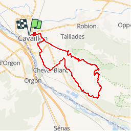
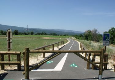
Trail Cycle of 33 km to be discovered at Provence-Alpes-Côte d'Azur, Vaucluse, Cavaillon. This trail is proposed by Vélo Loisir Provence.

Description

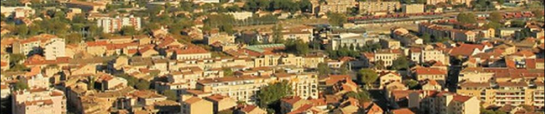
You will ride and climb The first crests of the petit Luberon in order to discover the landscapes of the Durance Valley. You will also have a view on this amazing colline St Jacques which overhang Cavaillon city. At the top of the mountain, you really deserve the view since the slope is stiff. Direction of the itinerary : Cavaillon => Cheval-blanc => Cavaillon

Elevation profile

Photos

Positioning

Country:
France
Region :
Provence-Alpes-Côte d'Azur
Department/Province :
Vaucluse
Municipality :
Cavaillon
Location:
Unknown
Start:(UTM)
663614 ; 4855502 (31T) N.

Comments

Please log in to post a review or rate the element


attention c'est pour le vtt ou gravel


Trails nearby

Trail Cycle Cavaillon - Autour du Luberon à vélo - Photo
Cycle
GUIDE+

Cycle

Difficult
(4)
Cavaillon, Provence-Alpes-Côte d'Azur, Vaucluse, France
236 km | 285 km-effort
15h 46min
Yes
Trail Cycle Cavaillon - Parcours n°3 - Cavaillon - Photo
Cycle
GUIDE+

Cycle

Easy
(2)
Cavaillon, Provence-Alpes-Côte d'Azur, Vaucluse, France
45 km | 50 km-effort
2h 55min
No
Trail Walking Orgon - plan Orgon di19mai2013 - Photo
Walking
tvtv84

Walking

Easy
(2)
Orgon, Provence-Alpes-Côte d'Azur, Bouches-du-Rhône, France
16 km | 18.8 km-effort
4h 28min
Yes
Trail Walking Taillades - Les Taillades-De la source du Boulon au Castelas - Gorge de Badarel sous la neige - Photo
Walking
tracegps

Walking

Difficult
(1)
Taillades, Provence-Alpes-Côte d'Azur, Vaucluse, France
7 km | 10.8 km-effort
3h 0min
Yes
Trail Walking Taillades - Taillades Badarel  Brayette Robion - Photo
Walking
kephas

Walking

Difficult
(1)
Taillades, Provence-Alpes-Côte d'Azur, Vaucluse, France
10.6 km | 17.6 km-effort
3h 41min
Yes
Trail Walking Cheval-Blanc - bergerie/badarel - Photo
Walking
fireman84

Walking

Medium
(1)
Cheval-Blanc, Provence-Alpes-Côte d'Azur, Vaucluse, France
9.9 km | 16 km-effort
3h 20min
Yes
Trail Mountain bike Cheval-Blanc - vidok vtt - Photo
Mountain bike
fireman84

Mountain bike

Difficult
(2)
Cheval-Blanc, Provence-Alpes-Côte d'Azur, Vaucluse, France
17.4 km | 24 km-effort
1h 36min
Yes
Trail Mountain bike Cavaillon - Foret des cêdres D+850m par veloroute Calavon - Photo
Mountain bike
ericberlin

Mountain bike

Very difficult
Cavaillon, Provence-Alpes-Côte d'Azur, Vaucluse, France
55 km | 66 km-effort
4h 35min
Yes
Trail Walking Orgon - Orgon Vallée Heureuse - Photo
Walking
GUIDE
nadinebondoux

Walking

Medium
Orgon, Provence-Alpes-Côte d'Azur, Bouches-du-Rhône, France
18.7 km | 25 km-effort
5h 1min
Yes


Close
My subscriptions