Trail Walking Saint-Chéron - Autour de Saint Chéron - Photo

Autour de Saint Chéron

 tracegps
tracegps

User

© OpenStreetMap contributors
Length
Length
24 km
Max alt
Max alt
166 m
Uphill gradient
Uphill gradient
456 m
Km-Effort
Km-Effort  
30 km
Min alt
Min alt
61 m
Downhill gradient
Downhill gradient
459 m
Boucle
Boucle
Yes
Creation date :
2014-12-10 00:00:00.0
Updated on :
2014-12-10 00:00:00.0

(0 Reviews)

Walking
Walking
5h00
Difficulty : Medium

Scan this QR Code to open this trail in the SityTrail application

FREE GPS app for hiking

Logo SityTrail SityTrail

IGN / Geographical institutes

Download SityTrail from the App Store Download SityTrail from Google Play

Logo SityTrail SityTrail World

The world is yours!

Download SityTrail from the App Store Download SityTrail from Google Play Download SityTrail on Huawei AppGallery

About

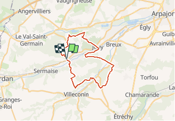
Trail Walking of 24 km to be discovered at Ile-de-France, Essonne, Saint-Chéron. This trail is proposed by tracegps.

Description

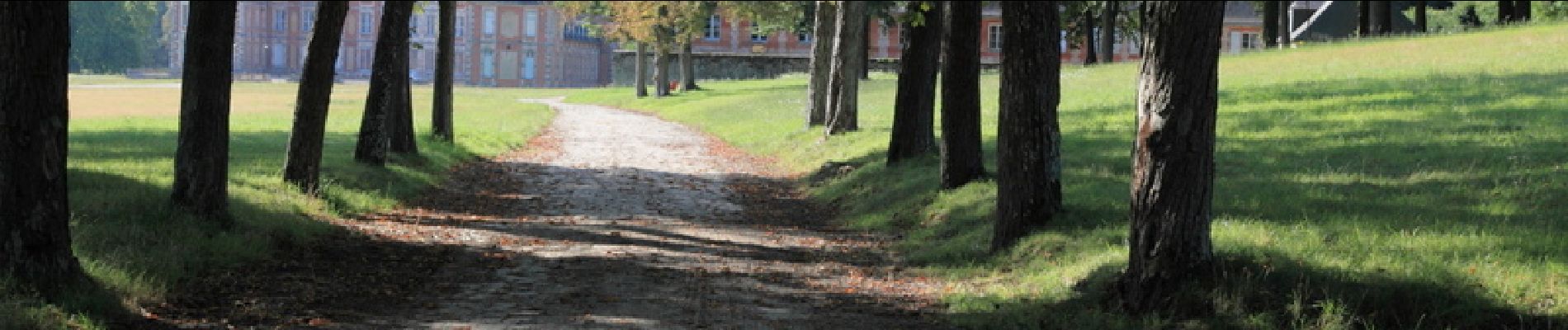
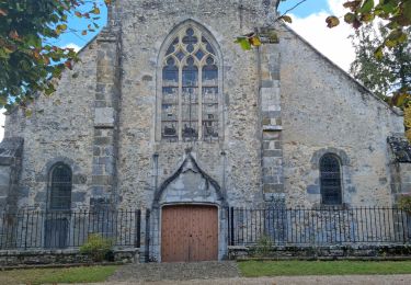
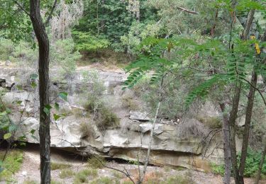
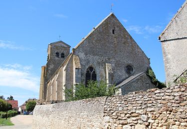
Au départ des faubourgs Est de Saint Chéron, ce parcours propose une large boucle autour de cette ville. Parmi les points d’intérêt, on peut citer le château de Baville, le château de Souzy la Briche et l’église de Saint Sulpice de Favières. Il alterne plateaux et vallons, et franchit deux fois chacune des vallées de l’Orge et de la Renarde.

Elevation profile

Photos

Positioning

Country:
France
Region :
Ile-de-France
Department/Province :
Essonne
Municipality :
Saint-Chéron
Location:
Unknown
Start:(UTM)
434383 ; 5377476 (31U) N.

Trails nearby

Trail Walking Saint-Sulpice-de-Favières - Les Pétales de Souzy - Photo
Walking
tracegps

Walking

Difficult
(1)
Saint-Sulpice-de-Favières, Ile-de-France, Essonne, France
23 km | 29 km-effort
4h 49min
Yes
Trail Walking Saint-Sulpice-de-Favières - St Sulpice - Photo
Walking
Auger91

Walking

Medium
(1)
Saint-Sulpice-de-Favières, Ile-de-France, Essonne, France
8 km | 10.1 km-effort
2h 18min
Yes
Trail Walking Sermaise - 2018-09-26 Rando Sermaise - Photo
Walking
jchezlemas

Walking

Easy
(1)
Sermaise, Ile-de-France, Essonne, France
12.3 km | 15 km-effort
3h 15min
Yes
Trail Walking Villeconin - Villeconin - Photo
Walking
guydu41

Walking

Medium
Villeconin, Ile-de-France, Essonne, France
8.5 km | 10.9 km-effort
2h 11min
Yes
Trail Walking Souzy-la-Briche - Carrières de Madagascar à Souzy-la-Briche  - Photo
Walking
guydu41

Walking

Medium
Souzy-la-Briche, Ile-de-France, Essonne, France
6.8 km | 8.3 km-effort
1h 52min
Yes
Trail Walking Saint-Maurice-Montcouronne - Boucle St Maurice Montcouronne - Brigitte - Photo
Walking
chessyca

Walking

Very easy
Saint-Maurice-Montcouronne, Ile-de-France, Essonne, France
21 km | 24 km-effort
4h 19min
Yes
Trail On foot Saint-Sulpice-de-Favières - Randonnée Saint-Sulpice-de-Favieres n°2 - Photo
On foot
Jean Pierre Parent

On foot

Medium
Saint-Sulpice-de-Favières, Ile-de-France, Essonne, France
20 km | 25 km-effort
4h 51min
Yes
Trail Walking Souzy-la-Briche - Rumba à Souzy la briche - Photo
Walking
philou91

Walking

Easy
Souzy-la-Briche, Ile-de-France, Essonne, France
7.6 km | 9.3 km-effort
2h 29min
Yes
Trail On foot Boissy-le-Sec - Sur les traces de la Renarde - Photo
On foot
PRO

On foot

Easy
Boissy-le-Sec, Ile-de-France, Essonne, France
6.3 km | 7.4 km-effort
1h 40min
No


Close
My subscriptions