Trail Walking Veynes - Charajaille - Photo
 Marco05
Marco05

User

© OpenStreetMap contributors
Length
Length
8.1 km
Max alt
Max alt
1778 m
Uphill gradient
Uphill gradient
606 m
Km-Effort
Km-Effort  
16.2 km
Min alt
Min alt
1168 m
Downhill gradient
Downhill gradient
605 m
Boucle
Boucle
Yes
Creation date :
2022-04-01 12:00:27.342
Updated on :
2024-03-18 09:58:20.267

(1 Reviews)

Walking
Walking
3h41
Difficulty : Difficult

Scan this QR Code to open this trail in the SityTrail application

FREE GPS app for hiking

Logo SityTrail SityTrail

IGN / Geographical institutes

Download SityTrail from the App Store Download SityTrail from Google Play

Logo SityTrail SityTrail World

The world is yours!

Download SityTrail from the App Store Download SityTrail from Google Play Download SityTrail on Huawei AppGallery

About

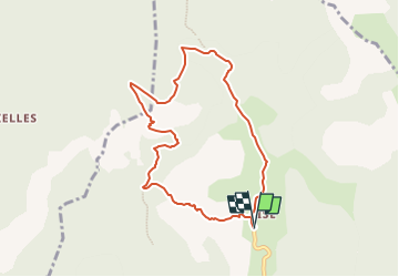
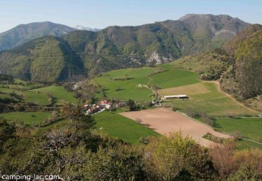
Trail Walking of 8.1 km to be discovered at Provence-Alpes-Côte d'Azur, Hautes-Alpes, Veynes. This trail is proposed by Marco05.

Description

Randonnée au nord de Veynes.
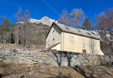
Suivre la direction de Glaise. Stationner 500m avant le village.
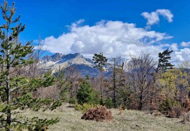
Prendre la piste à gauche en direction du col de Berthaud.

Elevation profile

Photos

Positioning

Country:
France
Region :
Provence-Alpes-Côte d'Azur
Department/Province :
Hautes-Alpes
Municipality :
Veynes
Location:
Unknown
Start:(UTM)
724300 ; 4939452 (31T) N.

Comments

Please log in to post a review or rate the element


Trails nearby

Trail Walking Veynes - R06   glaise - Photo
Walking
GUIDE+

Walking

Easy
(1)
Veynes, Provence-Alpes-Côte d'Azur, Hautes-Alpes, France
9.1 km | 14.9 km-effort
3h 4min
Yes
Trail Walking Montmaur - Montmaur Le Terrail - Photo
Walking
Marco05

Walking

Easy
(1)
Montmaur, Provence-Alpes-Côte d'Azur, Hautes-Alpes, France
5.3 km | 6.2 km-effort
1h 22min
Yes
Trail On foot Aspres-sur-Buëch - 9587028 - Photo
On foot
GUIDE+

On foot

Easy
Aspres-sur-Buëch, Provence-Alpes-Côte d'Azur, Hautes-Alpes, France
3.4 km | 5.3 km-effort
1h 12min
Yes
Trail Mountain bike Montmaur - VTT28 - Rabioux - Photo
Mountain bike
GUIDE+

Mountain bike

Difficult
Montmaur, Provence-Alpes-Côte d'Azur, Hautes-Alpes, France
24 km | 36 km-effort
2h 12min
Yes
Trail Walking Furmeyer - R04  Le sentier botanique de Furmeyer - Photo
Walking
GUIDE+

Walking

Easy
(2)
Furmeyer, Provence-Alpes-Côte d'Azur, Hautes-Alpes, France
4 km | 6.9 km-effort
1h 34min
Yes
Trail Walking Furmeyer - Pic de la Fayole - Photo
Walking
jlv05

Walking

Difficult
(1)
Furmeyer, Provence-Alpes-Côte d'Azur, Hautes-Alpes, France
5.4 km | 10.4 km-effort
2h 11min
Yes
Trail Walking Furmeyer - Furmeyer - Le Fays - Photo
Walking
PapouBertrand

Walking

Very difficult
Furmeyer, Provence-Alpes-Côte d'Azur, Hautes-Alpes, France
11.3 km | 22 km-effort
4h 57min
Yes
Trail Walking Montmaur - Les Sauvas - Photo
Walking
Marco05

Walking

Medium
Montmaur, Provence-Alpes-Côte d'Azur, Hautes-Alpes, France
12.9 km | 21 km-effort
4h 42min
Yes
Trail Walking Veynes - Champérus-Oriol - Photo
Walking
Marco05

Walking

Difficult
Veynes, Provence-Alpes-Côte d'Azur, Hautes-Alpes, France
8 km | 16.6 km-effort
3h 45min
No


Close
My subscriptions