Trail Mountain bike Cheval-Blanc - cheval blanc les taillades - Photo
© OpenStreetMap contributors
Length
Length
21 km
Max alt
Max alt
194 m
Uphill gradient
Uphill gradient
320 m
Km-Effort
Km-Effort  
25 km
Min alt
Min alt
86 m
Downhill gradient
Downhill gradient
322 m
Boucle
Boucle
No
Creation date :
2014-12-10 00:00:00.0
Updated on :
2014-12-10 00:00:00.0

(0 Reviews)

Mountain bike
Mountain bike
1h55
Difficulty : Medium

Scan this QR Code to open this trail in the SityTrail application

FREE GPS app for hiking

Logo SityTrail SityTrail

IGN / Geographical institutes

Download SityTrail from the App Store Download SityTrail from Google Play

Logo SityTrail SityTrail World

The world is yours!

Download SityTrail from the App Store Download SityTrail from Google Play Download SityTrail on Huawei AppGallery

About

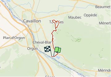
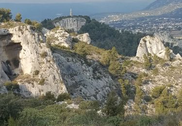
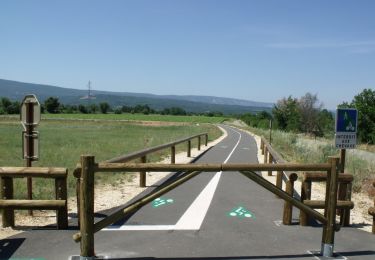
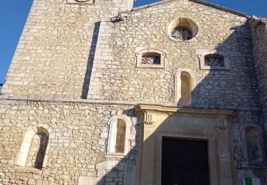
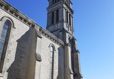
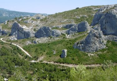
Trail Mountain bike of 21 km to be discovered at Provence-Alpes-Côte d'Azur, Vaucluse, Cheval-Blanc. This trail is proposed by nikos2904.

Description

Rando roulante un passage court difficile

Elevation profile

Photos

Positioning

Country:
France
Region :
Provence-Alpes-Côte d'Azur
Department/Province :
Vaucluse
Municipality :
Cheval-Blanc
Location:
Unknown
Start:(UTM)
667937 ; 4849280 (31T) N.

Trails nearby

Trail Walking Orgon - Orgon-vallée heureuse - Photo
Walking
Berpav

Walking

Difficult
(1)
Orgon, Provence-Alpes-Côte d'Azur, Bouches-du-Rhône, France
10.7 km | 13.4 km-effort
2h 27min
Yes
Trail Walking Cheval-Blanc - bergerie/badarel - Photo
Walking
fireman84

Walking

Medium
(1)
Cheval-Blanc, Provence-Alpes-Côte d'Azur, Vaucluse, France
9.9 km | 16 km-effort
3h 20min
Yes
Trail Mountain bike Cheval-Blanc - Cheval-Blanc  - Photo
Mountain bike
nikos2904

Mountain bike

Medium
(2)
Cheval-Blanc, Provence-Alpes-Côte d'Azur, Vaucluse, France
22 km | 29 km-effort
2h 16min
Yes
Trail Mountain bike Cheval-Blanc - vidok vtt - Photo
Mountain bike
fireman84

Mountain bike

Difficult
(2)
Cheval-Blanc, Provence-Alpes-Côte d'Azur, Vaucluse, France
17.4 km | 24 km-effort
1h 36min
Yes
Trail Mountain bike Cavaillon - Foret des cêdres D+850m par veloroute Calavon - Photo
Mountain bike
ericberlin

Mountain bike

Very difficult
Cavaillon, Provence-Alpes-Côte d'Azur, Vaucluse, France
55 km | 66 km-effort
4h 35min
Yes
Trail Walking Orgon - Orgon Vallée Heureuse - Photo
Walking
GUIDE
nadinebondoux

Walking

Medium
Orgon, Provence-Alpes-Côte d'Azur, Bouches-du-Rhône, France
18.7 km | 25 km-effort
5h 1min
Yes
Trail Walking Orgon - ORGON (13)  L' Adeline - Photo
Walking
Manoune

Walking

Medium
Orgon, Provence-Alpes-Côte d'Azur, Bouches-du-Rhône, France
17.3 km | 22 km-effort
5h 45min
Yes
Trail On foot Orgon - Tracé_22-JUIN-20 142647 - Photo
On foot
rigol05

On foot

Easy
Orgon, Provence-Alpes-Côte d'Azur, Bouches-du-Rhône, France
10.7 km | 13.6 km-effort
Unknown
Yes
Trail Other activity Orgon - SityTrail - Orgon - Photo
Other activity
Berpav

Other activity

Very easy
(2)
Orgon, Provence-Alpes-Côte d'Azur, Bouches-du-Rhône, France
10.5 km | 13.2 km-effort
Unknown
Yes


Close
My subscriptions