Trail Walking Pralognan-la-Vanoise - 2022-06-28 Marche TGV Refuge Valette Pralognan - Photo

2022-06-28 Marche TGV Refuge Valette Pralognan

 holtzv
holtzv

User GUIDE

© OpenStreetMap contributors
Length
Length
8.4 km
Max alt
Max alt
2596 m
Uphill gradient
Uphill gradient
333 m
Km-Effort
Km-Effort  
16 km
Min alt
Min alt
1639 m
Downhill gradient
Downhill gradient
1280 m
Boucle
Boucle
No
Creation date :
2022-06-28 04:49:59.153
Updated on :
2022-06-29 17:19:50.893

(0 Reviews)

Walking
Walking
4h20
Difficulty : Easy

Scan this QR Code to open this trail in the SityTrail application

FREE GPS app for hiking

Logo SityTrail SityTrail

IGN / Geographical institutes

Download SityTrail from the App Store Download SityTrail from Google Play

Logo SityTrail SityTrail World

The world is yours!

Download SityTrail from the App Store Download SityTrail from Google Play Download SityTrail on Huawei AppGallery

About

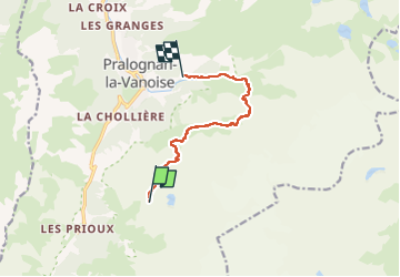
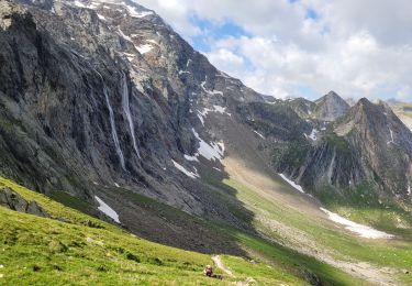
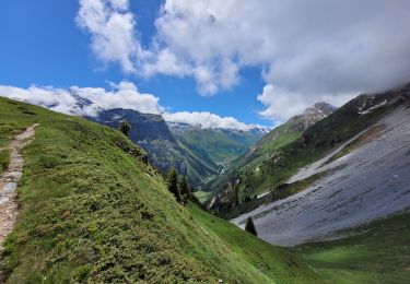
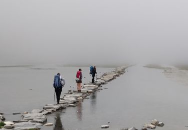
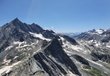
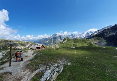
Trail Walking of 8.4 km to be discovered at Auvergne-Rhône-Alpes, Savoy, Pralognan-la-Vanoise. This trail is proposed by holtzv.

Description

- Etape 05 - Refuge de la Valette - Pralognan Les Fontanettes

Elevation profile

Photos

Positioning

Country:
France
Region :
Auvergne-Rhône-Alpes
Department/Province :
Savoy
Municipality :
Pralognan-la-Vanoise
Location:
Unknown
Start:(UTM)
321729 ; 5024738 (32T) N.

Trails nearby

Trail Walking Pralognan-la-Vanoise - Pralognan - Les Prioux  Lac de Chalet Clou - Photo
Walking
countryjack

Walking

Easy
(3)
Pralognan-la-Vanoise, Auvergne-Rhône-Alpes, Savoy, France
11 km | 19.3 km-effort
4h 41min
Yes
Trail Walking Pralognan-la-Vanoise - Pralognan - la crête du mont Charvet - Photo
Walking
countryjack

Walking

Medium
(1)
Pralognan-la-Vanoise, Auvergne-Rhône-Alpes, Savoy, France
11.4 km | 24 km-effort
5h 1min
No
Trail Walking Pralognan-la-Vanoise - pointe de Leschaux - Photo
Walking
GUIDE
amiral13

Walking

Difficult
Pralognan-la-Vanoise, Auvergne-Rhône-Alpes, Savoy, France
12 km | 28 km-effort
5h 43min
Yes
Trail Walking Pralognan-la-Vanoise - traversée des Fontanettes aux Prioux par le col du Grand marchet - Photo
Walking
GUIDE
amiral13

Walking

Difficult
Pralognan-la-Vanoise, Auvergne-Rhône-Alpes, Savoy, France
13.7 km | 30 km-effort
6h 51min
No
Trail Walking Pralognan-la-Vanoise - le lac de la patinoire - Photo
Walking
GUIDE
amiral13

Walking

Difficult
Pralognan-la-Vanoise, Auvergne-Rhône-Alpes, Savoy, France
11.3 km | 22 km-effort
5h 40min
Yes
Trail Walking Pralognan-la-Vanoise - col de napremont - Photo
Walking
GUIDE
amiral13

Walking

Easy
Pralognan-la-Vanoise, Auvergne-Rhône-Alpes, Savoy, France
9.4 km | 19.4 km-effort
4h 24min
Yes
Trail Walking Pralognan-la-Vanoise - 2022-06-24 Marche TGV Pralognan Refuge du Col de la Vanoise - Photo
Walking
GUIDE
holtzv

Walking

Medium
Pralognan-la-Vanoise, Auvergne-Rhône-Alpes, Savoy, France
7.1 km | 15.7 km-effort
2h 37min
No
Trail Walking Pralognan-la-Vanoise - col d'Aussois et pointe de l'Observatoire - Photo
Walking
GUIDE
amiral13

Walking

Difficult
Pralognan-la-Vanoise, Auvergne-Rhône-Alpes, Savoy, France
17 km | 34 km-effort
9h 29min
Yes
Trail Walking Pralognan-la-Vanoise - le refuge de La Valette (traversée) - Photo
Walking
GUIDE
amiral13

Walking

Difficult
Pralognan-la-Vanoise, Auvergne-Rhône-Alpes, Savoy, France
13.7 km | 29 km-effort
6h 41min
No


Close
My subscriptions