Trail Walking Py - PIC DE TRES ESTELLES - Photo

PIC DE TRES ESTELLES

© OpenStreetMap contributors
Length
Length
8.1 km
Max alt
Max alt
2124 m
Uphill gradient
Uphill gradient
457 m
Km-Effort
Km-Effort  
14.2 km
Min alt
Min alt
1759 m
Downhill gradient
Downhill gradient
454 m
Boucle
Boucle
Yes
Creation date :
2014-12-10 00:00:00.0
Updated on :
2014-12-10 00:00:00.0

(0 Reviews)

Walking
Walking
3h05
Difficulty : Easy

Scan this QR Code to open this trail in the SityTrail application

FREE GPS app for hiking

Logo SityTrail SityTrail

IGN / Geographical institutes

Download SityTrail from the App Store Download SityTrail from Google Play

Logo SityTrail SityTrail World

The world is yours!

Download SityTrail from the App Store Download SityTrail from Google Play Download SityTrail on Huawei AppGallery

About

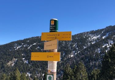
Trail Walking of 8.1 km to be discovered at Occitania, Pyrénées-Orientales, Py. This trail is proposed by PVERTICAL.

Description

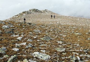
depuis col de Mantet  - retour proposé par une partie des crêtes et les trois pics formant le massif (2099,2114 et 2135) - privilégié le retour par même sentier avec enfants ou débutants

Elevation profile

Photos

Points of interest

Point of interest Py - Point 7 - Photo
PVERTICAL

Positioning

Country:
France
Region :
Occitania
Department/Province :
Pyrénées-Orientales
Municipality :
Py
Location:
Unknown
Start:(UTM)
443626 ; 4703444 (31T) N.

Trails nearby

Trail Walking Py - Roc Colom - Photo
Walking
tracegps

Walking

Difficult
(1)
Py, Occitania, Pyrénées-Orientales, France
19.4 km | 34 km-effort
4h 30min
No
Trail Snowshoes Mantet - Cime de Pomarole - Photo
Snowshoes
Pek56

Snowshoes

Medium
(1)
Mantet, Occitania, Pyrénées-Orientales, France
8.6 km | 16.2 km-effort
3h 21min
Yes
Trail Walking Py - 2022 TRANSPYRÉNÉENNE : refuge de Py- refuge des wmarialles - Photo
Walking
LEGUE

Walking

Very easy
Py, Occitania, Pyrénées-Orientales, France
9.7 km | 18.3 km-effort
2h 30min
No
Trail Walking Py - 20220528 Col de Mantet - Photo
Walking
ThonyM

Walking

Difficult
Py, Occitania, Pyrénées-Orientales, France
19.5 km | 36 km-effort
6h 40min
Yes
Trail Walking Py - 20210508 randonnée autour de Py - Photo
Walking
ThonyM

Walking

Medium
Py, Occitania, Pyrénées-Orientales, France
14.9 km | 27 km-effort
5h 11min
Yes
Trail Walking Py - 20210301 boucle Pu - Photo
Walking
ThonyM

Walking

Medium
Py, Occitania, Pyrénées-Orientales, France
13.1 km | 22 km-effort
4h 7min
Yes
Trail Walking Mantet - 24/02/2021 MANTET au Refuge des Allemany  - Photo
Walking
andre66

Walking

Difficult
Mantet, Occitania, Pyrénées-Orientales, France
8.9 km | 16.8 km-effort
3h 27min
Yes
Trail Walking Mantet - 20200826 Mantet-Allemany-.. - Photo
Walking
ThonyM

Walking

Medium
Mantet, Occitania, Pyrénées-Orientales, France
12.4 km | 22 km-effort
4h 9min
Yes
Trail Walking Py - Py boucle du Pas de Rotja  - Photo
Walking
ThonyM

Walking

Difficult
Py, Occitania, Pyrénées-Orientales, France
12.1 km | 21 km-effort
4h 58min
Yes


Close
My subscriptions