


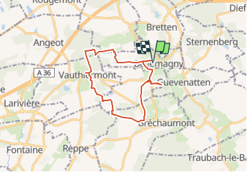

16.3 km | 19.5 km-effort


User


FREE GPS app for hiking
 SityTrail
IGN / Geographical institutes
SityTrail World
The world is yours!
Trail Walking of 12.2 km to be discovered at Grand Est, Haut-Rhin, Bellemagny. This trail is proposed by E.BURCK.
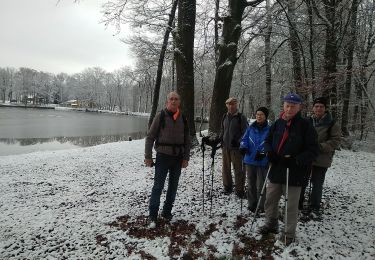
Une balade facile. Le circuit peut être raccourci et en cas de très mauvais temps nous pourrions maintenir le restaurant!
12 km dont 7.5 km le matin. Dénivelé: 184 m.
ACCÈS :
- prendre la D483 à partir du rond point de Burnhaupt le Haut direction Belfort, sortir à gauche 800 m après le rond point de Soppe le Bas, direction Bellemagny.
PARKING :
- derrière la mairie de Bellemagny en face de l'abbaye.
47.6893, 7.0641 ou
N 47°41'21.5", E 7°03'50.8"
RESTAURATION :
Auberge "La petite Charrue" 13 rue principale Vauthiermont
Tél: 03 84 23 89 14
Walking
Walking
Mountain bike

Walking

Mountain bike
Walking

4x4
Mountain bike

On foot