Trail Walking Isola - Lacs du Lausfer / pas de Ste Anne - Photo

Lacs du Lausfer / pas de Ste Anne

 bozo1970
bozo1970

User

© OpenStreetMap contributors
Length
Length
9.7 km
Max alt
Max alt
2495 m
Uphill gradient
Uphill gradient
802 m
Km-Effort
Km-Effort  
20 km
Min alt
Min alt
1717 m
Downhill gradient
Downhill gradient
802 m
Boucle
Boucle
Yes
Creation date :
2022-11-10 08:18:29.0
Updated on :
2022-11-10 15:21:46.158

(0 Reviews)

Walking
Walking
3h09
Difficulty : Easy

Scan this QR Code to open this trail in the SityTrail application

FREE GPS app for hiking

Logo SityTrail SityTrail

IGN / Geographical institutes

Download SityTrail from the App Store Download SityTrail from Google Play

Logo SityTrail SityTrail World

The world is yours!

Download SityTrail from the App Store Download SityTrail from Google Play Download SityTrail on Huawei AppGallery

About

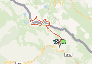
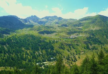
Trail Walking of 9.7 km to be discovered at Provence-Alpes-Côte d'Azur, Maritime Alps, Isola. This trail is proposed by bozo1970.

Description

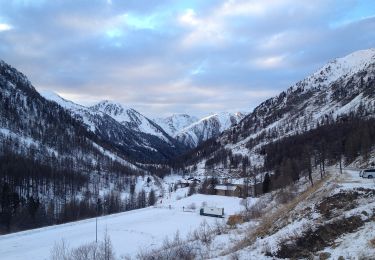
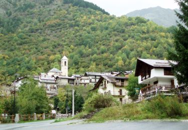
Départ de l’oratoire Ste Anne
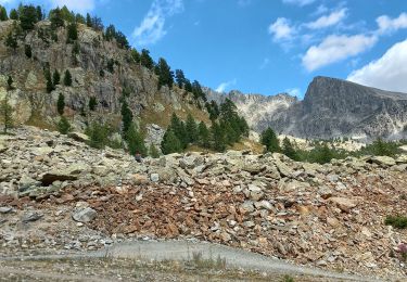
Pas de Ste Anne en 1h02’, 2km800 et D  590m
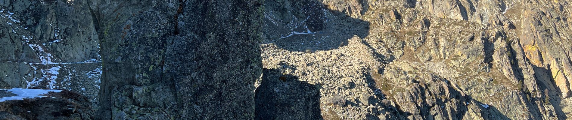
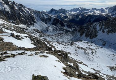
Tête de Colle Haute en 1h40’, 2495m et D  810m
Col du Lausfer en 1h56’
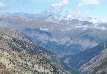
Retour par le GR et le pas de Ste Anne
A/R en 3h08’, 9km500 et D  842m
Magnifique ballade, facile et une vue splendide sur toutes les vallées, quelques chamoix

Elevation profile

Photos

Positioning

Country:
France
Region :
Provence-Alpes-Côte d'Azur
Department/Province :
Maritime Alps
Municipality :
Isola
Location:
Unknown
Start:(UTM)
349052 ; 4896798 (32T) N.

Trails nearby

Trail Walking Isola - Châtaigneraie ISOLA - Photo
Walking
jpnice06

Walking

Very easy
(1)
Isola, Provence-Alpes-Côte d'Azur, Maritime Alps, France
4.4 km | 7.1 km-effort
2h 9min
Yes
Trail Other activity Isola - Isola 2000 baisse Druos refuge Quesa - Photo
Other activity
patsure

Other activity

Very easy
(1)
Isola, Provence-Alpes-Côte d'Azur, Maritime Alps, France
21 km | 35 km-effort
8h 5min
Yes
Trail On foot Isola - Tête Mercière - Photo
On foot
PRO

On foot

Easy
Isola, Provence-Alpes-Côte d'Azur, Maritime Alps, France
8.1 km | 14.8 km-effort
3h 21min
No
Trail On foot Vinadio - Tour du Lausfer - Photo
On foot
PRO

On foot

Easy
Vinadio, Piemont, Cuneo, Italy
9.5 km | 16.7 km-effort
3h 47min
Yes
Trail On foot Vinadio - (SI E13) Sant'Anna di Vinadio - Vinadio Frazione Strepeis - Photo
On foot
PRO

On foot

Easy
Vinadio, Piemont, Cuneo, Italy
9.1 km | 16.1 km-effort
3h 40min
No
Trail Walking Isola - cime de la lombarde - Photo
Walking
osa

Walking

Very difficult
(1)
Isola, Provence-Alpes-Côte d'Azur, Maritime Alps, France
16.7 km | 31 km-effort
9h 25min
Yes
Trail Snowshoes Isola - Cime de Tavels  - Photo
Snowshoes
bozo1970

Snowshoes

Very difficult
Isola, Provence-Alpes-Côte d'Azur, Maritime Alps, France
8 km | 17.8 km-effort
6h 42min
Yes
Trail Walking Isola - Isola2000, Lacs rouges et Lac de Combe grosse, Pas du loup - Photo
Walking
GrouGary

Walking

Difficult
Isola, Provence-Alpes-Côte d'Azur, Maritime Alps, France
10.3 km | 18.2 km-effort
4h 8min
Yes
Trail Walking Isola - terres rouges lacs réel  - Photo
Walking
Ninie38MD

Walking

Medium
Isola, Provence-Alpes-Côte d'Azur, Maritime Alps, France
11.7 km | 21 km-effort
6h 43min
Yes


Close
My subscriptions