Trail Nordic walking Fumay - Les Ardoisières de Fumay - Photo

Les Ardoisières de Fumay

© OpenStreetMap contributors
Length
Length
7.4 km
Max alt
Max alt
265 m
Uphill gradient
Uphill gradient
214 m
Km-Effort
Km-Effort  
10.3 km
Min alt
Min alt
138 m
Downhill gradient
Downhill gradient
214 m
Boucle
Boucle
Yes
Creation date :
2023-02-07 17:31:14.391
Updated on :
2023-02-07 18:00:54.64

(0 Reviews)

Nordic walking
Nordic walking
2h19
Difficulty : Medium

Scan this QR Code to open this trail in the SityTrail application

FREE GPS app for hiking

Logo SityTrail SityTrail

IGN / Geographical institutes

Download SityTrail from the App Store Download SityTrail from Google Play

Logo SityTrail SityTrail World

The world is yours!

Download SityTrail from the App Store Download SityTrail from Google Play Download SityTrail on Huawei AppGallery

About

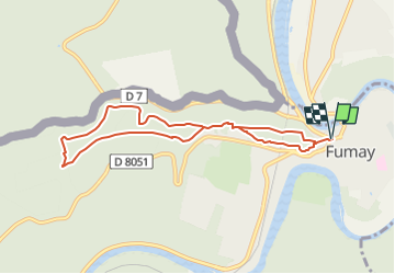
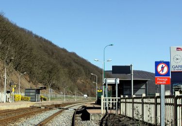
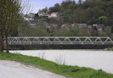
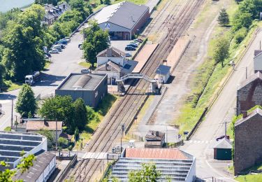
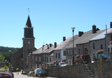
Trail Nordic walking of 7.4 km to be discovered at Grand Est, Ardennes, Fumay. This trail is proposed by denissculier.

Description

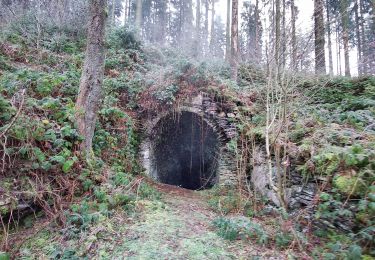
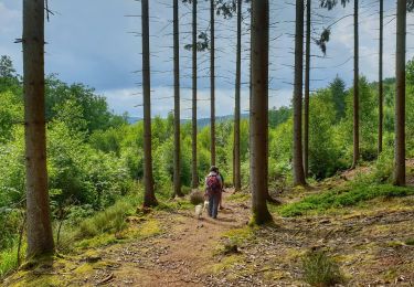
Une randonnée en sous-bois sur les hauteurs de Fumay reprenant les sentiers empruntés, jadis, par les scailleteux.

Elevation profile

Positioning

Country:
France
Region :
Grand Est
Department/Province :
Ardennes
Municipality :
Fumay
Location:
Unknown
Start:(UTM)
622020 ; 5539167 (31U) N.

Trails nearby

Trail Walking Viroinval - Le Trou du Diable à Oignies en Thiérache - Photo
Walking
GUIDE
Desrumaux

Walking

Very easy
(4)
Viroinval, Wallonia, Namur, Belgium
6.4 km | 9.1 km-effort
2h 32min
Yes
Trail Walking Viroinval - RF-Na-12 Oignies - Grande-boucle - Photo
Walking
PRO

Walking

Medium
(1)
Viroinval, Wallonia, Namur, Belgium
11 km | 14.2 km-effort
3h 2min
Yes
Trail Walking Viroinval - Balade à Le Mesnil - Viroinval - Photo
Walking
GUIDE
Desrumaux

Walking

Easy
Viroinval, Wallonia, Namur, Belgium
3.6 km | 4.8 km-effort
2h 16min
Yes
Trail Walking Viroinval - Balade à Oignies-en-Thiérache - Le Ry d'Alise - Photo
Walking
GUIDE
Desrumaux

Walking

Medium
Viroinval, Wallonia, Namur, Belgium
8.6 km | 11.8 km-effort
2h 40min
Yes
Trail On foot Haybes - Les Sentiers des Crêtes - Photo
On foot
PRO

On foot

Easy
Haybes, Grand Est, Ardennes, France
14.1 km | 19.5 km-effort
4h 25min
No
Trail On foot Haybes - La Roche de Madame de Cormont - Photo
On foot
PRO

On foot

Easy
Haybes, Grand Est, Ardennes, France
8.4 km | 11.8 km-effort
2h 41min
Yes
Trail On foot Fumay - Les Ardoisières de Fumay - Photo
On foot
PRO

On foot

Easy
Fumay, Grand Est, Ardennes, France
7.8 km | 10.7 km-effort
2h 25min
No
Trail On foot Viroinval - Le Centre de l'Europe des 15 - Photo
On foot
PRO

On foot

Easy
Viroinval, Wallonia, Namur, Belgium
14.1 km | 19.4 km-effort
4h 25min
No
Trail On foot Viroinval - Centre de l'Europe des 15 - Photo
On foot
GUIDE+

On foot

Medium
Viroinval, Wallonia, Namur, Belgium
14.6 km | 20 km-effort
4h 34min
Yes


Close
My subscriptions