


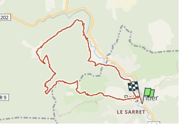

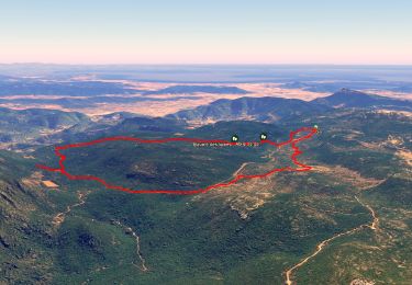
12.6 km | 16.7 km-effort

User


FREE GPS app for hiking
 SityTrail
IGN / Geographical institutes
SityTrail World
The world is yours!
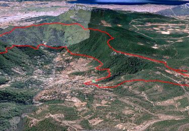
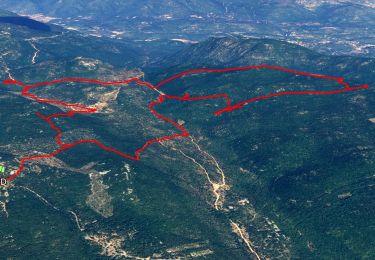
Trail Walking of 11.9 km to be discovered at Provence-Alpes-Côte d'Azur, Var, Belgentier. This trail is proposed by cdanielrando.
Circuit court mais qui comporte un passage très difficile.
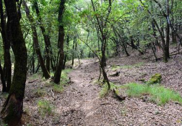
De la côte 541 jusqu'aux antennes, le sentier balisé jaune, parfois rouge et bleu est très vertical . Il y a des passages équipés de cordes qui sont bienvenues et d'autres passages qui obligent à utiliser les mains qu'ils faut protéger . aux antennes, magnifique point de vue puis le reste du trajet passe par la source de Montrieux le jeune ainsi que devant la chartreuse du même nom


Walking
Walking
Walking
Walking
Walking

Walking

Walking

Walking

Walking