


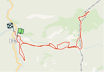

9.5 km | 14.9 km-effort


User


FREE GPS app for hiking
 SityTrail
IGN / Geographical institutes
SityTrail World
The world is yours!
Trail Walking of 7.2 km to be discovered at Occitania, Hautespyrenees, Ferrère. This trail is proposed by ach31.
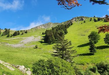
Magnifique sommet, très raide sur la fin !
Éviter le passage sur la route au départ, (passage dans une propriété privée!)
A essayer, le sentier coume de Hosse...

Walking
Walking
Walking
Walking
Walking
Walking

On foot
Walking
Walking