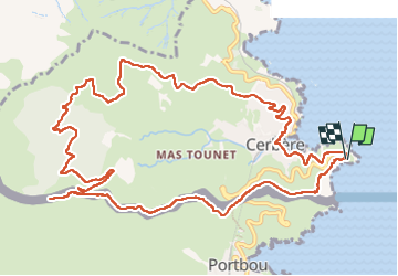
15.1 km | 22 km-effort
Cerbère chemin de la frigio lette
robertperello
User
Length
15.1 km
Max alt
363 m
Uphill gradient
524 m
Km-Effort
22 km
Min alt
8 m
Downhill gradient
519 m
Boucle
Yes
Creation date :
2023-04-12 07:22:39.0
Updated on :
2023-04-12 13:49:00.126
4h06
Difficulty : Medium
FREE GPS app for hiking
About
Trail Walking of 15.1 km to be discovered at Occitania, Pyrénées-Orientales, Cerbère. This trail is proposed by robertperello.
Description
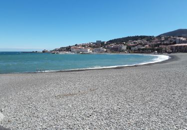
Départ cap Cerbère memorial retirada
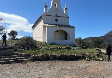
Montée raide.
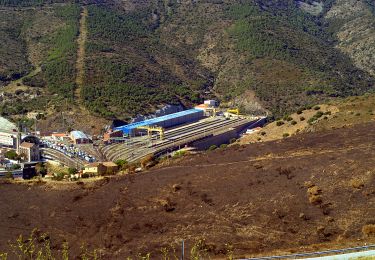
Le dolmen sans intérêt (ruine)
Positioning
Country:
France
Region :
Occitania
Department/Province :
Pyrénées-Orientales
Municipality :
Cerbère
Location:
Unknown
Start:(Dec)
Start:(UTM)
514456 ; 4698609 (31T) N.
Comments
Trails nearby
BANYULS- SUR-MER 66 - Sentier littoral - cap Rederis - col de la Creu
Walking
Difficult
(2)
Banyuls-sur-Mer,
Occitania,
Pyrénées-Orientales,
France
3h 45min
Yes
Banyuls Cerbère - Littoral retour bus - 10km 4h 320m déniv.
Walking
Difficult
(1)
Banyuls-sur-Mer,
Occitania,
Pyrénées-Orientales,
France
10 km | 14.3 km-effort
4h 12min
No
RP 66 BANYULS SUR MER - PUIG del Mas - PUIG JOAN - le 10.03.2017
Walking
Medium
(1)
Banyuls-sur-Mer,
Occitania,
Pyrénées-Orientales,
France
9.7 km | 16 km-effort
2h 21min
Yes
Banyuls sur Mer, chapelle notre Dame de la Salette
Walking
Banyuls-sur-Mer,
Occitania,
Pyrénées-Orientales,
France
6.7 km | 10.5 km-effort
2h 47min
Yes
Banyuls port a Collioure
Walking
Medium
Banyuls-sur-Mer,
Occitania,
Pyrénées-Orientales,
France
18.5 km | 24 km-effort
5h 8min
No
Cerbère cerbère
Walking
Easy
Cerbère,
Occitania,
Pyrénées-Orientales,
France
23 km | 30 km-effort
3h 46min
No
Banyuls-sur-Mer Madaloc par col des gascons
Walking
Medium
Banyuls-sur-Mer,
Occitania,
Pyrénées-Orientales,
France
17.4 km | 27 km-effort
6h 0min
No
Découverte de Banyuls
Walking
Easy
Banyuls-sur-Mer,
Occitania,
Pyrénées-Orientales,
France
3.6 km | 4.7 km-effort
1h 15min
Yes