


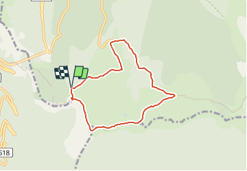

7.6 km | 10.8 km-effort


User


FREE GPS app for hiking
 SityTrail
IGN / Geographical institutes
SityTrail World
The world is yours!
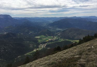
Trail Walking of 6.8 km to be discovered at Auvergne-Rhône-Alpes, Drôme, Saint-Agnan-en-Vercors. This trail is proposed by dhommee.
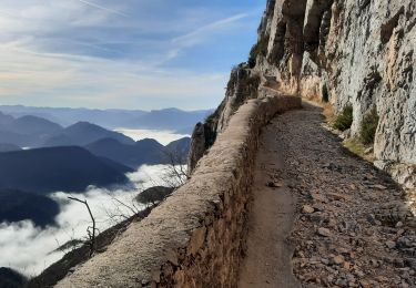
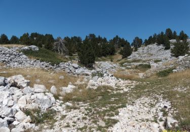
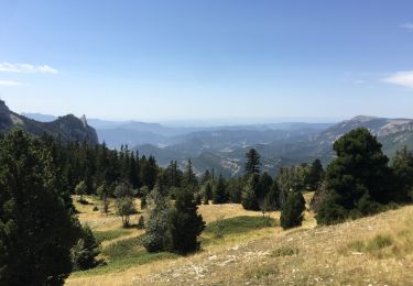
Sentier permettant la découverte de la montagne de Beure par les crêtes avec un magnifique panorama sur les Hauts plateaux du Vercors et sur la Vallée de la Drôme. Possibilité d'observation des vautours et de restauration en été au Chalet de Beure

Snowshoes

Mountain bike
Walking

Walking
Walking
Walking
Walking

Snowshoes
Walking