Trail Walking Saint-Laurent-en-Gâtines - Saint-Laurent-en-Gâtines - variante du PR Chemin de Chenusson - 10.2km 90m 2h25 - 2023 07 30 - Photo

Saint-Laurent-en-Gâtines - variante du PR Chemin de Chenusson - 10.2km 90m 2h25 - 2023 07 30

 Orcal37
Orcal37

User

© OpenStreetMap contributors
Length
Length
10.3 km
Max alt
Max alt
171 m
Uphill gradient
Uphill gradient
92 m
Km-Effort
Km-Effort  
11.5 km
Min alt
Min alt
136 m
Downhill gradient
Downhill gradient
91 m
Boucle
Boucle
Yes
Creation date :
2023-07-30 13:11:54.206
Updated on :
2023-08-02 09:38:58.782

(0 Reviews)

Walking
Walking
2h25
Difficulty : Easy

Scan this QR Code to open this trail in the SityTrail application

FREE GPS app for hiking

Logo SityTrail SityTrail

IGN / Geographical institutes

Download SityTrail from the App Store Download SityTrail from Google Play

Logo SityTrail SityTrail World

The world is yours!

Download SityTrail from the App Store Download SityTrail from Google Play Download SityTrail on Huawei AppGallery

About

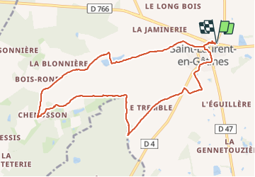
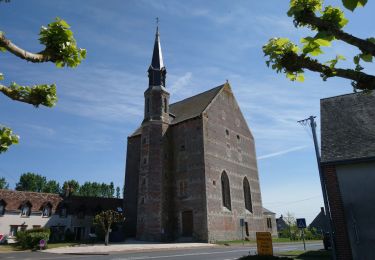
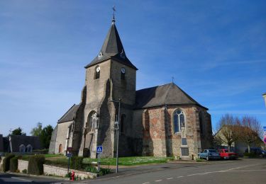
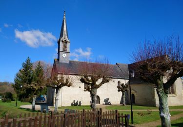
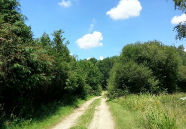
Trail Walking of 10.3 km to be discovered at Centre-Loire Valley, Indre-et-Loire, Saint-Laurent-en-Gâtines. This trail is proposed by Orcal37.

Description

Saint-Laurent-en-Gâtines - variante du PR Chemin de Chenusson - 10.2km 90m 2h25 - 2023 07 30

Elevation profile

Photos

Positioning

Country:
France
Region :
Centre-Loire Valley
Department/Province :
Indre-et-Loire
Municipality :
Saint-Laurent-en-Gâtines
Location:
Unknown
Start:(UTM)
333026 ; 5272851 (31T) N.

Trails nearby

Trail Walking La Ferrière - la Ferrière - le Moulin à Vent à Saint-Laurent-en-Gâtines - 14.9km 115m 3h20 (30mn) - 2023 07 30 - Photo
Walking
Orcal37

Walking

Easy
La Ferrière, Centre-Loire Valley, Indre-et-Loire, France
14.9 km | 16.5 km-effort
3h 20min
Yes
Trail Walking Saint-Laurent-en-Gâtines - Saint-Laurent-en-Gatines - Photo
Walking
guydu41

Walking

Difficult
Saint-Laurent-en-Gâtines, Centre-Loire Valley, Indre-et-Loire, France
13.1 km | 14.9 km-effort
3h 23min
Yes
Trail Walking Villedômer - Villedômer - Photo
Walking
guydu41

Walking

Easy
Villedômer, Centre-Loire Valley, Indre-et-Loire, France
10.8 km | 12.8 km-effort
2h 54min
Yes
Trail Walking La Ferrière - La Ferrière - Photo
Walking
guydu41

Walking

Easy
La Ferrière, Centre-Loire Valley, Indre-et-Loire, France
10.6 km | 11.9 km-effort
2h 42min
Yes
Trail Walking Monthodon - Monthodon Le Sentier - Photo
Walking
guydu41

Walking

Medium
Monthodon, Centre-Loire Valley, Indre-et-Loire, France
8.5 km | 9.5 km-effort
2h 9min
Yes
Trail Walking Saint-Laurent-en-Gâtines - Saint-Laurent-en-Gâtines - Circuit jaune avec variante le Sentier - 18.7km 120m 4h30 - 2022 05 01 - Photo
Walking
Orcal37

Walking

Easy
Saint-Laurent-en-Gâtines, Centre-Loire Valley, Indre-et-Loire, France
18.7 km | 20 km-effort
4h 30min
Yes
Trail Walking Nouzilly - Nouzilly - Circuit des Orchidées - 22.4km 375m 5h10 - 2022 04 10 - Photo
Walking
Orcal37

Walking

Medium
Nouzilly, Centre-Loire Valley, Indre-et-Loire, France
22 km | 27 km-effort
5h 10min
Yes
Trail Walking Crotelles - Crotelles - PR avec variante - 21.4km 285m 4h35 (30mn) - 2021 03 20 - Photo
Walking
Orcal37

Walking

Easy
Crotelles, Centre-Loire Valley, Indre-et-Loire, France
21 km | 25 km-effort
4h 35min
Yes
Trail Walking Monthodon - Monthodon - et Le Sentier - 26.7km 230m 6h00 - 2018 07 15 - public - Photo
Walking
Orcal37

Walking

Easy
Monthodon, Centre-Loire Valley, Indre-et-Loire, France
27 km | 30 km-effort
5h 45min
Yes


Close
My subscriptions