Trail Walking Taillades - Taillades Badarel  Brayette Robion - Photo

Taillades Badarel Brayette Robion

 kephas
kephas

User

© OpenStreetMap contributors
Length
Length
10.6 km
Max alt
Max alt
499 m
Uphill gradient
Uphill gradient
527 m
Km-Effort
Km-Effort  
17.6 km
Min alt
Min alt
118 m
Downhill gradient
Downhill gradient
524 m
Boucle
Boucle
Yes
Creation date :
2016-01-05 00:00:00.0
Updated on :
2016-01-05 00:00:00.0

(1 Reviews)

Walking
Walking
3h41
Difficulty : Difficult

Scan this QR Code to open this trail in the SityTrail application

FREE GPS app for hiking

Logo SityTrail SityTrail

IGN / Geographical institutes

Download SityTrail from the App Store Download SityTrail from Google Play

Logo SityTrail SityTrail World

The world is yours!

Download SityTrail from the App Store Download SityTrail from Google Play Download SityTrail on Huawei AppGallery

About

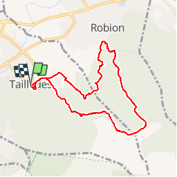
Trail Walking of 10.6 km to be discovered at Provence-Alpes-Côte d'Azur, Vaucluse, Taillades. This trail is proposed by kephas.

Elevation profile

Photos

Points of interest

Point of interest Taillades - Point 2 - Photo
kephas
TAILLADES 
Point of interest Robion - Point 3 - Photo
kephas
ROBION 
Point of interest Robion - Point 4 - Photo
kephas
ROBION 
Point of interest Robion - Point 5 - Photo
kephas
ROBION 

Positioning

Country:
France
Region :
Provence-Alpes-Côte d'Azur
Department/Province :
Vaucluse
Municipality :
Taillades
Location:
Unknown
Start:(UTM)
668286 ; 4855547 (31T) N.

Comments

Please log in to post a review or rate the element


Belle randonnée avec des passages en falaise


Trails nearby

Trail Walking Robion - petit luberon - Photo
Walking
GUIDE
nadinebondoux

Walking

Difficult
(1)
Robion, Provence-Alpes-Côte d'Azur, Vaucluse, France
16.7 km | 27 km-effort
6h 23min
Yes
Trail Cycle Cavaillon - Autour du Luberon à vélo - Photo
Cycle
GUIDE+

Cycle

Difficult
(4)
Cavaillon, Provence-Alpes-Côte d'Azur, Vaucluse, France
236 km | 285 km-effort
15h 46min
Yes
Trail Cycle Cavaillon - Parcours n°3 - Cavaillon - Photo
Cycle
GUIDE+

Cycle

Easy
(2)
Cavaillon, Provence-Alpes-Côte d'Azur, Vaucluse, France
45 km | 50 km-effort
2h 55min
No
Trail Cycle Cavaillon - Parcours n°1 - Cavaillon - Photo
Cycle
GUIDE+

Cycle

Difficult
(2)
Cavaillon, Provence-Alpes-Côte d'Azur, Vaucluse, France
33 km | 41 km-effort
2h 21min
Yes
Trail Walking Taillades - Par la Gorge de Badarel et les Rochers de Baude - Photo
Walking
tracegps

Walking

Medium
(3)
Taillades, Provence-Alpes-Côte d'Azur, Vaucluse, France
8 km | 14.7 km-effort
4h 0min
Yes
Trail Walking Taillades - taillades - Photo
Walking
fireman84

Walking

Very easy
(1)
Taillades, Provence-Alpes-Côte d'Azur, Vaucluse, France
7.6 km | 9.8 km-effort
1h 36min
Yes
Trail Walking Taillades - Les Taillades-De la source du Boulon au Castelas - Gorge de Badarel sous la neige - Photo
Walking
tracegps

Walking

Difficult
(1)
Taillades, Provence-Alpes-Côte d'Azur, Vaucluse, France
7 km | 10.8 km-effort
3h 0min
Yes
Trail Mountain bike Maubec - Luberon - Grande Traversée de Vaucluse - de Maubec / Robion à Mérindol - Photo
Mountain bike
GUIDE+

Mountain bike

Difficult
(1)
Maubec, Provence-Alpes-Côte d'Azur, Vaucluse, France
32 km | 42 km-effort
2h 47min
No
Trail Walking Cheval-Blanc - bergerie/badarel - Photo
Walking
fireman84

Walking

Medium
(1)
Cheval-Blanc, Provence-Alpes-Côte d'Azur, Vaucluse, France
9.9 km | 16 km-effort
3h 20min
Yes


Close
My subscriptions