Trail Mountain bike Vars - lac de peyrol ,col de vars,crête de la maït,retour ST marcellin - Photo

lac de peyrol ,col de vars,crête de la maït,retour ST marcellin

 tchoua
tchoua

User

© OpenStreetMap contributors
Length
Length
32 km
Max alt
Max alt
2232 m
Uphill gradient
Uphill gradient
1129 m
Km-Effort
Km-Effort  
47 km
Min alt
Min alt
1596 m
Downhill gradient
Downhill gradient
1124 m
Boucle
Boucle
Yes
Creation date :
2023-08-12 07:37:37.101
Updated on :
2023-08-13 07:44:17.03

(0 Reviews)

Mountain bike
Mountain bike
3h29
Difficulty : Very difficult

Scan this QR Code to open this trail in the SityTrail application

FREE GPS app for hiking

Logo SityTrail SityTrail

IGN / Geographical institutes

Download SityTrail from the App Store Download SityTrail from Google Play

Logo SityTrail SityTrail World

The world is yours!

Download SityTrail from the App Store Download SityTrail from Google Play Download SityTrail on Huawei AppGallery

About

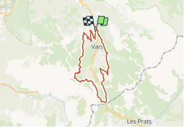
Trail Mountain bike of 32 km to be discovered at Provence-Alpes-Côte d'Azur, Hautes-Alpes, Vars. This trail is proposed by tchoua.

Description

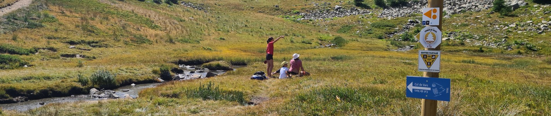
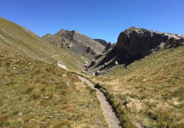
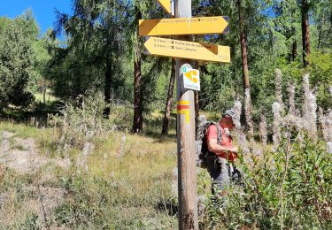
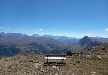
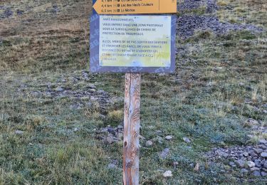
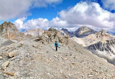
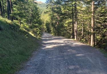
Montée depuis ST Marcellin route forestière jusqu’au lac de Peyrol puis sentier et route en terre pour rejoindre lac de Chabriere puis prendre direction col de vars ( portion très agréable)itinéraire sentier ,du col rejoindre refuge Napoléon remonter piste forestière jusqu’à la crête de la Mayt petit col puis descendre direction Vars ste Marie ,Sté Catherine, ⚠️section raide sur 100m  au début puis sentier ,route forestière , et route bitumée en traversée.magnifique panorama tout le long .( spécial bravo à la station de Vars pour l aménagements du sentier section Chabriere col de vars).

Elevation profile

Photos

Positioning

Country:
France
Region :
Provence-Alpes-Côte d'Azur
Department/Province :
Hautes-Alpes
Municipality :
Vars
Location:
Unknown
Start:(UTM)
316582 ; 4941950 (32T) N.

Trails nearby

Trail Walking Vars - Lac des 9 couleurs - Photo
Walking
Brice244

Walking

Easy
(4)
Vars, Provence-Alpes-Côte d'Azur, Hautes-Alpes, France
8.9 km | 14.9 km-effort
2h 59min
Yes
Trail Walking Vars - Crêtes de Vars - Photo
Walking
BLANCHET

Walking

Medium
(2)
Vars, Provence-Alpes-Côte d'Azur, Hautes-Alpes, France
7.7 km | 14.9 km-effort
4h 0min
Yes
Trail Walking Vars - 05 Tour Font Sancte - étape 2 - Photo
Walking
Maryma

Walking

Very difficult
(1)
Vars, Provence-Alpes-Côte d'Azur, Hautes-Alpes, France
19 km | 38 km-effort
8h 41min
No
Trail Other activity Vars - vars 2014 01 11 - Photo
Other activity
vincent.bessiron

Other activity

Very easy
(2)
Vars, Provence-Alpes-Côte d'Azur, Hautes-Alpes, France
34 km | 79 km-effort
2h 5min
No
Trail Walking Vars - crêtes de Vars - Photo
Walking
gibello

Walking

Easy
Vars, Provence-Alpes-Côte d'Azur, Hautes-Alpes, France
8.4 km | 16.6 km-effort
4h 30min
Yes
Trail Walking Vars - Pic de Chabrières 2744m 31.7.22 - Photo
Walking
fredetpascale

Walking

Difficult
Vars, Provence-Alpes-Côte d'Azur, Hautes-Alpes, France
9.7 km | 15.9 km-effort
3h 25min
No
Trail Walking Vars - Mortices sud et nord - Photo
Walking
gibello

Walking

Difficult
Vars, Provence-Alpes-Côte d'Azur, Hautes-Alpes, France
14.6 km | 28 km-effort
10h 34min
Yes
Trail Walking Vars - Motrice sud et nord - Photo
Walking
PapouBertrand

Walking

Very difficult
(1)
Vars, Provence-Alpes-Côte d'Azur, Hautes-Alpes, France
14.7 km | 28 km-effort
7h 59min
Yes
Trail Walking Risoul - Crêtes de Penon - Photo
Walking
gildascb

Walking

Very easy
(1)
Risoul, Provence-Alpes-Côte d'Azur, Hautes-Alpes, France
10.6 km | 15.3 km-effort
3h 15min
Yes


Close
My subscriptions