


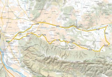
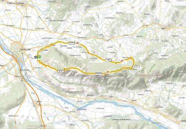
236 km | 285 km-effort


User


FREE GPS app for hiking
 SityTrail
IGN / Geographical institutes
SityTrail World
The world is yours!
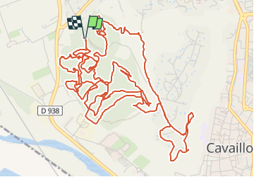
Trail Mountain bike of 13 km to be discovered at Provence-Alpes-Côte d'Azur, Vaucluse, Cavaillon. This trail is proposed by denel.
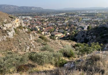
VTTAE assez technique
Fantastique vue et single dans la Colline saint Jacques au dessus de Cavaillon

Cycle

Cycle

Cycle
Mountain bike
Walking

Cycle
Road bike
Mountain bike
Walking