Trail On foot Lièpvre - circuit Liepvre - Photo

circuit Liepvre

 RichardZ
RichardZ

User

© OpenStreetMap contributors
Length
Length
5.6 km
Max alt
Max alt
471 m
Uphill gradient
Uphill gradient
200 m
Km-Effort
Km-Effort  
8.3 km
Min alt
Min alt
272 m
Downhill gradient
Downhill gradient
203 m
Boucle
Boucle
Yes
Creation date :
2024-02-05 11:03:28.872
Updated on :
2024-02-05 11:20:44.087

(0 Reviews)

On foot
On foot
1h52
Difficulty : Easy

Scan this QR Code to open this trail in the SityTrail application

FREE GPS app for hiking

Logo SityTrail SityTrail

IGN / Geographical institutes

Download SityTrail from the App Store Download SityTrail from Google Play

Logo SityTrail SityTrail World

The world is yours!

Download SityTrail from the App Store Download SityTrail from Google Play Download SityTrail on Huawei AppGallery

About

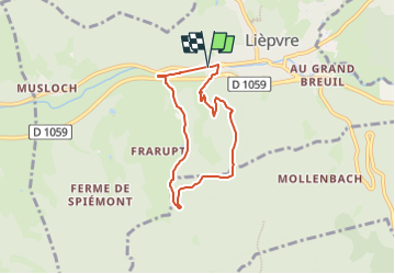
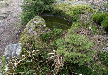
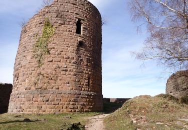
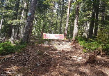
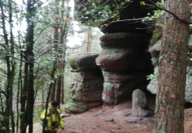
Trail On foot of 5.6 km to be discovered at Grand Est, Haut-Rhin, Lièpvre. This trail is proposed by RichardZ.

Description

Parking Liepvre - Estary - passage devant la ferme d'Argentin - antennes - retour par parcours de santé - Parking Liepvre

Elevation profile

Positioning

Country:
France
Region :
Grand Est
Department/Province :
Haut-Rhin
Municipality :
Lièpvre
Location:
Unknown
Start:(UTM)
371875 ; 5347768 (32U) N.

Trails nearby

Trail Walking La Vancelle - 2020-05-21 Marche La Vancelle Boucle - Photo
Walking
GUIDE
holtzv

Walking

Very easy
La Vancelle, Grand Est, Bas-Rhin, France
16.3 km | 26 km-effort
6h 41min
Yes
Trail Walking La Vancelle - 2015-01-02 Marche Rocher du Coucou Chateau Frankenbourg - Photo
Walking
GUIDE
holtzv

Walking

Easy
(1)
La Vancelle, Grand Est, Bas-Rhin, France
10.9 km | 18.1 km-effort
3h 47min
Yes
Trail Walking Thannenkirch - circuit Taennchel - Photo
Walking
Patlac3

Walking

Medium
Thannenkirch, Grand Est, Haut-Rhin, France
8.6 km | 13.9 km-effort
4h 5min
Yes
Trail Mountain bike Bergheim - 1 ère sortie - Photo
Mountain bike
Jeje Seuil

Mountain bike

Easy
Bergheim, Grand Est, Haut-Rhin, France
12.6 km | 19.1 km-effort
1h 53min
Yes
Trail Walking Sainte-Marie-aux-Mines - taenichel - Photo
Walking
apa

Walking

Medium
Sainte-Marie-aux-Mines, Grand Est, Haut-Rhin, France
13.3 km | 19.1 km-effort
5h 26min
Yes
Trail Walking Breitenau - 20230309_BREITENAU_rando_Breitenau_Le Rocher du Coucou - Le Château du Frankenbourg - Photo
Walking
nfranche

Walking

Medium
Breitenau, Grand Est, Bas-Rhin, France
14.5 km | 24 km-effort
5h 24min
Yes
Trail Walking Thannenkirch - Taennchel par Thannenkirch - Photo
Walking
Mich&Agnès

Walking

Medium
(2)
Thannenkirch, Grand Est, Haut-Rhin, France
15.5 km | 23 km-effort
5h 19min
Yes
Trail Walking Sainte-Marie-aux-Mines - Col du Haut de Ribeauvillé - Rochers des Géants (Rother n°31) - Photo
Walking
Bart2015

Walking

Medium
Sainte-Marie-aux-Mines, Grand Est, Haut-Rhin, France
15.3 km | 22 km-effort
3h 56min
Yes
Trail Walking Rombach-le-Franc - Col de Fouchy  - Photo
Walking
apa

Walking

Medium
Rombach-le-Franc, Grand Est, Haut-Rhin, France
11.8 km | 17.6 km-effort
3h 23min
Yes


Close
My subscriptions