Trail Walking Saint-Bertrand-de-Comminges - Mail de HARD - Photo
© OpenStreetMap contributors
Length
Length
5.2 km
Max alt
Max alt
816 m
Uphill gradient
Uphill gradient
381 m
Km-Effort
Km-Effort  
10.3 km
Min alt
Min alt
460 m
Downhill gradient
Downhill gradient
374 m
Boucle
Boucle
Yes
Creation date :
2024-02-29 08:28:03.0
Updated on :
2024-02-29 10:57:32.574

(0 Reviews)

Walking
Walking
1h59
Difficulty : Unknown

Scan this QR Code to open this trail in the SityTrail application

FREE GPS app for hiking

Logo SityTrail SityTrail

IGN / Geographical institutes

Download SityTrail from the App Store Download SityTrail from Google Play

Logo SityTrail SityTrail World

The world is yours!

Download SityTrail from the App Store Download SityTrail from Google Play Download SityTrail on Huawei AppGallery

About

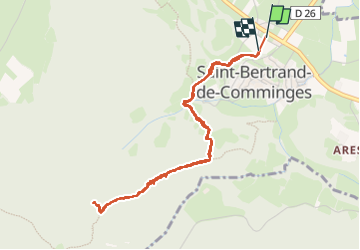
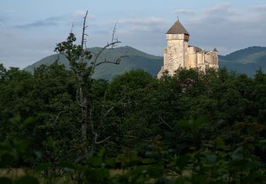
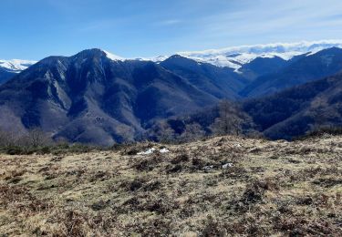
Trail Walking of 5.2 km to be discovered at Occitania, Haute-Garonne, Saint-Bertrand-de-Comminges. This trail is proposed by (null) (null)2d73a32012fbb405f85d3457f10971c41.

Description

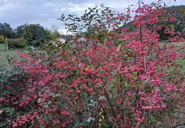
Narcisses à foison!!!

Elevation profile

Positioning

Country:
France
Region :
Occitania
Department/Province :
Haute-Garonne
Municipality :
Saint-Bertrand-de-Comminges
Location:
Unknown
Start:(UTM)
302188 ; 4766978 (31T) N.

Trails nearby

Trail Walking Saint-Bertrand-de-Comminges - Autour de Saint Bertrand de Comminges - Photo
Walking
tracegps

Walking

Difficult
(1)
Saint-Bertrand-de-Comminges, Occitania, Haute-Garonne, France
10.2 km | 17.1 km-effort
3h 30min
Yes
Trail Walking Seilhan - Tour de Seilhan - Photo
Walking
tracegps

Walking

Easy
(1)
Seilhan, Occitania, Haute-Garonne, France
5.9 km | 7.7 km-effort
1h 30min
Yes
Trail Walking Barbazan - Tour de Barbazan - Photo
Walking
tracegps

Walking

Easy
(2)
Barbazan, Occitania, Haute-Garonne, France
5.7 km | 7.3 km-effort
1h 30min
Yes
Trail Walking Antichan - sommet d'Herbe Rouge en boucle depuis Antichan  - Photo
Walking
GUIDE
lhomme.ph

Walking

Medium
Antichan, Occitania, Hautespyrenees, France
11.4 km | 20 km-effort
5h 47min
Yes
Trail On foot Saint-Bertrand-de-Comminges - Saint-Bertrand-de-Comminges : au coeur du Comminges - Photo
On foot
PRO

On foot

Easy
Saint-Bertrand-de-Comminges, Occitania, Haute-Garonne, France
10.1 km | 17.1 km-effort
3h 52min
Yes
Trail On foot Aventignan - AVENTIGNAN/GARGAS   2871325 - Photo
On foot
GUIDE
marmotte65

On foot

Easy
Aventignan, Occitania, Hautespyrenees, France
9.7 km | 11.5 km-effort
2h 38min
Yes
Trail Walking Seilhan - bord de Garonne vers Labroquère  - Photo
Walking
GUIDE
lhomme.ph

Walking

Medium
Seilhan, Occitania, Haute-Garonne, France
9.5 km | 11.4 km-effort
2h 51min
Yes
Trail On foot Barbazan - BARBAZAN  le refuge saint-martin G3 Fait
On foot
GUIDE
marmotte65

On foot

Easy
Barbazan, Occitania, Haute-Garonne, France
11.2 km | 18.1 km-effort
3h 34min
Yes
Trail Walking Sacoué - marrouye depuis le pied du Touroc  - Photo
Walking
GUIDE
lhomme.ph

Walking

Medium
Sacoué, Occitania, Hautespyrenees, France
15 km | 25 km-effort
6h 12min
Yes


Close
My subscriptions