Trail On foot Bonnières - BONNIERES (62) - Les éoliennes - Photo

BONNIERES (62) - Les éoliennes

© OpenStreetMap contributors
Length
Length
15.2 km
Max alt
Max alt
147 m
Uphill gradient
Uphill gradient
126 m
Km-Effort
Km-Effort  
16.9 km
Min alt
Min alt
78 m
Downhill gradient
Downhill gradient
125 m
Boucle
Boucle
Yes
Creation date :
2024-03-31 07:43:53.993
Updated on :
2024-03-31 07:52:32.762

(0 Reviews)

On foot
On foot
3h50
Difficulty : Easy

Scan this QR Code to open this trail in the SityTrail application

FREE GPS app for hiking

Logo SityTrail SityTrail

IGN / Geographical institutes

Download SityTrail from the App Store Download SityTrail from Google Play

Logo SityTrail SityTrail World

The world is yours!

Download SityTrail from the App Store Download SityTrail from Google Play Download SityTrail on Huawei AppGallery

About

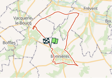
Trail On foot of 15.2 km to be discovered at Hauts-de-France, Pas-de-Calais, Bonnières. This trail is proposed by temmichel.

Description

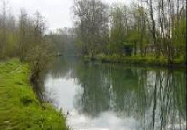
Cette randonnée vous fera découvrir les charmes de la campagne environnante de FREVENT, commune baignée par la Canche. Vous marcherez sur le GRP Canche Authies entre FORTEL ET Frévent et contournerez le village de Bonnières qui durant le seconde guerre mondiale abritait une rampe de lancement de V2 dont quelques blockhaus sont encore présents aujourd'hui. Les nombreuses éoliennes qui jalonnent votre parcours ont donné le nom à cette randonnée
Bonne randonée
Jean-Michel

Elevation profile

Photos

Positioning

Country:
France
Region :
Hauts-de-France
Department/Province :
Pas-de-Calais
Municipality :
Bonnières
Location:
Bonnières
Start:(UTM)
446444 ; 5566725 (31U) N.

Trails nearby

Trail Walking Boubers-sur-Canche - 7 km autour de Boubers sur Canche - Photo
Walking
tracegps

Walking

Easy
Boubers-sur-Canche, Hauts-de-France, Pas-de-Calais, France
6.8 km | 7.9 km-effort
1h 40min
Yes
Trail Walking Ligny-sur-Canche - LIGNY SUR CANCHE - Le fond de Boubers - Photo
Walking
temmichel

Walking

Difficult
Ligny-sur-Canche, Hauts-de-France, Pas-de-Calais, France
10.7 km | 12.7 km-effort
2h 52min
Yes
Trail Other activity Frévent - Nord - Pas-de-Calais - Ligne 305 - Saint-Roch - Frévent - Photo
Other activity
mich54

Other activity

Very easy
Frévent, Hauts-de-France, Pas-de-Calais, France
11 km | 12.4 km-effort
5min
No
Trail Walking Frévent - FREVENT  - Photo
Walking
dehemjacques

Walking

Medium
Frévent, Hauts-de-France, Pas-de-Calais, France
27 km | 31 km-effort
6h 42min
Yes
Trail Walking Frévent - Rando Frevent 16 km - Photo
Walking
alainchti62

Walking

Difficult
Frévent, Hauts-de-France, Pas-de-Calais, France
15.9 km | 18.4 km-effort
4h 11min
Yes
Trail Walking Frévent - Frévent (3) 23.5Kms Dén P 319m - Photo
Walking
alain62rando

Walking

Very difficult
Frévent, Hauts-de-France, Pas-de-Calais, France
24 km | 28 km-effort
6h 4min
Yes


Close
My subscriptions