Trail Walking Cantaron - Cantaron : Monts Macaron et Ubac - Photo

Cantaron : Monts Macaron et Ubac

 ETMU5496
ETMU5496

User

© OpenStreetMap contributors
Length
Length
19 km
Max alt
Max alt
793 m
Uphill gradient
Uphill gradient
1152 m
Km-Effort
Km-Effort  
34 km
Min alt
Min alt
100 m
Downhill gradient
Downhill gradient
1152 m
Boucle
Boucle
Yes
Creation date :
2024-05-08 06:05:03.0
Updated on :
2024-05-08 15:04:14.799

(0 Reviews)

Walking
Walking
7h47
Difficulty : Medium

Scan this QR Code to open this trail in the SityTrail application

FREE GPS app for hiking

Logo SityTrail SityTrail

IGN / Geographical institutes

Download SityTrail from the App Store Download SityTrail from Google Play

Logo SityTrail SityTrail World

The world is yours!

Download SityTrail from the App Store Download SityTrail from Google Play Download SityTrail on Huawei AppGallery

About

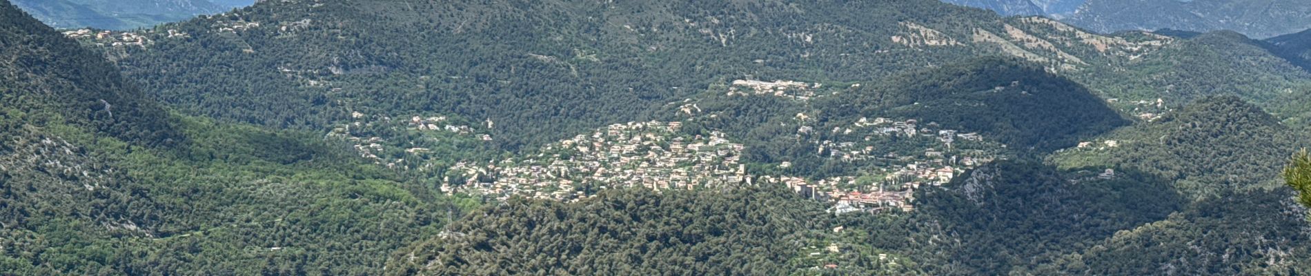
Trail Walking of 19 km to be discovered at Provence-Alpes-Côte d'Azur, Maritime Alps, Cantaron. This trail is proposed by ETMU5496.

Description

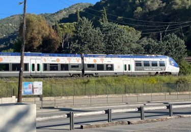
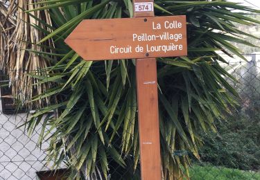
Départ de la randonnée : Gare de Cantaron ou Parking (gratuit) situé à l'entrée de Cantaron une cinquantaine de mètres après la traversée la voie ferrée
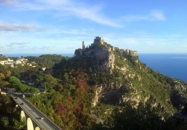
Le circuit de la randonnée est le suivant : Cantaron, Bordinas, Balise 784 - Baisse de Bordinas, Balise 744 - Baisse du Macaron, Antécime du Mont Macaron, Balise 745 (absente sur le terrain), Mont Macaron, Balise 743 (absente sur le terrain), Chapelle Saint-Joseph, Balise 742/47, Balise 741/48,  Balise 740/48 - Col de Châteauneuf, Balises 787 et 788 (absentes sur le terrain), Traversée du Rio Sec par un pont, Balise 789 (absente sur le terain), Tourrette-Levens, Balise 781 - Traversée du Rio Sec par le Pont Joseph Portaneri, Balise 782 - Tra la Torre, Balise 783, Balise 784 - Bordinas,
De la Baisse de Bordinas faire un aller-retour au Mont de l’Ubac duquel la vue sur Nice est optimum.
Retour baisse Bordinas puis reprendre chemin aller Cantaron.
La randonnée ne présente pas de difficulté technique et pas de passage exposé. Qqes sentiers sont toutefois non balisés et nécessite un suivi avec la trace GPS. IBP = 111

Elevation profile

Photos

38 photos in total. Please click on a photo to see them all in the gallery.

Positioning

Country:
France
Region :
Provence-Alpes-Côte d'Azur
Department/Province :
Maritime Alps
Municipality :
Cantaron
Location:
Unknown
Start:(UTM)
364668 ; 4846760 (32T) N.

Trails nearby

Trail On foot Èze - Circuit du mont Bastide - Photo
On foot
PRO

On foot

Easy
Èze, Provence-Alpes-Côte d'Azur, Maritime Alps, France
7 km | 14.7 km-effort
3h 20min
Yes
Trail Walking Èze - Mont Bastide, sentier de Nietzsche - Photo
Walking
PEBREJOSIANE

Walking

Easy
(1)
Èze, Provence-Alpes-Côte d'Azur, Maritime Alps, France
7.2 km | 15.1 km-effort
3h 15min
Yes
Trail Walking Èze - eze 221213 - Photo
Walking
legios84

Walking

Medium
(1)
Èze, Provence-Alpes-Côte d'Azur, Maritime Alps, France
9.9 km | 14.7 km-effort
2h 4min
Yes
Trail Walking Cantaron - Cantaron : Monts Macaron et Ubac  par Levens Tourette réelle - Photo
Walking
jouans

Walking

Very difficult
Cantaron, Provence-Alpes-Côte d'Azur, Maritime Alps, France
19.7 km | 35 km-effort
7h 57min
Yes
Trail Walking Tourrette-Levens - Tour Sud de Tourette Levens - Photo
Walking
Renefrt

Walking

Medium
Tourrette-Levens, Provence-Alpes-Côte d'Azur, Maritime Alps, France
8.1 km | 13 km-effort
5h 20min
Yes
Trail Walking Falicon - Pyramide de Nice Falicon - Photo
Walking
jll7513

Walking

Easy
Falicon, Provence-Alpes-Côte d'Azur, Maritime Alps, France
4 km | 6 km-effort
1h 7min
Yes
Trail Walking Peille - La Lourquiere au départ de la gare de Grave de Peille - Photo
Walking
Renefrt

Walking

Medium
Peille, Provence-Alpes-Côte d'Azur, Maritime Alps, France
8.5 km | 13.5 km-effort
5h 48min
No
Trail Walking Peille - Peille-Peillon - Photo
Walking
ETMU5496

Walking

Difficult
Peille, Provence-Alpes-Côte d'Azur, Maritime Alps, France
21 km | 34 km-effort
5h 41min
Yes
Trail Walking Peille - Grave de PEILLE - Peillon - Peille - Photo
Walking
GSananes

Walking

Very difficult
Peille, Provence-Alpes-Côte d'Azur, Maritime Alps, France
19.9 km | 33 km-effort
6h 12min
Yes


Close
My subscriptions