


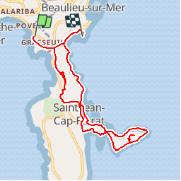


7.9 km | 10.3 km-effort


User


FREE GPS app for hiking
 SityTrail
IGN / Geographical institutes
SityTrail World
The world is yours!
Trail Walking of 10.1 km to be discovered at Provence-Alpes-Côte d'Azur, Maritime Alps, Villefranche-sur-Mer. This trail is proposed by jlrayon.
Circuit Long
Départ : Parking de l’ange gardien -Port de St Jean Cap Ferrat –
Chapelle de Saint-Hospice - Plage de passable (Baignade et piquenique)
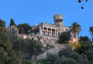
Villa Ephrussi de Rothschild -Villa Grecque Kérylos -Retour au parking
Walking

Walking
On foot

Walking
Walking
Walking

Walking
Walking

Walking