Trail Walking Corneilla-del-Vercol - CORNEILLA-DEL-VERCOL 66 - THEZA - l'Agouille de la Mar - le VERCOL - Photo

CORNEILLA-DEL-VERCOL 66 - THEZA - l'Agouille de la Mar - le VERCOL

 jeff66
jeff66

User

© OpenStreetMap contributors
Length
Length
12.3 km
Max alt
Max alt
20 m
Uphill gradient
Uphill gradient
56 m
Km-Effort
Km-Effort  
13.1 km
Min alt
Min alt
3 m
Downhill gradient
Downhill gradient
56 m
Boucle
Boucle
Yes
Creation date :
2015-06-30 00:00:00.0
Updated on :
2015-06-30 00:00:00.0

(1 Reviews)

Walking
Walking
2h12
Difficulty : Easy

Scan this QR Code to open this trail in the SityTrail application

FREE GPS app for hiking

Logo SityTrail SityTrail

IGN / Geographical institutes

Download SityTrail from the App Store Download SityTrail from Google Play

Logo SityTrail SityTrail World

The world is yours!

Download SityTrail from the App Store Download SityTrail from Google Play Download SityTrail on Huawei AppGallery

About

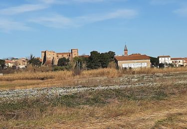
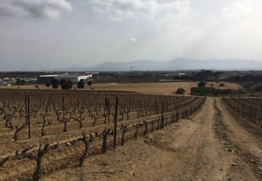
Trail Walking of 12.3 km to be discovered at Occitania, Pyrénées-Orientales, Corneilla-del-Vercol. This trail is proposed by jeff66.

Description

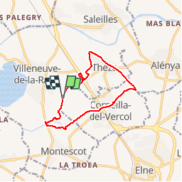
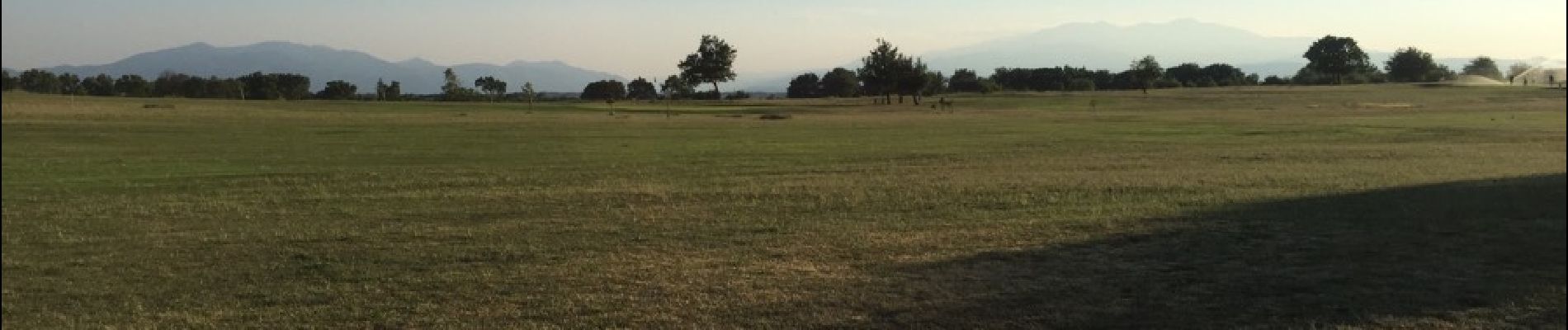
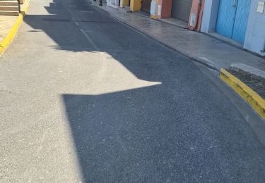
CORNEILLA-DEL-VERCOL 66 - Les Fontetes - Les Closes - bretelle sur N114 - La traces sa  - la Podadora - THEZA - lot. Quinze Olius - mas Sant Joan - l'Oratori - tombe - rue Carolus Magnus - rue du canal - Christ - chemin de Charlemagne - Negabous - mas de la méridienne - le petit mas blanc - l'Agouille de la Mar - station d'épuration - Chapelle du Paradis - parcours sportif - Corneilla del vercol - aires de jeux - cimetière - rue du canal - passage le long de l'agouille sous la RN 114 et la voie ferrée - berges de l'agouille Prairies du Vercol et ALBERES - La Bassetta - Prat del Roc - passages à gués et ponts - allée de mûriers centenaires - mas Bellrich - château d'Avallrich - la Colomina d'en Vidal - golf club de Villeneuve de la Raho - les Rotes - Val Marie

Elevation profile

Photos

24 photos in total. Please click on a photo to see them all in the gallery.

Positioning

Country:
France
Region :
Occitania
Department/Province :
Pyrénées-Orientales
Municipality :
Corneilla-del-Vercol
Location:
Unknown
Start:(UTM)
494357 ; 4719407 (31T) N.

Comments

Please log in to post a review or rate the element


Trails nearby

Trail Walking Montescot - 66 VILLENEUVE-DE-LA-RAHO grand tour du lac en Sens horaire  - Photo
Walking
jeff66

Walking

Easy
(1)
Montescot, Occitania, Pyrénées-Orientales, France
6.7 km | 7.5 km-effort
1h 4min
Yes
Trail Walking Théza - 66 THEZA - CORNEILLA-DEL-VERCOL - Photo
Walking
jeff66

Walking

Easy
(2)
Théza, Occitania, Pyrénées-Orientales, France
7 km | 7.5 km-effort
1h 8min
Yes
Trail Walking Villeneuve-de-la-Raho - 66 VILLENEUVE-DE-LA-RAHO - grand tour périphérique du lac par les lignes de crêtes  - Photo
Walking
jeff66

Walking

Easy
(2)
Villeneuve-de-la-Raho, Occitania, Pyrénées-Orientales, France
10 km | 11.5 km-effort
1h 44min
Yes
Trail Walking Saleilles - 66 SALEILLES - St-NAZAIRE, entre FOSSEILLE et REART - Photo
Walking
jeff66

Walking

Easy
(1)
Saleilles, Occitania, Pyrénées-Orientales, France
7.3 km | 7.7 km-effort
1h 8min
Yes
Trail Quad Villeneuve-de-la-Raho -  Villeneuve-de-la-Raho-Collioure (Septembre/Juin) - Photo
Quad
Quad Ride

Quad

Medium
(1)
Villeneuve-de-la-Raho, Occitania, Pyrénées-Orientales, France
44 km | 51 km-effort
1h 45min
No
Trail Walking Corneilla-del-Vercol - thématique mo tescot du 18 02 2023 - Photo
Walking
66Gribouille83

Walking

Medium
(1)
Corneilla-del-Vercol, Occitania, Pyrénées-Orientales, France
8.9 km | 9.4 km-effort
1h 57min
Yes
Trail Walking Perpignan - Perpignan  - Photo
Walking
ombrabella

Walking

Very easy
Perpignan, Occitania, Pyrénées-Orientales, France
18 km | 19.9 km-effort
2h 23min
No
Trail Walking Montescot - 66 VILLENEUVE-DE-LA-RAHO grand tour du lac en Sens horaire  - Photo
Walking
jeff66

Walking

Easy
Montescot, Occitania, Pyrénées-Orientales, France
6.7 km | 7.5 km-effort
1h 4min
Yes
Trail Walking Perpignan - 66 PERPIGNAN - mas Balande, parc des sports, aviateurs, St Martin, MAV, Vertefeuille - Photo
Walking
jeff66

Walking

Easy
Perpignan, Occitania, Pyrénées-Orientales, France
10.6 km | 11.6 km-effort
1h 52min
Yes


Close
My subscriptions