Trail Walking Saint-Christophe-en-Oisans - Oisans - Vénéon - La Lavey - Photo
 Orcal37
Orcal37

User

© OpenStreetMap contributors
Length
Length
12.9 km
Max alt
Max alt
1808 m
Uphill gradient
Uphill gradient
573 m
Km-Effort
Km-Effort  
21 km
Min alt
Min alt
1429 m
Downhill gradient
Downhill gradient
573 m
Boucle
Boucle
Yes
Creation date :
2015-07-01 00:00:00.0
Updated on :
2021-09-09 17:14:46.624

(0 Reviews)

Walking
Walking
5h40
Difficulty : Difficult

Scan this QR Code to open this trail in the SityTrail application

FREE GPS app for hiking

Logo SityTrail SityTrail

IGN / Geographical institutes

Download SityTrail from the App Store Download SityTrail from Google Play

Logo SityTrail SityTrail World

The world is yours!

Download SityTrail from the App Store Download SityTrail from Google Play Download SityTrail on Huawei AppGallery

About

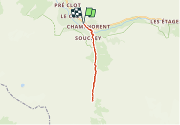
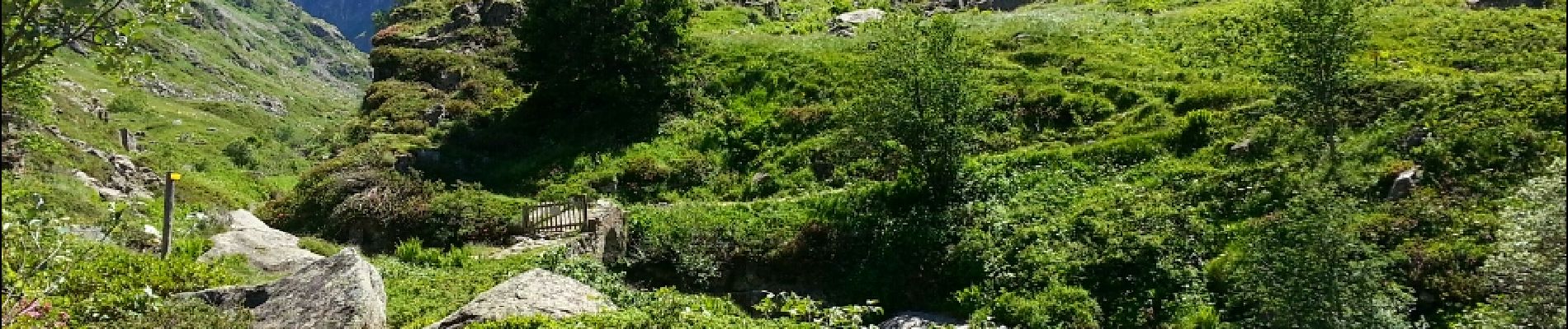
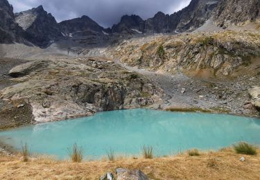
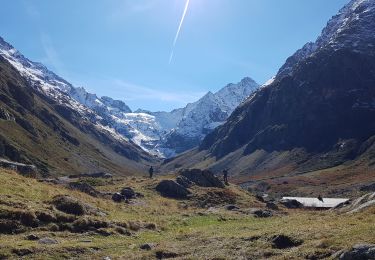
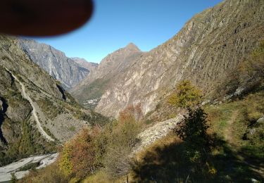
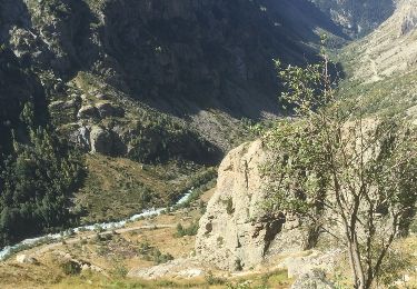
Trail Walking of 12.9 km to be discovered at Auvergne-Rhône-Alpes, Isère, Saint-Christophe-en-Oisans. This trail is proposed by Orcal37.

Description

Oisans - Vénéon - Refuge de La Lavey

Elevation profile

Photos

Positioning

Country:
France
Region :
Auvergne-Rhône-Alpes
Department/Province :
Isère
Municipality :
Saint-Christophe-en-Oisans
Location:
Unknown
Start:(UTM)
279032 ; 4979626 (32T) N.

Trails nearby

Trail Walking Saint-Christophe-en-Oisans - Lac des Bèches - Photo
Walking
GuyVachet

Walking

Very difficult
Saint-Christophe-en-Oisans, Auvergne-Rhône-Alpes, Isère, France
16 km | 31 km-effort
6h 33min
Yes
Trail Walking Saint-Christophe-en-Oisans - Le Refuge de La Lavey - Photo
Walking
patjobou

Walking

Medium
Saint-Christophe-en-Oisans, Auvergne-Rhône-Alpes, Isère, France
12.2 km | 20 km-effort
5h 52min
Yes
Trail Walking Les Deux Alpes - BOUCLE DU VENEON - Photo
Walking
floup6138

Walking

Difficult
Les Deux Alpes, Auvergne-Rhône-Alpes, Isère, France
12.5 km | 22 km-effort
5h 9min
Yes
Trail Walking Saint-Christophe-en-Oisans - Oisans - Vallon des Etages - 6.5km 375m 2h20 - 2018 06 19 - public - Photo
Walking
Orcal37

Walking

Medium
Saint-Christophe-en-Oisans, Auvergne-Rhône-Alpes, Isère, France
6.3 km | 11.2 km-effort
3h 20min
Yes
Trail Walking Saint-Christophe-en-Oisans - MONTÉE vers LE REFUGE DU SOREILLER-08-09-2016 - Photo
Walking
RD78-38

Walking

Medium
Saint-Christophe-en-Oisans, Auvergne-Rhône-Alpes, Isère, France
5.6 km | 16.9 km-effort
4h 5min
No
Trail Walking Saint-Christophe-en-Oisans - RETOUR du REFUGE DU SOREILLER-09-09-2016 - Photo
Walking
RD78-38

Walking

Medium
Saint-Christophe-en-Oisans, Auvergne-Rhône-Alpes, Isère, France
5.6 km | 9.6 km-effort
3h 2min
No
Trail Walking Saint-Christophe-en-Oisans - 0isans - Vénéon - du gîte du Plan du lac au Pont des Granges - AR - Photo
Walking
Orcal37

Walking

Medium
Saint-Christophe-en-Oisans, Auvergne-Rhône-Alpes, Isère, France
8.4 km | 11.6 km-effort
4h 15min
Yes
Trail Walking Saint-Christophe-en-Oisans - Oisans - Vénéon - Les Etages - Photo
Walking
Orcal37

Walking

Easy
Saint-Christophe-en-Oisans, Auvergne-Rhône-Alpes, Isère, France
5.2 km | 7.6 km-effort
3h 15min
Yes
Trail Walking Saint-Christophe-en-Oisans - Oisans - Vénéon - Vallon de Lanchâtra - Photo
Walking
Orcal37

Walking

Difficult
Saint-Christophe-en-Oisans, Auvergne-Rhône-Alpes, Isère, France
12.6 km | 24 km-effort
6h 5min
Yes


Close
My subscriptions