Trail Walking Saint-Paul-sur-Ubaye - Lac des 9 couleurs et Tête de la Frema - Photo
 fhascoet
fhascoet

User

© OpenStreetMap contributors
Length
Length
19.4 km
Max alt
Max alt
3123 m
Uphill gradient
Uphill gradient
1338 m
Km-Effort
Km-Effort  
37 km
Min alt
Min alt
1863 m
Downhill gradient
Downhill gradient
1313 m
Boucle
Boucle
Yes
Creation date :
2015-08-23 00:00:00.0
Updated on :
2015-08-23 00:00:00.0

(0 Reviews)

Walking
Walking
7h58
Difficulty : Difficult

Scan this QR Code to open this trail in the SityTrail application

FREE GPS app for hiking

Logo SityTrail SityTrail

IGN / Geographical institutes

Download SityTrail from the App Store Download SityTrail from Google Play

Logo SityTrail SityTrail World

The world is yours!

Download SityTrail from the App Store Download SityTrail from Google Play Download SityTrail on Huawei AppGallery

About

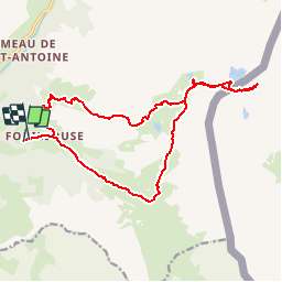
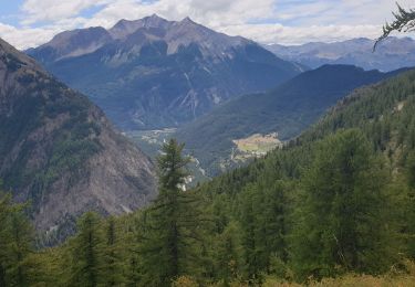
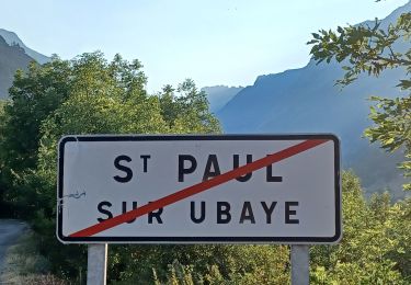
Trail Walking of 19.4 km to be discovered at Provence-Alpes-Côte d'Azur, Alpes-de-Haute-Provence, Saint-Paul-sur-Ubaye. This trail is proposed by fhascoet.

Description

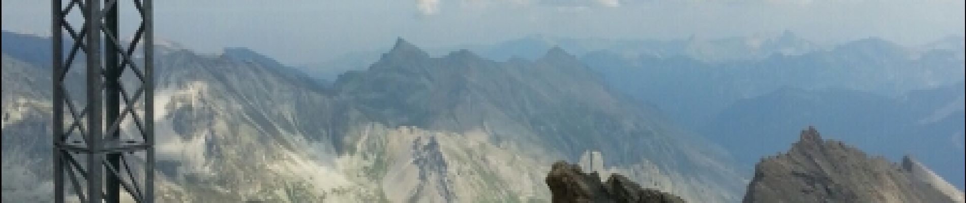
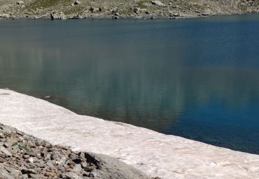
Balade classique jusqu'au lac des 9 couleurs. Extension vers la tête de la Frema en passant par le col de la Gypière.
Montée et descente à la Tête de la Frema sans difficultés mais raide.

Elevation profile

Photos

Positioning

Country:
France
Region :
Provence-Alpes-Côte d'Azur
Department/Province :
Alpes-de-Haute-Provence
Municipality :
Saint-Paul-sur-Ubaye
Location:
Unknown
Start:(UTM)
324941 ; 4932517 (32T) N.

Trails nearby

Trail Walking Val-d'Oronaye - Saint Ours - Plateau de Mallemort - Photo
Walking
Coqorico

Walking

Very easy
(2)
Val-d'Oronaye, Provence-Alpes-Côte d'Azur, Alpes-de-Haute-Provence, France
10.4 km | 15.4 km-effort
1h 49min
Yes
Trail Walking Saint-Paul-sur-Ubaye - Pic Panestrel - Photo
Walking
GAPIAN43

Walking

Difficult
(1)
Saint-Paul-sur-Ubaye, Provence-Alpes-Côte d'Azur, Alpes-de-Haute-Provence, France
13 km | 32 km-effort
6h 16min
Yes
Trail Other activity Saint-Paul-sur-Ubaye - massour  - Photo
Other activity
Sandrine1

Other activity

Medium
(1)
Saint-Paul-sur-Ubaye, Provence-Alpes-Côte d'Azur, Alpes-de-Haute-Provence, France
6.1 km | 19.3 km-effort
3h 19min
No
Trail Walking Saint-Paul-sur-Ubaye - Lac des 9 couleurs - Photo
Walking
andre06130

Walking

Medium
(1)
Saint-Paul-sur-Ubaye, Provence-Alpes-Côte d'Azur, Alpes-de-Haute-Provence, France
17.4 km | 31 km-effort
6h 15min
Yes
Trail Walking Val-d'Oronaye - FORT DE ST-OURS HAUT - Photo
Walking
walrou63

Walking

Easy
Val-d'Oronaye, Provence-Alpes-Côte d'Azur, Alpes-de-Haute-Provence, France
3.7 km | 5.2 km-effort
3h 15min
Yes
Trail Walking Saint-Paul-sur-Ubaye - Ancienne Batterie de Vallon Claous - Photo
Walking
andre06130

Walking

Very difficult
Saint-Paul-sur-Ubaye, Provence-Alpes-Côte d'Azur, Alpes-de-Haute-Provence, France
10.7 km | 19.6 km-effort
3h 16min
Yes
Trail Walking Saint-Paul-sur-Ubaye - SAINT PAUL  . Fouillouse o - Photo
Walking
RobinMicheline

Walking

Easy
Saint-Paul-sur-Ubaye, Provence-Alpes-Côte d'Azur, Alpes-de-Haute-Provence, France
12.6 km | 21 km-effort
3h 52min
Yes
Trail Walking Saint-Paul-sur-Ubaye - pic de la Fema par le lac des 9 couleurs - Photo
Walking
scalpy

Walking

Difficult
Saint-Paul-sur-Ubaye, Provence-Alpes-Côte d'Azur, Alpes-de-Haute-Provence, France
20 km | 38 km-effort
5h 56min
No
Trail Walking Val-d'Oronaye - Cabane et belvédère forêt de la Rochaille.  - Photo
Walking
Dervalmarc

Walking

Medium
Val-d'Oronaye, Provence-Alpes-Côte d'Azur, Alpes-de-Haute-Provence, France
8.9 km | 14.1 km-effort
4h 47min
Yes


Close
My subscriptions