Trail Walking Beuil - Là tête du Garnier  - Photo
 franquen
franquen

User

© OpenStreetMap contributors
Length
Length
14 km
Max alt
Max alt
1901 m
Uphill gradient
Uphill gradient
521 m
Km-Effort
Km-Effort  
21 km
Min alt
Min alt
1434 m
Downhill gradient
Downhill gradient
537 m
Boucle
Boucle
Yes
Creation date :
2015-09-19 00:00:00.0
Updated on :
2015-09-19 00:00:00.0

(0 Reviews)

Walking
Walking
4h18
Difficulty : Easy

Scan this QR Code to open this trail in the SityTrail application

FREE GPS app for hiking

Logo SityTrail SityTrail

IGN / Geographical institutes

Download SityTrail from the App Store Download SityTrail from Google Play

Logo SityTrail SityTrail World

The world is yours!

Download SityTrail from the App Store Download SityTrail from Google Play Download SityTrail on Huawei AppGallery

About

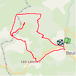
Trail Walking of 14 km to be discovered at Provence-Alpes-Côte d'Azur, Maritime Alps, Beuil. This trail is proposed by franquen.

Description

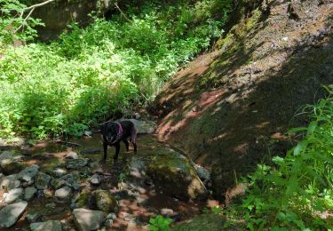
Randonnée agréable dans les bois de pins et de mélèzes.
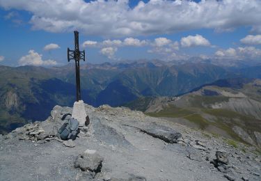
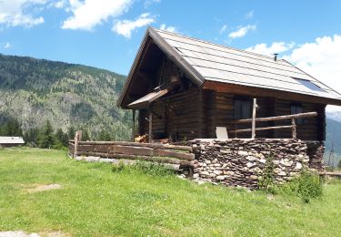
Belle vue du haut Mercantour de la tête de Garnier.

Elevation profile

Positioning

Country:
France
Region :
Provence-Alpes-Côte d'Azur
Department/Province :
Maritime Alps
Municipality :
Beuil
Location:
Unknown
Start:(UTM)
338748 ; 4884611 (32T) N.

Trails nearby

Trail Snowshoes Beuil - Beuil :Rando raquettes (Aller) - Photo
Snowshoes
PEBREJOSIANE

Snowshoes

Easy
(2)
Beuil, Provence-Alpes-Côte d'Azur, Maritime Alps, France
4.3 km | 6.6 km-effort
1h 40min
No
Trail On foot Guillaumes - Sentier Planétaire - Photo
On foot
PRO

On foot

Easy
Guillaumes, Provence-Alpes-Côte d'Azur, Maritime Alps, France
9.2 km | 13 km-effort
2h 57min
Yes
Trail On foot Beuil - Tête du Garnier - Photo
On foot
PRO

On foot

Easy
Beuil, Provence-Alpes-Côte d'Azur, Maritime Alps, France
11.2 km | 17.8 km-effort
4h 3min
Yes
Trail On foot Beuil - Corniches du Cians - Photo
On foot
PRO

On foot

Difficult
Beuil, Provence-Alpes-Côte d'Azur, Maritime Alps, France
18.3 km | 32 km-effort
7h 12min
Yes
Trail On foot Péone - Mont Mounier - Photo
On foot
PRO

On foot

Difficult
Péone, Provence-Alpes-Côte d'Azur, Maritime Alps, France
18.4 km | 34 km-effort
7h 41min
Yes
Trail Snowshoes Roubion - Couillole Mt Brussière - Photo
Snowshoes
evdm

Snowshoes

Easy
(2)
Roubion, Provence-Alpes-Côte d'Azur, Maritime Alps, France
5 km | 8.6 km-effort
2h 0min
Yes
Trail Walking Beuil - corniche du CIANS - Photo
Walking
fredopaca

Walking

Medium
(1)
Beuil, Provence-Alpes-Côte d'Azur, Maritime Alps, France
18.8 km | 32 km-effort
6h 35min
Yes
Trail Walking Beuil - balcon sur les gorges du cians - Photo
Walking
pln30

Walking

Medium
Beuil, Provence-Alpes-Côte d'Azur, Maritime Alps, France
10.2 km | 16.3 km-effort
3h 16min
Yes
Trail Walking Roure - Refuge et Porte de Longon, circuit de Vignols, Roure J2 - Photo
Walking
GrouGary

Walking

Medium
Roure, Provence-Alpes-Côte d'Azur, Maritime Alps, France
19.6 km | 28 km-effort
5h 8min
No


Close
My subscriptions