Trail Walking Sainte-Marie-la-Mer - 66 SAINTE-MARIE-LA-MER - à Sainte-Marie plage par la SALANQUE, la TÊT, le port le front de mer, et les canaux  - Photo

66 SAINTE-MARIE-LA-MER - à Sainte-Marie plage par la SALANQUE, la TÊT, le port le front de mer, et les canaux

 jeff66
jeff66

User

© OpenStreetMap contributors
Length
Length
12.1 km
Max alt
Max alt
6 m
Uphill gradient
Uphill gradient
42 m
Km-Effort
Km-Effort  
12.6 km
Min alt
Min alt
-2 m
Downhill gradient
Downhill gradient
41 m
Boucle
Boucle
Yes
Creation date :
2016-03-09 00:00:00.0
Updated on :
2016-03-09 00:00:00.0

(1 Reviews)

Walking
Walking
2h00
Difficulty : Medium

Scan this QR Code to open this trail in the SityTrail application

FREE GPS app for hiking

Logo SityTrail SityTrail

IGN / Geographical institutes

Download SityTrail from the App Store Download SityTrail from Google Play

Logo SityTrail SityTrail World

The world is yours!

Download SityTrail from the App Store Download SityTrail from Google Play Download SityTrail on Huawei AppGallery

About

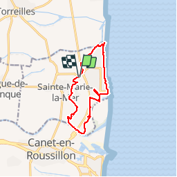
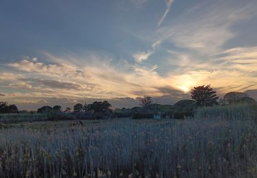
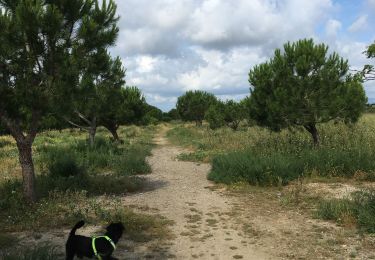
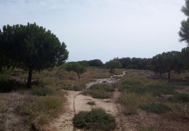
Trail Walking of 12.1 km to be discovered at Occitania, Pyrénées-Orientales, Sainte-Marie-la-Mer. This trail is proposed by jeff66.

Description

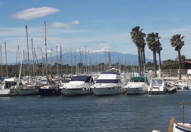
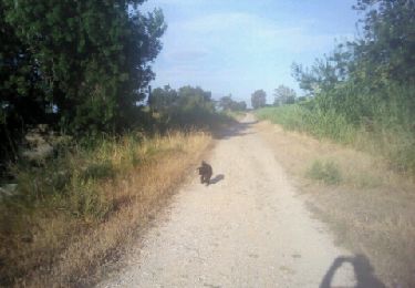
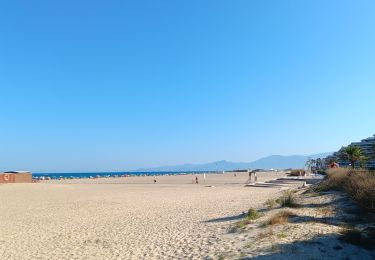
66 SAINTE-MARIE-LA-MER - parking du stade Louis Carrere, D12. av. du stade,pl. g. Brassens et j. cocteau, rue Debussy. Av. Pablo Casals, rue  sdes palmiers, des chênes - els Carboelles - Carrer de Mallorca - champs d'artichauts - El Riberal - la TÊT, passage sous la D81, les closes - petite passerelle sur l'Eixau vella - SAINTE-MARIE-PLAGE - els Gravatels - port de plaisance - av. des dauphins et des berges du canal - bar l'oasis, plages, Bld du front de mer, rue des mouettes, el pica pica, pica beach, etang, Agulla de l'Auca, moli de la vilallonga. Les illes - rues des abricotiers, des pêchers - sainte Marie la mer villahe, passage piéton sous D81

Elevation profile

Photos

Positioning

Country:
France
Region :
Occitania
Department/Province :
Pyrénées-Orientales
Municipality :
Sainte-Marie-la-Mer
Location:
Unknown
Start:(UTM)
502029 ; 4730902 (31T) N.

Comments

Please log in to post a review or rate the element


Trails nearby

Trail Walking Canet-en-Roussillon - CANET-EN-ROUSSILLON 66 - entre TÊT, marais. étang et RÉART  - Photo
Walking
jeff66

Walking

Medium
(1)
Canet-en-Roussillon, Occitania, Pyrénées-Orientales, France
16.3 km | 17.5 km-effort
2h 49min
Yes
Trail Walking Sainte-Marie-la-Mer - sainte marie la mer - village et plage  - Photo
Walking
stef789

Walking

Easy
Sainte-Marie-la-Mer, Occitania, Pyrénées-Orientales, France
8.6 km | 8.9 km-effort
2h 40min
Yes
Trail Walking Sainte-Marie-la-Mer - sainte Marie la mer HUIT KM plus retour en voiture oups désolé  - Photo
Walking
stef789

Walking

Very difficult
Sainte-Marie-la-Mer, Occitania, Pyrénées-Orientales, France
45 km | 49 km-effort
4h 18min
No
Trail Walking Sainte-Marie-la-Mer - sainte-marie côté mer  - Photo
Walking
stef789

Walking

Very easy
Sainte-Marie-la-Mer, Occitania, Pyrénées-Orientales, France
8.4 km | 8.7 km-effort
2h 45min
Yes
Trail Walking Torreilles - Torreilles plage -Torreilles village  - Photo
Walking
merencianoep

Walking

Torreilles, Occitania, Pyrénées-Orientales, France
8.2 km | 8.6 km-effort
1h 47min
Yes
Trail Walking Torreilles - Les Dunes Juhègues - Photo
Walking
karani27

Walking

Easy
Torreilles, Occitania, Pyrénées-Orientales, France
11.5 km | 12 km-effort
2h 21min
No
Trail Walking Sainte-Marie-la-Mer - tour de ste Marie la mer  - Photo
Walking
junique

Walking

Very easy
Sainte-Marie-la-Mer, Occitania, Pyrénées-Orientales, France
5.7 km | 6 km-effort
1h 19min
Yes
Trail Walking Torreilles - long agly pres juhegues 29 juin 2013 matin - Photo
Walking
merencianoep

Walking

Very easy
Torreilles, Occitania, Pyrénées-Orientales, France
9.5 km | 10.1 km-effort
1h 31min
No
Trail Walking Canet-en-Roussillon - Le canet, la plage des kèkès ... - Photo
Walking
stef789

Walking

Easy
Canet-en-Roussillon, Occitania, Pyrénées-Orientales, France
4.3 km | 4.6 km-effort
1h 7min
Yes


Close
My subscriptions