


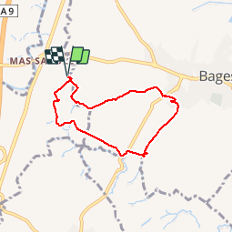

6.7 km | 7.5 km-effort


User


FREE GPS app for hiking
 SityTrail
IGN / Geographical institutes
SityTrail World
The world is yours!
Trail Walking of 6.5 km to be discovered at Occitania, Pyrénées-Orientales, Villemolaque. This trail is proposed by jeff66.
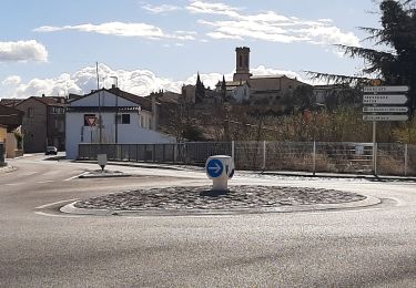
66 MAS SABOLE - serrat d'en guixet - panorama sur BAGES VILLENEUVE LES ALBÈRES - Mas Llobes - la Vinya nova - Candell - emprunter la
RD40b - les conques - El Fornas - BAGES passage à gue puis pont sur la riberette, rue de la tramontane, allée du levant, rue du sirocco, PUIG Dallat - traverser la RD40b pour prendre le chemin vers le Château d'Eau - Millaroles - les questions

Walking

Walking

Walking
Walking

Mountain bike
Walking
Walking

Walking
Walking