Trail Walking Riquewihr - Sentier des grands crus - Photo

Sentier des grands crus

 pascalou73
pascalou73

User GUIDE

© OpenStreetMap contributors
Length
Length
11.5 km
Max alt
Max alt
299 m
Uphill gradient
Uphill gradient
218 m
Km-Effort
Km-Effort  
14.4 km
Min alt
Min alt
209 m
Downhill gradient
Downhill gradient
219 m
Boucle
Boucle
Yes
Creation date :
2015-10-15 00:00:00.0
Updated on :
2015-10-15 00:00:00.0

(2 Reviews)

Walking
Walking
3h07
Difficulty : Medium

Scan this QR Code to open this trail in the SityTrail application

FREE GPS app for hiking

Logo SityTrail SityTrail

IGN / Geographical institutes

Download SityTrail from the App Store Download SityTrail from Google Play

Logo SityTrail SityTrail World

The world is yours!

Download SityTrail from the App Store Download SityTrail from Google Play Download SityTrail on Huawei AppGallery

About

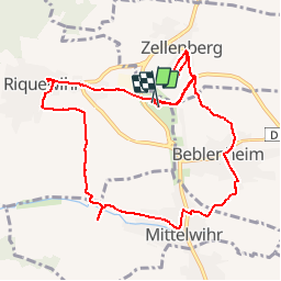
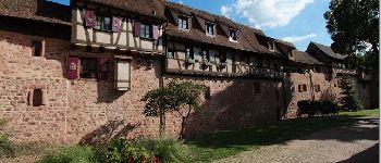
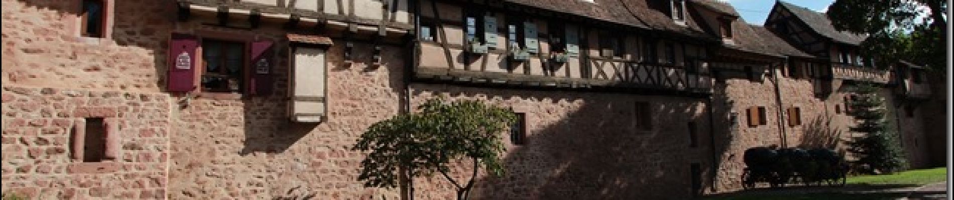
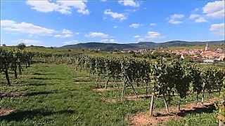
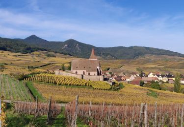
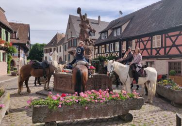
Trail Walking of 11.5 km to be discovered at Grand Est, Haut-Rhin, Riquewihr. This trail is proposed by pascalou73.

Description

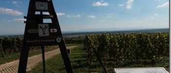
Une rando sur les sentiers viticole des grands crus de l Alsace.Avec les beaux villages d Alsace .bonne rando

Elevation profile

Photos

Points of interest

Point of interest Beblenheim - grand cru - Photo
pascalou73
BEBLENHEIM 
Point of interest Mittelwihr - grand cru - Photo
pascalou73
MITTELWIHR 
Point of interest Beblenheim - grand cru - Photo
pascalou73
BEBLENHEIM 
Point of interest Riquewihr - grand cru - Photo
pascalou73
RIQUEWIHR 
Point of interest Riquewihr - grand cru - Photo
pascalou73
RIQUEWIHR 
Point of interest Riquewihr - grand cru - Photo
pascalou73
RIQUEWIHR 

Positioning

Country:
France
Region :
Grand Est
Department/Province :
Haut-Rhin
Municipality :
Riquewihr
Location:
Unknown
Start:(UTM)
374736 ; 5335896 (32U) N.

Comments

Please log in to post a review or rate the element


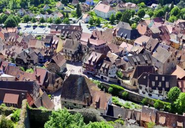
Jolie rando, dommage que la dernière partie soit un peu trop en ville


Trails nearby

Trail Walking Ammerschwihr - D'Ammerschwihr aux Trois Epis - Photo
Walking
VacheKiri67

Walking

Difficult
(1)
Ammerschwihr, Grand Est, Haut-Rhin, France
17.1 km | 25 km-effort
5h 35min
Yes
Trail Mountain bike Ribeauvillé - Ribeauvillé Riquewihr - Photo
Mountain bike
tracegps

Mountain bike

Medium
(1)
Ribeauvillé, Grand Est, Haut-Rhin, France
19.3 km | 24 km-effort
1h 30min
Yes
Trail Walking Ribeauvillé - 2023-08-26 Marche Ribeauville Taennchel - Photo
Walking
GUIDE
holtzv

Walking

Medium
(1)
Ribeauvillé, Grand Est, Haut-Rhin, France
20 km | 34 km-effort
7h 45min
Yes
Trail Walking Kaysersberg-Vignoble - 2021-05-30 Marche Kaysersberg Ursprung St Alexis - Photo
Walking
GUIDE
holtzv

Walking

Very difficult
Kaysersberg-Vignoble, Grand Est, Haut-Rhin, France
17.1 km | 26 km-effort
4h 46min
Yes
Trail Horseback riding Kaysersberg-Vignoble - 2019-10-26 CDTE67 Tournage Video Promotion TE - Photo
Horseback riding
GUIDE
holtzv

Horseback riding

Easy
Kaysersberg-Vignoble, Grand Est, Haut-Rhin, France
24 km | 29 km-effort
24min
No
Trail Walking Hunawihr - Hunawihr - Riquewihr - Photo
Walking
JMCMoreau

Walking

Easy
(1)
Hunawihr, Grand Est, Haut-Rhin, France
6.3 km | 9 km-effort
2h 15min
Yes
Trail Horseback riding Kaysersberg-Vignoble - 000004 - Photo
Horseback riding
GUIDE
holtzv

Horseback riding

Very difficult
Kaysersberg-Vignoble, Grand Est, Haut-Rhin, France
32 km | 45 km-effort
5h 55min
Yes
Trail Walking Kaysersberg-Vignoble - Le tour de Kysersberg - Photo
Walking
GUIDE
pascalou73

Walking

Medium
(1)
Kaysersberg-Vignoble, Grand Est, Haut-Rhin, France
7.9 km | 11.7 km-effort
2h 34min
Yes
Trail Walking Mittelwihr - Mittelwihr - Beblenheim - Zellenberg - Hunawihr  - Riquewihr -  Nécropole de Sigolsheim - Photo
Walking
VacheKiri67

Walking

Medium
Mittelwihr, Grand Est, Haut-Rhin, France
14.5 km | 19.3 km-effort
4h 8min
Yes


Close
My subscriptions