Trail Walking Le Soler - 66 LE SOLER - TOULOUGES, village, jardins, vergers, canaux et la Basse - Photo

66 LE SOLER - TOULOUGES, village, jardins, vergers, canaux et la Basse

 jeff66
jeff66

User

© OpenStreetMap contributors
Length
Length
13.5 km
Max alt
Max alt
80 m
Uphill gradient
Uphill gradient
59 m
Km-Effort
Km-Effort  
14.3 km
Min alt
Min alt
60 m
Downhill gradient
Downhill gradient
59 m
Boucle
Boucle
Yes
Creation date :
2015-10-21 00:00:00.0
Updated on :
2015-10-21 00:00:00.0

(0 Reviews)

Walking
Walking
2h15
Difficulty : Medium

Scan this QR Code to open this trail in the SityTrail application

FREE GPS app for hiking

Logo SityTrail SityTrail

IGN / Geographical institutes

Download SityTrail from the App Store Download SityTrail from Google Play

Logo SityTrail SityTrail World

The world is yours!

Download SityTrail from the App Store Download SityTrail from Google Play Download SityTrail on Huawei AppGallery

About

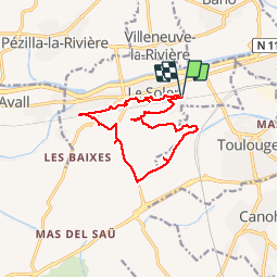
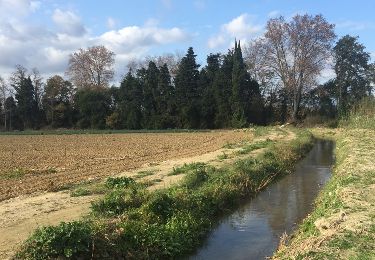
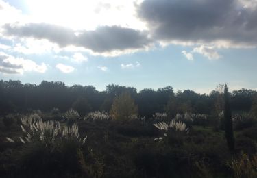
Trail Walking of 13.5 km to be discovered at Occitania, Pyrénées-Orientales, Le Soler. This trail is proposed by jeff66.

Description

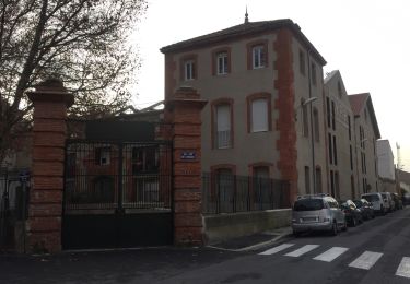
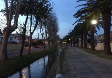
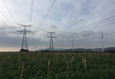
66 LE SOLER - parking du stade de rugby à XIII, centres de loisirs, garderie, suivre RD39 Route de TOULOUGES, jusqu'au rond point Jordi Barre, prendre avenue Pablo Casals, enjamber puis suivre Correc de Santa Eugenia, impasse Marabeille, Mognas (Monyas) - longer la Basse,la font de Llapi, les Taoulous, le syphon, l'espinassera, retenue de la font Del Castanyer, parc photovoltaïque, ouvragesu sur du diamant et du ruisseau de l'Achau, mas de l'Eule - emprunter la RD37 - l'Arrancada, longer puis traverser la voie ferrée, rues Molière, Gilbert brutus, l'idem, rue Pastzur, cité des fleurs, rue Daniele Casanova, rues Coppernic, Gutemberg, Claude Bernard, lot.Camp de la Creu, rue Franklin, école François Arago. Rue de Cerdagne

Elevation profile

Photos

Positioning

Country:
France
Region :
Occitania
Department/Province :
Pyrénées-Orientales
Municipality :
Le Soler
Location:
Unknown
Start:(UTM)
484420 ; 4725467 (31T) N.

Trails nearby

Trail Mountain bike Canohès - canohes - Photo
Mountain bike
haroldtheviking

Mountain bike

Medium
(2)
Canohès, Occitania, Pyrénées-Orientales, France
37 km | 44 km-effort
2h 12min
Yes
Trail Walking Perpignan - canal Perpignan  - Photo
Walking
Fildesir

Walking

Very easy
Perpignan, Occitania, Pyrénées-Orientales, France
25 km | 27 km-effort
7h 29min
No
Trail Walking Saint-Féliu-d'Avall - 66 ST-FELIU-D'AVALL, CORNEILLA DE LA RIVIERE, promenade autour de la Têt - Photo
Walking
jeff66

Walking

Easy
Saint-Féliu-d'Avall, Occitania, Pyrénées-Orientales, France
6.6 km | 7 km-effort
1h 16min
Yes
Trail Walking Perpignan - 66 PERPIGNAN - CANOHES par le canal et le ch. des Carlettes - Photo
Walking
jeff66

Walking

Medium
(1)
Perpignan, Occitania, Pyrénées-Orientales, France
9.4 km | 10.1 km-effort
1h 45min
Yes
Trail Walking Baho - 66 SAINT-ESTEVE, promenade entre jardins, canaux et centre ville - Photo
Walking
jeff66

Walking

Easy
Baho, Occitania, Pyrénées-Orientales, France
6.9 km | 7.3 km-effort
1h 16min
Yes
Trail Walking Perpignan - 66 PERPIGNAN - de la Z.I.Sud au Centre Ville et retour par Saint-Mathieu - Photo
Walking
jeff66

Walking

Easy
Perpignan, Occitania, Pyrénées-Orientales, France
7.8 km | 8.5 km-effort
1h 28min
Yes
Trail Walking Saint-Estève - 66 ST-ESTEVE, à PERPIGNAN-Bas Vernet par Le centre ville, la Colomina et l'espace St-Mamet - Photo
Walking
jeff66

Walking

Medium
Saint-Estève, Occitania, Pyrénées-Orientales, France
14.2 km | 15.2 km-effort
2h 23min
Yes
Trail Walking Baixas - 66 VILLENEUVE-LA-RIVIÈRE, promenade entre parcs éoliens et vignobles CALCE - Photo
Walking
jeff66

Walking

Easy
Baixas, Occitania, Pyrénées-Orientales, France
8 km | 8.7 km-effort
1h 33min
Yes
Trail Walking Perpignan - 66 PERPIGNAN, Ch. de STE BARBE, Mailloles, quartier des aviateurs, Serrat d'en Vaquer - Photo
Walking
jeff66

Walking

Easy
Perpignan, Occitania, Pyrénées-Orientales, France
8 km | 9.4 km-effort
1h 29min
Yes


Close
My subscriptions