Trail Walking Aime-la-Plagne - Circuit par les cretes Dzonfie, Quermoz depuis La Combe. - Photo

Circuit par les cretes Dzonfie, Quermoz depuis La Combe.

 DROCHON
DROCHON

User

© OpenStreetMap contributors
Length
Length
11.3 km
Max alt
Max alt
2440 m
Uphill gradient
Uphill gradient
989 m
Km-Effort
Km-Effort  
25 km
Min alt
Min alt
1638 m
Downhill gradient
Downhill gradient
986 m
Boucle
Boucle
Yes
Creation date :
2016-09-11 00:00:00.0
Updated on :
2016-09-11 00:00:00.0

(0 Reviews)

Walking
Walking
4h52
Difficulty : Easy

Scan this QR Code to open this trail in the SityTrail application

FREE GPS app for hiking

Logo SityTrail SityTrail

IGN / Geographical institutes

Download SityTrail from the App Store Download SityTrail from Google Play

Logo SityTrail SityTrail World

The world is yours!

Download SityTrail from the App Store Download SityTrail from Google Play Download SityTrail on Huawei AppGallery

About

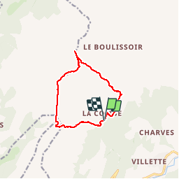
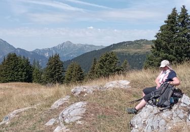
Trail Walking of 11.3 km to be discovered at Auvergne-Rhône-Alpes, Savoy, Aime-la-Plagne. This trail is proposed by DROCHON.

Description

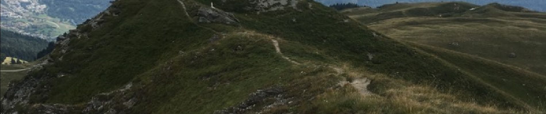
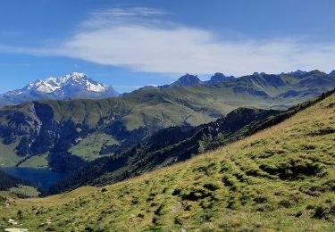
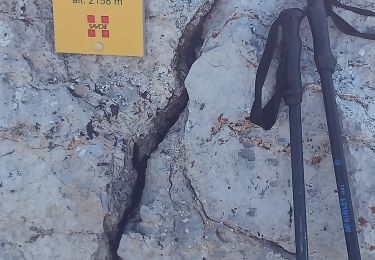
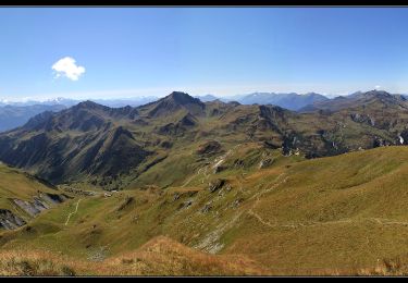
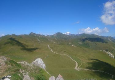
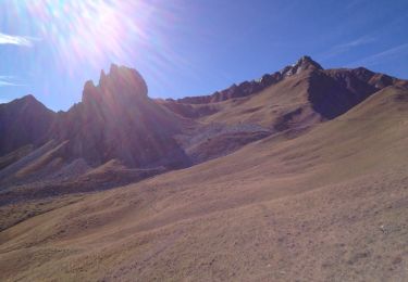
Circuit par les cretes depuis La Combe, Roche a Jonathan, pte du col, Dzonfie, Pte de Bagnaz, Quermoz et retour a La Combe.

Elevation profile

Photos

Positioning

Country:
France
Region :
Auvergne-Rhône-Alpes
Department/Province :
Savoy
Municipality :
Aime-la-Plagne
Location:
Aime
Start:(UTM)
311601 ; 5048134 (32T) N.

Trails nearby

Trail Walking Aime-la-Plagne - Balcons de Granier - Photo
Walking
patrando49

Walking

Easy
(2)
Aime-la-Plagne, Auvergne-Rhône-Alpes, Savoy, France
7.3 km | 12.6 km-effort
2h 48min
Yes
Trail Walking La Léchère - lacs de la tempête - Photo
Walking
GuyVachet

Walking

Very difficult
La Léchère, Auvergne-Rhône-Alpes, Savoy, France
14.8 km | 25 km-effort
7h 10min
Yes
Trail Walking Aime-la-Plagne - croix de tessins roche de janatan - Photo
Walking
Nolene

Walking

Medium
Aime-la-Plagne, Auvergne-Rhône-Alpes, Savoy, France
7.4 km | 15.2 km-effort
2h 22min
Yes
Trail Walking Aime-la-Plagne - Mont Coin  - Photo
Walking
flip38

Walking

Medium
Aime-la-Plagne, Auvergne-Rhône-Alpes, Savoy, France
17 km | 32 km-effort
6h 59min
Yes
Trail Walking La Léchère - Tour du Quermoz par Grand Naves  - Photo
Walking
zazie

Walking

Medium
La Léchère, Auvergne-Rhône-Alpes, Savoy, France
16 km | 30 km-effort
4h 30min
No
Trail Walking Aime-la-Plagne - le verraret (granier) par combe bénite - Photo
Walking
pascal.heurteau

Walking

Difficult
Aime-la-Plagne, Auvergne-Rhône-Alpes, Savoy, France
13 km | 24 km-effort
4h 24min
Yes
Trail Snowshoes La Léchère - poinye du dzonfie - Photo
Snowshoes
melsacri

Snowshoes

Medium
La Léchère, Auvergne-Rhône-Alpes, Savoy, France
5.4 km | 12.4 km-effort
49min
No
Trail Walking La Léchère - grand naves Beaufortain  - Photo
Walking
BernardAF

Walking

Very difficult
La Léchère, Auvergne-Rhône-Alpes, Savoy, France
12.8 km | 21 km-effort
5h 31min
Yes
Trail Walking Aime-la-Plagne - Boucle vers Montvillier Longefoy - Photo
Walking
NANE51

Walking

Medium
Aime-la-Plagne, Auvergne-Rhône-Alpes, Savoy, France
9.5 km | 13.7 km-effort
3h 33min
Yes


Close
My subscriptions