


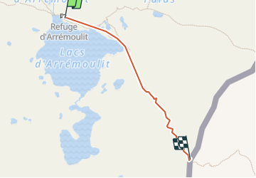


12.6 km | 19.1 km-effort


User


FREE GPS app for hiking
 SityTrail
IGN / Geographical institutes
SityTrail World
The world is yours!
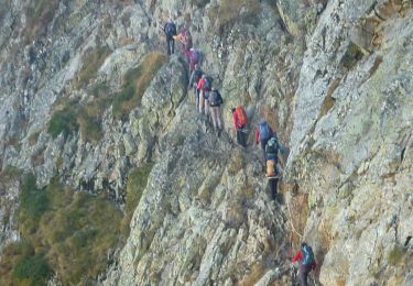
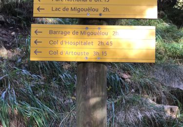
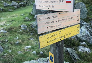
Trail Walking of 1.1 km to be discovered at New Aquitaine, Pyrénées-Atlantiques, Laruns. This trail is proposed by majorelle11.
Sept 2016

Walking

Walking
Walking
Walking
On foot
Walking
Walking

Walking

Walking