Trail Walking Vallouise-Pelvoux - Lac de Puy Aillaud - Photo
 R@ph
R@ph

User GUIDE

© OpenStreetMap contributors
Length
Length
11.5 km
Max alt
Max alt
2565 m
Uphill gradient
Uphill gradient
983 m
Km-Effort
Km-Effort  
25 km
Min alt
Min alt
1595 m
Downhill gradient
Downhill gradient
975 m
Boucle
Boucle
Yes
Creation date :
2016-09-25 00:00:00.0
Updated on :
2016-09-25 00:00:00.0

(0 Reviews)

Walking
Walking
5h01
Difficulty : Very difficult

Scan this QR Code to open this trail in the SityTrail application

FREE GPS app for hiking

Logo SityTrail SityTrail

IGN / Geographical institutes

Download SityTrail from the App Store Download SityTrail from Google Play

Logo SityTrail SityTrail World

The world is yours!

Download SityTrail from the App Store Download SityTrail from Google Play Download SityTrail on Huawei AppGallery

About

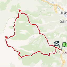
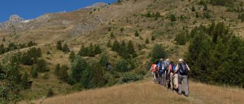
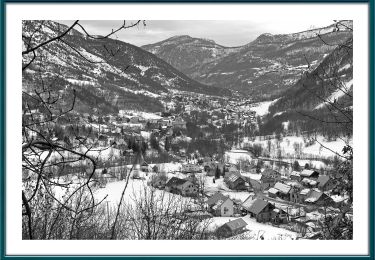
Trail Walking of 11.5 km to be discovered at Provence-Alpes-Côte d'Azur, Hautes-Alpes, Vallouise-Pelvoux. This trail is proposed by R@ph.

Description

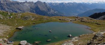
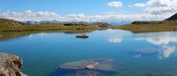
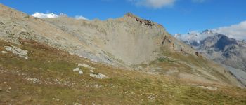
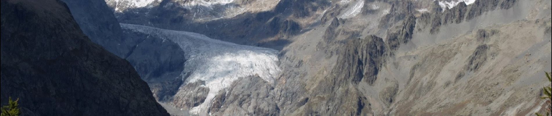
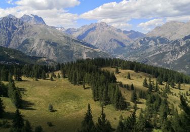
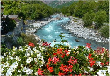
Belle randonnée en boucle vers le Lac de Puy Aillaud au départ de la station de Pelvoux. Passage par le belvédère des 3 refuges et retour à Puy Aillaud.

Elevation profile

Photos

Points of interest

Point of interest Vallouise-Pelvoux - Belvédère - Photo
R@ph
VALLOUISE-PELVOUX 
Point of interest Vallouise-Pelvoux - Lac Puy Aillaud - Photo
R@ph
VALLOUISE-PELVOUX 
Point of interest Vallouise-Pelvoux - Lac Puy Aillaud - Photo
R@ph
VALLOUISE-PELVOUX 
Point of interest Vallouise-Pelvoux - La dent du lac - Photo
R@ph
VALLOUISE-PELVOUX 
Point of interest Vallouise-Pelvoux - L'ascension - Photo
R@ph
VALLOUISE-PELVOUX 

Positioning

Country:
France
Region :
Provence-Alpes-Côte d'Azur
Department/Province :
Hautes-Alpes
Municipality :
Vallouise-Pelvoux
Location:
Vallouise
Start:(UTM)
300966 ; 4970006 (32T) N.

Trails nearby

Trail Walking Puy-Saint-Vincent - La tête d'Oreac - Photo
Walking
Sigmut

Walking

Easy
(1)
Puy-Saint-Vincent, Provence-Alpes-Côte d'Azur, Hautes-Alpes, France
6 km | 10.4 km-effort
3h 55min
Yes
Trail Walking Vallouise-Pelvoux - traversé du pelvoux - Photo
Walking
bellouelo46

Walking

Very easy
(2)
Vallouise-Pelvoux, Provence-Alpes-Côte d'Azur, Hautes-Alpes, France
25 km | 58 km-effort
19h 10min
No
Trail Walking Puy-Saint-Vincent - Cascades de Narreyroux - Puy Saint Vincent - Photo
Walking
tracegps

Walking

Difficult
(1)
Puy-Saint-Vincent, Provence-Alpes-Côte d'Azur, Hautes-Alpes, France
11.4 km | 19.2 km-effort
4h 0min
Yes
Trail On foot Vallouise-Pelvoux - Boucle vers Puy Aillaud - Photo
On foot
PRO

On foot

Easy
Vallouise-Pelvoux, Provence-Alpes-Côte d'Azur, Hautes-Alpes, France
5.3 km | 10.2 km-effort
2h 19min
No
Trail On foot Vallouise-Pelvoux - Boucle de Pelvoux - Photo
On foot
PRO

On foot

Easy
Vallouise-Pelvoux, Provence-Alpes-Côte d'Azur, Hautes-Alpes, France
12.2 km | 18.7 km-effort
4h 15min
Yes
Trail On foot Vallouise-Pelvoux - Boucle de Vallouise - Photo
On foot
PRO

On foot

Easy
Vallouise-Pelvoux, Provence-Alpes-Côte d'Azur, Hautes-Alpes, France
8.1 km | 11.6 km-effort
2h 38min
Yes
Trail Snowshoes Puy-Saint-Vincent - la tête d'Oréac - Photo
Snowshoes
GUIDE
amiral13

Snowshoes

Medium
Puy-Saint-Vincent, Provence-Alpes-Côte d'Azur, Hautes-Alpes, France
6.4 km | 11.4 km-effort
4h 7min
Yes
Trail Walking Puy-Saint-Vincent - le lac des Hermes - Photo
Walking
GUIDE
amiral13

Walking

Easy
Puy-Saint-Vincent, Provence-Alpes-Côte d'Azur, Hautes-Alpes, France
4.3 km | 6.5 km-effort
3h 9min
Yes
Trail Walking Puy-Saint-Vincent - Narreyroux au départ de PSV 1600 - Photo
Walking
GUIDE
amiral13

Walking

Very easy
Puy-Saint-Vincent, Provence-Alpes-Côte d'Azur, Hautes-Alpes, France
4.6 km | 6.3 km-effort
1h 49min
Yes


Close
My subscriptions