


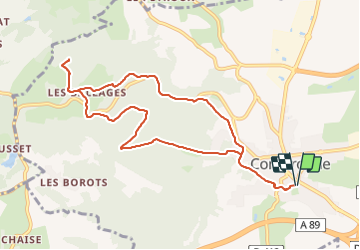

9.5 km | 13.4 km-effort

User GUIDE


FREE GPS app for hiking
 SityTrail
IGN / Geographical institutes
SityTrail World
The world is yours!
Trail Walking of 10 km to be discovered at Auvergne-Rhône-Alpes, Puy-de-Dôme, Combronde. This trail is proposed by jagarnier.
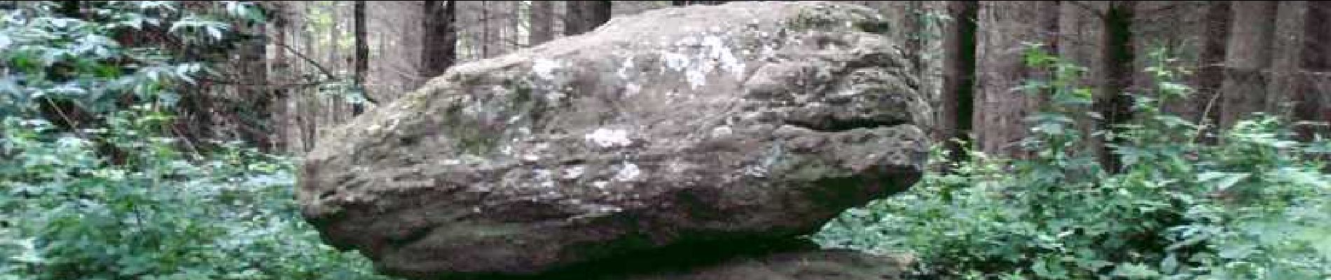
Dans une contrée où l'eau est une richesse multiforme, cette randonnée, traverse aussi les époques. D'un site curieux, "la pierre branlante", jusqu'à l'autoroute qui est venu traverser le paysage au début de XXIème siècle.


Walking

Walking

Walking

Walking

Walking
On foot
On foot

Walking

On foot