Trail Walking Saint-Sulpice-de-Favières - 2016-12-20 Saint Sulpice de Favières - Photo

2016-12-20 Saint Sulpice de Favières

© OpenStreetMap contributors
Length
Length
15.7 km
Max alt
Max alt
158 m
Uphill gradient
Uphill gradient
267 m
Km-Effort
Km-Effort  
19.2 km
Min alt
Min alt
54 m
Downhill gradient
Downhill gradient
271 m
Boucle
Boucle
Yes
Creation date :
2018-09-15 15:04:40.802
Updated on :
2018-09-15 15:04:40.949

(0 Reviews)

Walking
Walking
5h10
Difficulty : Medium

Scan this QR Code to open this trail in the SityTrail application

FREE GPS app for hiking

Logo SityTrail SityTrail

IGN / Geographical institutes

Download SityTrail from the App Store Download SityTrail from Google Play

Logo SityTrail SityTrail World

The world is yours!

Download SityTrail from the App Store Download SityTrail from Google Play Download SityTrail on Huawei AppGallery

About

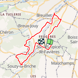
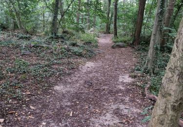
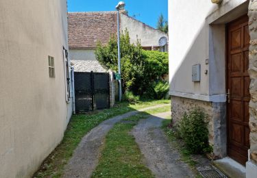
Trail Walking of 15.7 km to be discovered at Ile-de-France, Essonne, Saint-Sulpice-de-Favières. This trail is proposed by Lucquiaud.

Description

départ du parking près de l'église de Saint Sulpice, passage par le cimetierre de Saint Yon (tombe de Mr Morel, Roi Du Bout Dur),l'ancienne léproserie la Madeleine, les carrières de Madagascar,lavoir de la Boëlle avec sources, moulin de l'écurie,

Elevation profile

Photos

Positioning

Country:
France
Region :
Ile-de-France
Department/Province :
Essonne
Municipality :
Saint-Sulpice-de-Favières
Location:
Unknown
Start:(Dec)
Start:(UTM)
439097 ; 5376857 (31U) N.

Comments

Please log in to post a review or rate the element


très sympa


Trails nearby

Trail Walking Saint-Sulpice-de-Favières - Les Pétales de Souzy - Photo
Walking
tracegps

Walking

Difficult
(1)
Saint-Sulpice-de-Favières, Ile-de-France, Essonne, France
23 km | 29 km-effort
4h 49min
Yes
Trail On foot Saint-Yon - Sur les traces de la Renarde - Photo
On foot
PRO

On foot

Very difficult
Saint-Yon, Ile-de-France, Essonne, France
38 km | 44 km-effort
10h 4min
No
Trail Walking Saint-Sulpice-de-Favières - St Sulpice - Photo
Walking
Auger91

Walking

Medium
(1)
Saint-Sulpice-de-Favières, Ile-de-France, Essonne, France
8 km | 10.1 km-effort
2h 18min
Yes
Trail Walking Boissy-sous-Saint-Yon - Carrière de Madagascar  - Photo
Walking
danbott

Walking

Very easy
(1)
Boissy-sous-Saint-Yon, Ile-de-France, Essonne, France
13.2 km | 16.5 km-effort
2h 59min
Yes
Trail Walking Saint-Chéron - De Saint Chéron à Dourdan par les côteaux de la rive gauche - Photo
Walking
philippebenne

Walking

Difficult
(1)
Saint-Chéron, Ile-de-France, Essonne, France
13.5 km | 17 km-effort
3h 51min
No
Trail Walking Villeconin - Villeconin - Photo
Walking
guydu41

Walking

Medium
Villeconin, Ile-de-France, Essonne, France
8.5 km | 10.9 km-effort
2h 11min
Yes
Trail Walking Saint-Sulpice-de-Favières - Saint-Sulpice-de-Favières - Photo
Walking
guydu41

Walking

Medium
Saint-Sulpice-de-Favières, Ile-de-France, Essonne, France
7.5 km | 9.4 km-effort
1h 55min
Yes
Trail Walking Chamarande - Lardy - Le Lièvre d'Or - Photo
Walking
guydu41

Walking

Difficult
Chamarande, Ile-de-France, Essonne, France
9 km | 12.4 km-effort
2h 48min
Yes
Trail Walking Souzy-la-Briche - Carrières de Madagascar à Souzy-la-Briche  - Photo
Walking
guydu41

Walking

Medium
Souzy-la-Briche, Ile-de-France, Essonne, France
6.8 km | 8.3 km-effort
1h 52min
Yes


Close
My subscriptions