Trail Walking Saint-Paul-de-Varces - Tour du Rocher de l'Eperrimont - Photo

Tour du Rocher de l'Eperrimont

 patjobou
patjobou

User

© OpenStreetMap contributors
Length
Length
13.6 km
Max alt
Max alt
1247 m
Uphill gradient
Uphill gradient
797 m
Km-Effort
Km-Effort  
24 km
Min alt
Min alt
519 m
Downhill gradient
Downhill gradient
803 m
Boucle
Boucle
Yes
Creation date :
2017-04-13 00:00:00.0
Updated on :
2017-04-13 00:00:00.0

(0 Reviews)

Walking
Walking
4h58
Difficulty : Medium

Scan this QR Code to open this trail in the SityTrail application

FREE GPS app for hiking

Logo SityTrail SityTrail

IGN / Geographical institutes

Download SityTrail from the App Store Download SityTrail from Google Play

Logo SityTrail SityTrail World

The world is yours!

Download SityTrail from the App Store Download SityTrail from Google Play Download SityTrail on Huawei AppGallery

About

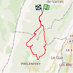
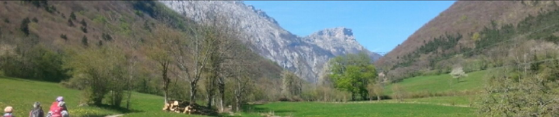
Trail Walking of 13.6 km to be discovered at Auvergne-Rhône-Alpes, Isère, Saint-Paul-de-Varces. This trail is proposed by patjobou.

Description

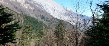
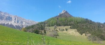
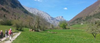
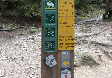
Jolie boucle en foret de feuillus encore claire et ombragée à cette saison.Il est préférable de monter directement au col de l'Eperrimont, et de revenir par l'Echaillon. Bons sentiers ou pistes, sauf au dessus du col de l'Eperrimont, où le sentier est dit 'écologique': départ difficile à trouver (poteau à terre), et il n'est plus entretenu, si bien qu'on le perd souvent et qu'on le retrouve quelques fois si on est observateur   GPS. Si on n'aime pas les aventures en foret pentue, il est préférable de prendre le sentier qui plonge vers le sud dès le col de l'Eperrimont, puis de rejoindre Baleyère et Les Vincents par la piste.
Au départ, parking difficile au Pont du Batou; préférer un départ au bout de la route.

Elevation profile

Photos

Points of interest

Point of interest Le Gua - Point 1 - Photo
patjobou
LE GUA 
Point of interest Le Gua - Point 2 - Photo
patjobou
LE GUA 
Point of interest Le Gua - Point 3 - Photo
patjobou
LE GUA 

Positioning

Country:
France
Region :
Auvergne-Rhône-Alpes
Department/Province :
Isère
Municipality :
Saint-Paul-de-Varces
Location:
Unknown
Start:(UTM)
706894 ; 4992871 (31T) N.

Trails nearby

Trail Walking Villard-de-Lans - villard col des 2 soeurs - Photo
Walking
arnaudconde

Walking

Medium
(1)
Villard-de-Lans, Auvergne-Rhône-Alpes, Isère, France
7.7 km | 13.8 km-effort
2h 45min
Yes
Trail Walking Villard-de-Lans - Le sentier Peronnard et le Pas de l'OEille - Photo
Walking
tracegps

Walking

Easy
(1)
Villard-de-Lans, Auvergne-Rhône-Alpes, Isère, France
13.7 km | 25 km-effort
6h 0min
Yes
Trail Walking Villard-de-Lans - Le Plateau du Cornafion 1906m - Photo
Walking
tracegps

Walking

Difficult
(1)
Villard-de-Lans, Auvergne-Rhône-Alpes, Isère, France
7.8 km | 17.7 km-effort
4h 30min
Yes
Trail Walking Vif - la ferme oriol en circuit  - Photo
Walking
Youcef Atallah

Walking

Very difficult
Vif, Auvergne-Rhône-Alpes, Isère, France
13.7 km | 24 km-effort
3h 15min
Yes
Trail Snowshoes Villard-de-Lans - de l'eau - Photo
Snowshoes
ferk

Snowshoes

Very easy
Villard-de-Lans, Auvergne-Rhône-Alpes, Isère, France
9.4 km | 15.2 km-effort
4h 14min
Yes
Trail Walking Villard-de-Lans - Le lac du clos du prey - Photo
Walking
GUIDE
nadinebondoux

Walking

Medium
Villard-de-Lans, Auvergne-Rhône-Alpes, Isère, France
11.7 km | 18.7 km-effort
3h 47min
Yes
Trail Walking Villard-de-Lans - Sentier Gobert - Photo
Walking
crocau

Walking

Difficult
Villard-de-Lans, Auvergne-Rhône-Alpes, Isère, France
7.8 km | 13.7 km-effort
3h 34min
Yes
Trail Walking Villard-de-Lans - Le Pic Saint-Michel (Villard-de-Lans) - Photo
Walking
Philindy26

Walking

Difficult
(1)
Villard-de-Lans, Auvergne-Rhône-Alpes, Isère, France
11.9 km | 23 km-effort
4h 10min
Yes
Trail Walking Villard-de-Lans - 38 pas oeille balcon est col vert - Photo
Walking
himba26100

Walking

Medium
Villard-de-Lans, Auvergne-Rhône-Alpes, Isère, France
15 km | 25 km-effort
7h 4min
No


Close
My subscriptions