Trail Walking Raon-sur-Plaine - Cascade de la Crache - Photo

Cascade de la Crache

 Le_Grand
Le_Grand

User

© OpenStreetMap contributors
Length
Length
3.8 km
Max alt
Max alt
620 m
Uphill gradient
Uphill gradient
157 m
Km-Effort
Km-Effort  
5.9 km
Min alt
Min alt
463 m
Downhill gradient
Downhill gradient
157 m
Boucle
Boucle
Yes
Creation date :
2018-09-03 11:42:51.393
Updated on :
2018-09-03 11:42:51.402

(1 Reviews)

Walking
Walking
1h16
Difficulty : Easy

Scan this QR Code to open this trail in the SityTrail application

FREE GPS app for hiking

Logo SityTrail SityTrail

IGN / Geographical institutes

Download SityTrail from the App Store Download SityTrail from Google Play

Logo SityTrail SityTrail World

The world is yours!

Download SityTrail from the App Store Download SityTrail from Google Play Download SityTrail on Huawei AppGallery

About

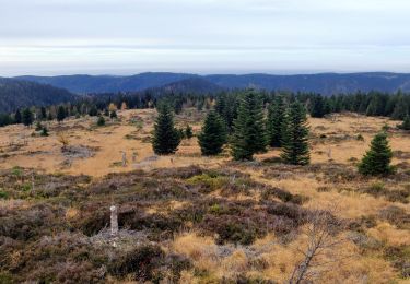
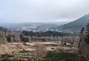
Trail Walking of 3.8 km to be discovered at Grand Est, Vosges, Raon-sur-Plaine. This trail is proposed by Le_Grand.

Description

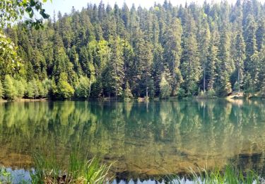
Circuit très agréable au pied du Donon sous les frondaisons avec pour point d'intérêt la cascade de la Crache. On peut revenir sur ses pas si on ne veut pas faire le circuit complet.

Elevation profile

Positioning

Country:
France
Region :
Grand Est
Department/Province :
Vosges
Municipality :
Raon-sur-Plaine
Location:
Unknown
Start:(UTM)
359591 ; 5374132 (32U) N.

Comments

Please log in to post a review or rate the element


On n'a pas réussi à suivre le parcours indiqué


Trails nearby

Trail Walking Grandfontaine - Donon sentier des casemates - sud - Photo
Walking
VacheKiri67

Walking

Medium
(1)
Grandfontaine, Grand Est, Bas-Rhin, France
12.6 km | 16.9 km-effort
4h 13min
Yes
Trail Walking Grandfontaine - Le site des 2 Donons - Photo
Walking
VacheKiri67

Walking

Medium
(4)
Grandfontaine, Grand Est, Bas-Rhin, France
12.6 km | 19.4 km-effort
4h 52min
Yes
Trail Walking Moussey - Col de Prayé - Photo
Walking
VacheKiri67

Walking

Difficult
(1)
Moussey, Grand Est, Vosges, France
16.8 km | 23 km-effort
6h 55min
Yes
Trail Walking Grandfontaine - 2023-05-29 Marche Les Minières Lac de la Maix - Photo
Walking
GUIDE
holtzv

Walking

Medium
Grandfontaine, Grand Est, Bas-Rhin, France
22 km | 34 km-effort
7h 43min
Yes
Trail Walking Grandfontaine - 2022-11-12 Marche Grandfontaine Tête Mathis Col de Praye La Corbeille - Photo
Walking
GUIDE
holtzv

Walking

Medium
Grandfontaine, Grand Est, Bas-Rhin, France
15.3 km | 23 km-effort
4h 34min
Yes
Trail On foot Grandfontaine - Circuit du Chemin d'Allemagne - Photo
On foot
PRO

On foot

Easy
Grandfontaine, Grand Est, Bas-Rhin, France
8.7 km | 13.9 km-effort
3h 10min
No
Trail Walking Grandfontaine - 2020-09-20 Marche Donon Petit Donon Casemates - Photo
Walking
GUIDE
holtzv

Walking

Very easy
(1)
Grandfontaine, Grand Est, Bas-Rhin, France
13.4 km | 20 km-effort
4h 17min
Yes
Trail Walking Grandfontaine - 2019-01-05 Marche Temple du Donon - Photo
Walking
GUIDE
holtzv

Walking

Medium
Grandfontaine, Grand Est, Bas-Rhin, France
5.6 km | 9.3 km-effort
1h 54min
Yes
Trail Walking Grandfontaine - suuntoapp-Hiking-2024-01-13T07-49-52Z - Photo
Walking
GUIDE
holtzv

Walking

Difficult
Grandfontaine, Grand Est, Bas-Rhin, France
24 km | 34 km-effort
7h 41min
No


Close
My subscriptions