Trail Other activity Soultzeren - Totom 4 lacs - Photo
 dinozore
dinozore

User

© OpenStreetMap contributors
Length
Length
15.6 km
Max alt
Max alt
1304 m
Uphill gradient
Uphill gradient
783 m
Km-Effort
Km-Effort  
26 km
Min alt
Min alt
950 m
Downhill gradient
Downhill gradient
782 m
Boucle
Boucle
Yes
Creation date :
2017-07-13 00:00:00.0
Updated on :
2017-07-13 00:00:00.0

(1 Reviews)

Other activity
Other activity
4h37
Difficulty : Medium

Scan this QR Code to open this trail in the SityTrail application

FREE GPS app for hiking

Logo SityTrail SityTrail

IGN / Geographical institutes

Download SityTrail from the App Store Download SityTrail from Google Play

Logo SityTrail SityTrail World

The world is yours!

Download SityTrail from the App Store Download SityTrail from Google Play Download SityTrail on Huawei AppGallery

About

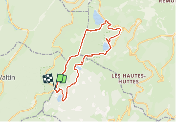
Trail Other activity of 15.6 km to be discovered at Grand Est, Haut-Rhin, Soultzeren. This trail is proposed by dinozore.

Description

Tour des 4 lacs par le bas et retour par les chaumes

Elevation profile

Photos

Positioning

Country:
France
Region :
Grand Est
Department/Province :
Haut-Rhin
Municipality :
Soultzeren
Location:
Unknown
Start:(UTM)
355601 ; 5328434 (32U) N.

Comments

Please log in to post a review or rate the element


Une rando incontournable avec une vue méritée .


Trails nearby

Trail Horseback riding Orbey - 2020-06-28 WE Orbey Petit Hohnack Glasborn - Photo
Horseback riding
GUIDE
holtzv

Horseback riding

Difficult
(1)
Orbey, Grand Est, Haut-Rhin, France
22 km | 31 km-effort
4h 5min
Yes
Trail Horseback riding Orbey - 2020-06-27 WE Orbey Noir Gazon Vert Forlet - Photo
Horseback riding
GUIDE
holtzv

Horseback riding

Medium
(1)
Orbey, Grand Est, Haut-Rhin, France
21 km | 30 km-effort
3h 59min
Yes
Trail Walking Stosswihr - Tour du belvedere avec le passage sur les crêtes  - Photo
Walking
ocepee

Walking

Very easy
(2)
Stosswihr, Grand Est, Haut-Rhin, France
8.5 km | 0 m-effort
2h 28min
Yes
Trail Walking Hohrod - Circuit historique 1914-18 Hohrodberg - Linge - Photo
Walking
VacheKiri67

Walking

Medium
(1)
Hohrod, Grand Est, Haut-Rhin, France
14 km | 19.8 km-effort
5h 50min
Yes
Trail Walking Le Valtin - Les Hirschsteine - Photo
Walking
VacheKiri67

Walking

Difficult
(1)
Le Valtin, Grand Est, Vosges, France
16.1 km | 25 km-effort
6h 28min
Yes
Trail Walking Orbey - Le Tour du Lac Blanc par le Rocher Hans et le sentier de crête - Photo
Walking
tracegps

Walking

Difficult
(3)
Orbey, Grand Est, Haut-Rhin, France
4.4 km | 7.7 km-effort
2h 30min
Yes
Trail Walking Le Bonhomme - Tête des faux . - Photo
Walking
heurtinpatrick

Walking

Medium
(1)
Le Bonhomme, Grand Est, Haut-Rhin, France
11.9 km | 16.6 km-effort
3h 46min
Yes
Trail Walking Soultzeren - Tanet-Gazon du faing par lac vert et retour sommet du Tanet - Photo
Walking
ride-in-Elsass

Walking

Medium
(1)
Soultzeren, Grand Est, Haut-Rhin, France
10 km | 15.6 km-effort
4h 24min
Yes
Trail Snowshoes Le Valtin - raquettes  - Photo
Snowshoes
vathi54

Snowshoes

Very easy
(1)
Le Valtin, Grand Est, Vosges, France
6.6 km | 9.4 km-effort
3h 8min
No


Close
My subscriptions