Trail Walking Rombach-le-Franc - Rombach-Le-Franc 19 800m +887m - Photo

Rombach-Le-Franc 19 800m +887m

© OpenStreetMap contributors
Length
Length
19.7 km
Max alt
Max alt
772 m
Uphill gradient
Uphill gradient
840 m
Km-Effort
Km-Effort  
31 km
Min alt
Min alt
302 m
Downhill gradient
Downhill gradient
837 m
Boucle
Boucle
Yes
Creation date :
2017-08-14 00:00:00.0
Updated on :
2017-08-14 00:00:00.0

(0 Reviews)

Walking
Walking
6h30
Difficulty : Medium

Scan this QR Code to open this trail in the SityTrail application

FREE GPS app for hiking

Logo SityTrail SityTrail

IGN / Geographical institutes

Download SityTrail from the App Store Download SityTrail from Google Play

Logo SityTrail SityTrail World

The world is yours!

Download SityTrail from the App Store Download SityTrail from Google Play Download SityTrail on Huawei AppGallery

About

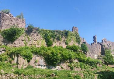
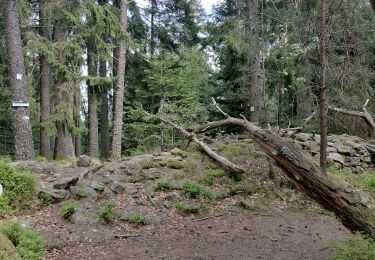
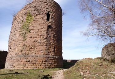
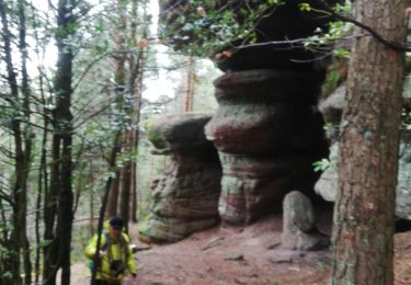
Trail Walking of 19.7 km to be discovered at Grand Est, Haut-Rhin, Rombach-le-Franc. This trail is proposed by DanielROLLET.

Description

2017 08 13 8h50 à 15h50
D/A Église de Rombach-le-Franc
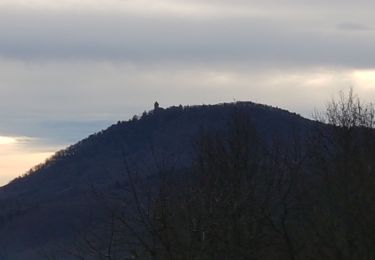
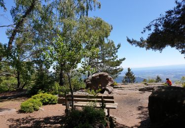
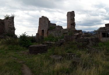
Col de Fouchy - Col de Noirceux avec un point de vue à mi-parcours - Schlingoutte - La Hungrie et sa chapelle - Creux chêne et son abri (pique-nique de 12:30 à 13:00)- La Chambrette (une erreur aprés la croix)- Lièpvre ouest - Hargoutte (attention à la portin de chemin sans balisage) - satatue du Sacré-coeur et table d'orientation (prendre le sentier au pied de la statue et ne pas couper SW) - église de Rombach.

Elevation profile

Points of interest

Point of interest Sainte-Croix-aux-Mines - on aurait du sortir la Point 1 - Photo
DanielROLLET
SAINTE-CROIX-AUX-MINES 

Positioning

Country:
France
Region :
Grand Est
Department/Province :
Haut-Rhin
Municipality :
Rombach-le-Franc
Location:
Unknown
Start:(UTM)
371080 ; 5349064 (32U) N.

Trails nearby

Trail Walking La Vancelle - 2020-05-21 Marche La Vancelle Boucle - Photo
Walking
GUIDE
holtzv

Walking

Very easy
La Vancelle, Grand Est, Bas-Rhin, France
16.3 km | 26 km-effort
6h 41min
Yes
Trail Walking La Vancelle - 2015-01-02 Marche Rocher du Coucou Chateau Frankenbourg - Photo
Walking
GUIDE
holtzv

Walking

Easy
(1)
La Vancelle, Grand Est, Bas-Rhin, France
10.9 km | 18.1 km-effort
3h 47min
Yes
Trail Walking Thannenkirch - circuit Taennchel - Photo
Walking
Patlac3

Walking

Medium
Thannenkirch, Grand Est, Haut-Rhin, France
8.6 km | 13.9 km-effort
4h 5min
Yes
Trail Walking Breitenau - 20230309_BREITENAU_rando_Breitenau_Le Rocher du Coucou - Le Château du Frankenbourg - Photo
Walking
nfranche

Walking

Medium
Breitenau, Grand Est, Bas-Rhin, France
14.5 km | 24 km-effort
5h 24min
Yes
Trail Walking Rombach-le-Franc - Col de Fouchy  - Photo
Walking
apa

Walking

Medium
Rombach-le-Franc, Grand Est, Haut-Rhin, France
11.8 km | 17.6 km-effort
3h 23min
Yes
Trail Walking Lièpvre - Liépvre - Roche des Fées, Roche de Chalmont, Rocher du Coucou, château du Frankenbourg - Photo
Walking
Bart2015

Walking

Difficult
Lièpvre, Grand Est, Haut-Rhin, France
19.4 km | 31 km-effort
5h 53min
Yes
Trail Walking La Vancelle - Les Hauts de La Vancelle - Photo
Walking
VacheKiri67

Walking

Medium
La Vancelle, Grand Est, Bas-Rhin, France
13.4 km | 21 km-effort
4h 39min
Yes
Trail Walking Breitenau - xc 191017 cv breitenau  - Photo
Walking
xc

Walking

Very easy
(1)
Breitenau, Grand Est, Bas-Rhin, France
11.9 km | 18.3 km-effort
5h 6min
No
Trail Walking Rombach-le-Franc - Col de Fouchy - Photo
Walking
LUTZMarc

Walking

Medium
Rombach-le-Franc, Grand Est, Haut-Rhin, France
20 km | 29 km-effort
4h 47min
Yes


Close
My subscriptions