


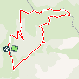

10.3 km | 17.5 km-effort


User


FREE GPS app for hiking
 SityTrail
IGN / Geographical institutes
SityTrail World
The world is yours!
Trail Walking of 11.8 km to be discovered at Auvergne-Rhône-Alpes, Drôme, Lus-la-Croix-Haute. This trail is proposed by rigol05.
Sortie du 28/08/2017
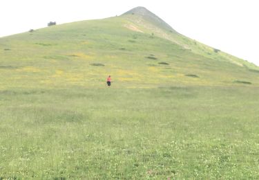
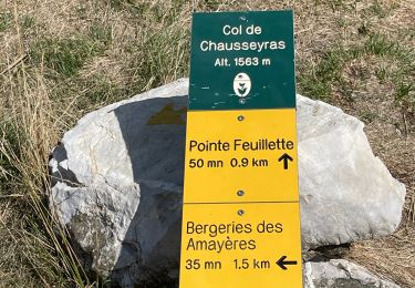
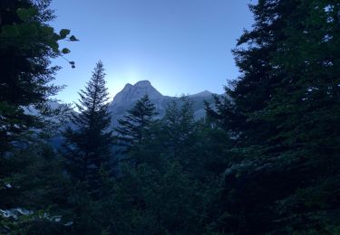
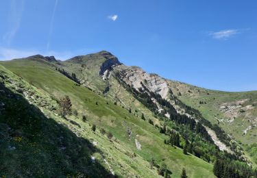
Itinéraire pour profiter d'une belle crête (montagne de Jajène, de belles pelouses et d'un panorama à 360°. Du col Tournerond, le petit sentier en balcon est plus agréable que la piste en contrebas
Walking

Walking

Walking
Walking
Walking
Walking
Walking
Walking
Walking