Trail Walking Saint-Julien-en-Beauchêne - VAUNIERES-LA PARE-03-08-2017 - Photo
 RD78-38
RD78-38

User

© OpenStreetMap contributors
Length
Length
11.7 km
Max alt
Max alt
1793 m
Uphill gradient
Uphill gradient
680 m
Km-Effort
Km-Effort  
21 km
Min alt
Min alt
1164 m
Downhill gradient
Downhill gradient
680 m
Boucle
Boucle
Yes
Creation date :
2017-09-03 00:00:00.0
Updated on :
2020-07-11 00:21:35.215

(0 Reviews)

Walking
Walking
5h42
Difficulty : Medium

Scan this QR Code to open this trail in the SityTrail application

FREE GPS app for hiking

Logo SityTrail SityTrail

IGN / Geographical institutes

Download SityTrail from the App Store Download SityTrail from Google Play

Logo SityTrail SityTrail World

The world is yours!

Download SityTrail from the App Store Download SityTrail from Google Play Download SityTrail on Huawei AppGallery

About

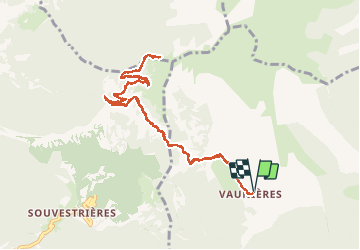
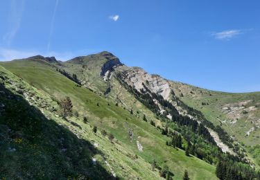
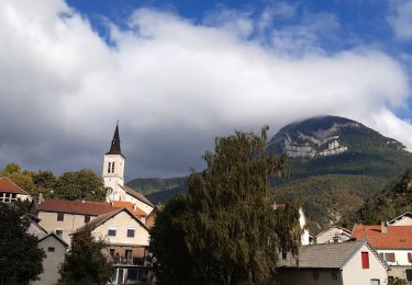
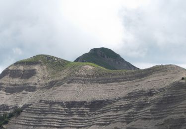
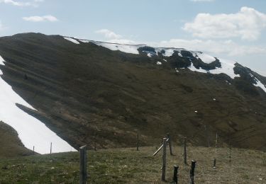
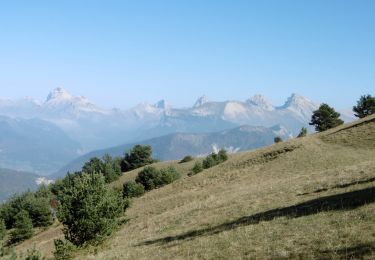
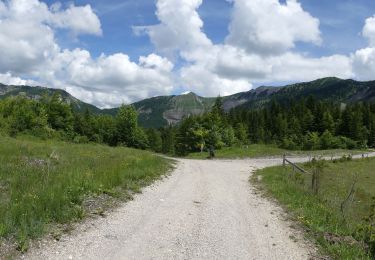
Trail Walking of 11.7 km to be discovered at Provence-Alpes-Côte d'Azur, Hautes-Alpes, Saint-Julien-en-Beauchêne. This trail is proposed by RD78-38.

Description

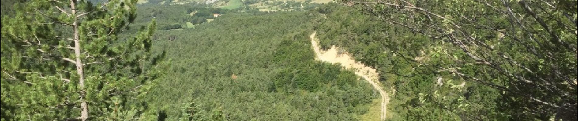
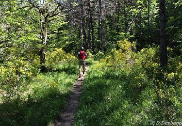
Très agréable parcours mais hélas écourté par 4 PATOUX non retenus par le berger bien que pouvais faire la différence entre nous et un loup !! Nous n'avons donc dû faire 1/2 tour sans pouvoir atteindre lPARE ni ensuite le Col de tousière pour effectuer le retour sur le GR 95 ! Très dommage car le paysage était superbe.

Elevation profile

Photos

Positioning

Country:
France
Region :
Provence-Alpes-Côte d'Azur
Department/Province :
Hautes-Alpes
Municipality :
Saint-Julien-en-Beauchêne
Location:
Unknown
Start:(UTM)
710647 ; 4945839 (31T) N.

Trails nearby

Trail On foot Montbrand - 9587037(1) - Photo
On foot
GUIDE+

On foot

Easy
Montbrand, Provence-Alpes-Côte d'Azur, Hautes-Alpes, France
3.5 km | 4.6 km-effort
1h 2min
Yes
Trail Walking Saint-Julien-en-Beauchêne - ST JULIEN EN BEAUCHENE- VAUNIERES - Photo
Walking
BLANCHET

Walking

Medium
(1)
Saint-Julien-en-Beauchêne, Provence-Alpes-Côte d'Azur, Hautes-Alpes, France
9.4 km | 18.4 km-effort
3h 59min
No
Trail Walking Lus-la-Croix-Haute - MAS REBUFAT - POINTE FEUILLETTE  - Photo
Walking
RD78-38

Walking

Medium
Lus-la-Croix-Haute, Auvergne-Rhône-Alpes, Drôme, France
11.7 km | 20 km-effort
3h 33min
Yes
Trail Walking Lus-la-Croix-Haute - Antécime de La Toussière - Photo
Walking
GuyVachet

Walking

Difficult
Lus-la-Croix-Haute, Auvergne-Rhône-Alpes, Drôme, France
8.6 km | 17.4 km-effort
5h 44min
Yes
Trail Walking Saint-Julien-en-Beauchêne - Dorbon l'ancienne chartreuse  - Photo
Walking
GILOU440

Walking

Medium
Saint-Julien-en-Beauchêne, Provence-Alpes-Côte d'Azur, Hautes-Alpes, France
12.6 km | 20 km-effort
4h 15min
Yes
Trail Walking Boulc - La Pare - La Toussière à partir de Boulc - Photo
Walking
Philindy26

Walking

Very difficult
Boulc, Auvergne-Rhône-Alpes, Drôme, France
16.1 km | 31 km-effort
6h 0min
Yes
Trail Walking Val-Maravel - Le Luzet - Montagne Chauvet (Val-Maravel en Diois)... - Photo
Walking
Philindy26

Walking

Difficult
Val-Maravel, Auvergne-Rhône-Alpes, Drôme, France
11.4 km | 21 km-effort
4h 0min
Yes
Trail Walking Saint-Julien-en-Beauchêne - Boucle d'Or Quigouret - Photo
Walking
rigol05

Walking

Very easy
Saint-Julien-en-Beauchêne, Provence-Alpes-Côte d'Azur, Hautes-Alpes, France
9.5 km | 19 km-effort
Unknown
Yes
Trail Walking Boulc - 2018-06-09 Diois - La Pare - Photo
Walking
Philindy26

Walking

Difficult
Boulc, Auvergne-Rhône-Alpes, Drôme, France
11.4 km | 21 km-effort
4h 13min
Yes


Close
My subscriptions