Trail Walking Salles-Arbuissonnas-en-Beaujolais - Salles-Arbuissonnas-en-Beaujolais - Photo
© OpenStreetMap contributors
Length
Length
16.4 km
Max alt
Max alt
665 m
Uphill gradient
Uphill gradient
526 m
Km-Effort
Km-Effort  
23 km
Min alt
Min alt
250 m
Downhill gradient
Downhill gradient
526 m
Boucle
Boucle
Yes
Creation date :
2018-04-17 10:52:50.518
Updated on :
2018-04-17 10:52:50.518

(0 Reviews)

Walking
Walking
4h55
Difficulty : Easy

Scan this QR Code to open this trail in the SityTrail application

FREE GPS app for hiking

Logo SityTrail SityTrail

IGN / Geographical institutes

Download SityTrail from the App Store Download SityTrail from Google Play

Logo SityTrail SityTrail World

The world is yours!

Download SityTrail from the App Store Download SityTrail from Google Play Download SityTrail on Huawei AppGallery

About

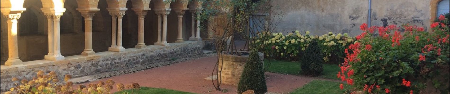
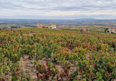
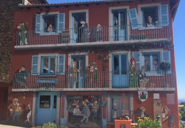
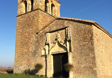
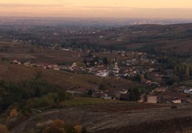
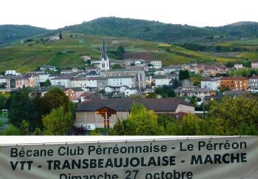
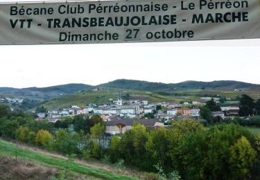
Trail Walking of 16.4 km to be discovered at Auvergne-Rhône-Alpes, Rhône, Salles-Arbuissonnas-en-Beaujolais. This trail is proposed by Thomasdanielle.

Description

Départ/Arrivée parking entrée rue du
11 Novembre. Suivre toujours les indications : Flèches bleues.
Très belle randonnées sans difficultés particulières vignes et bois. Si cette marche est faite en Automne et par beau temps, les vues sont  magnifiques.

Elevation profile

Photos

Positioning

Country:
France
Region :
Auvergne-Rhône-Alpes
Department/Province :
Rhône
Municipality :
Salles-Arbuissonnas-en-Beaujolais
Location:
Salles
Start:(UTM)
626646 ; 5099880 (31T) N.

Trails nearby

Trail Walking Montmelas-Saint-Sorlin - Col de Saint Bonnet (13-09-18)  - Photo
Walking
Thomasdanielle

Walking

Easy
(1)
Montmelas-Saint-Sorlin, Auvergne-Rhône-Alpes, Rhône, France
8.1 km | 11.9 km-effort
2h 29min
Yes
Trail Walking Rivolet - Rivolet - Photo
Walking
jpcoco

Walking

Medium
(2)
Rivolet, Auvergne-Rhône-Alpes, Rhône, France
11.1 km | 17.2 km-effort
3h 42min
No
Trail On foot Vaux-en-Beaujolais - SityTrail - 3843016 - etape-2 - Photo
On foot
chessyca

On foot

Very difficult
Vaux-en-Beaujolais, Auvergne-Rhône-Alpes, Rhône, France
22 km | 35 km-effort
7h 58min
No
Trail Walking Vaux-en-Beaujolais - Vaulx en beaujolais  - Photo
Walking
aurel69

Walking

Easy
(1)
Vaux-en-Beaujolais, Auvergne-Rhône-Alpes, Rhône, France
14.3 km | 22 km-effort
4h 25min
Yes
Trail Walking Denicé - Denice´ - 2 - (69) - Photo
Walking
Thomasdanielle

Walking

Very easy
Denicé, Auvergne-Rhône-Alpes, Rhône, France
11.5 km | 17.4 km-effort
3h 17min
Yes
Trail Walking Denicé - Denicé (69) - Photo
Walking
Thomasdanielle

Walking

Easy
Denicé, Auvergne-Rhône-Alpes, Rhône, France
11.6 km | 17.5 km-effort
3h 17min
Yes
Trail Walking Le Perréon - le Perréon (69) - Photo
Walking
Thomasdanielle

Walking

Easy
Le Perréon, Auvergne-Rhône-Alpes, Rhône, France
10.8 km | 16.5 km-effort
3h 17min
Yes
Trail Mountain bike Le Perréon - La 22ème Transbeaujolaise (2013-VTT-40km) - Le Perréon - Photo
Mountain bike
tracegps

Mountain bike

Difficult
Le Perréon, Auvergne-Rhône-Alpes, Rhône, France
37 km | 48 km-effort
4h 0min
Yes
Trail Mountain bike Le Perréon - La 22ème Transbeaujolaise (2013-VTT-60km) - Le Perréon - Photo
Mountain bike
tracegps

Mountain bike

Very difficult
Le Perréon, Auvergne-Rhône-Alpes, Rhône, France
55 km | 76 km-effort
5h 0min
Yes


Close
My subscriptions