Trail Road bike Lus-la-Croix-Haute - C21 - Le Trièves - Photo

Les Hautes Alpes à découvrir ! GUIDE+

© OpenStreetMap contributors
Length
Length
134 km
Max alt
Max alt
1462 m
Uphill gradient
Uphill gradient
3989 m
Km-Effort
Km-Effort  
188 km
Min alt
Min alt
585 m
Downhill gradient
Downhill gradient
4233 m
Boucle
Boucle
No
Creation date :
2018-03-23 05:39:47.749
Updated on :
2019-05-13 13:07:12.614

(0 Reviews)

Road bike
Road bike
9h53
Difficulty : Very difficult

Scan this QR Code to open this trail in the SityTrail application

FREE GPS app for hiking

Logo SityTrail SityTrail

IGN / Geographical institutes

Download SityTrail from the App Store Download SityTrail from Google Play

Logo SityTrail SityTrail World

The world is yours!

Download SityTrail from the App Store Download SityTrail from Google Play Download SityTrail on Huawei AppGallery

About

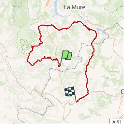
Trail Road bike of 134 km to be discovered at Auvergne-Rhône-Alpes, Drôme, Lus-la-Croix-Haute. This trail is proposed by Camping Les Rives du Lac.

Description

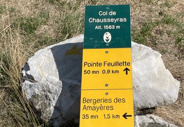
An exceptional hike for well-trained athletes! Do not hesitate to ask us for advice before leaving because the massif of Trièves is wet and the weather completely different from that of Veynes.

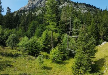
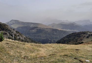
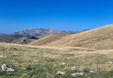
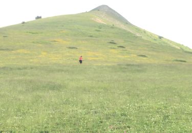
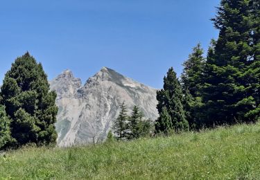
This hike allows to discover the South Vercors (Col de Grimone, Col de Ménée ...), the massif of Trièves (against the backdrop of the magnificent Mont Aiguille) then to cross the massif of Dévoluy. Panoramic views of the different mountains breathtaking.

We advise you to avoid the first part unpleasant (heavy traffic on the road to Grenoble) by taking the train to Veynes and stopping at Lus la Croix Haute. You can go from Veynes and that adds 30kms.

Elevation profile

Photos

Positioning

Country:
France
Region :
Auvergne-Rhône-Alpes
Department/Province :
Drôme
Municipality :
Lus-la-Croix-Haute
Location:
Unknown
Start:(UTM)
714433 ; 4949333 (31T) N.

Trails nearby

Trail Walking Lus-la-Croix-Haute - R48 - Gorges des Amayères - Photo
Walking
GUIDE+

Walking

Easy
Lus-la-Croix-Haute, Auvergne-Rhône-Alpes, Drôme, France
10.3 km | 17.5 km-effort
3h 1min
No
Trail Walking Lus-la-Croix-Haute - R38   Col des Aiguilles depuis Lus - Photo
Walking
GUIDE+

Walking

Medium
Lus-la-Croix-Haute, Auvergne-Rhône-Alpes, Drôme, France
5.6 km | 15 km-effort
2h 53min
Yes
Trail Walking Lus-la-Croix-Haute - Le Rognon - Photo
Walking
GAPIAN43

Walking

Medium
(1)
Lus-la-Croix-Haute, Auvergne-Rhône-Alpes, Drôme, France
12.3 km | 22 km-effort
4h 33min
Yes
Trail Walking Saint-Julien-en-Beauchêne - ST JULIEN EN BEAUCHENE- VAUNIERES - Photo
Walking
BLANCHET

Walking

Medium
(1)
Saint-Julien-en-Beauchêne, Provence-Alpes-Côte d'Azur, Hautes-Alpes, France
9.4 km | 18.4 km-effort
3h 59min
No
Trail Walking Glandage - Le Jocou 2 - Photo
Walking
Marco05

Walking

Difficult
Glandage, Auvergne-Rhône-Alpes, Drôme, France
8.5 km | 18.1 km-effort
4h 0min
Yes
Trail Walking Lus-la-Croix-Haute - Pointe Feuillette - Photo
Walking
Marco05

Walking

Difficult
Lus-la-Croix-Haute, Auvergne-Rhône-Alpes, Drôme, France
10.5 km | 20 km-effort
4h 36min
Yes
Trail Walking Lus-la-Croix-Haute - Pointe feuillette  - Photo
Walking
ajd26

Walking

Medium
Lus-la-Croix-Haute, Auvergne-Rhône-Alpes, Drôme, France
11.4 km | 21 km-effort
4h 52min
Yes
Trail Walking Saint-Julien-en-Beauchêne - Montagne de Durbonas - Photo
Walking
Marco05

Walking

Difficult
Saint-Julien-en-Beauchêne, Provence-Alpes-Côte d'Azur, Hautes-Alpes, France
12.3 km | 23 km-effort
5h 16min
Yes
Trail Walking Lus-la-Croix-Haute - MAS REBUFAT - POINTE FEUILLETTE  - Photo
Walking
RD78-38

Walking

Medium
Lus-la-Croix-Haute, Auvergne-Rhône-Alpes, Drôme, France
11.7 km | 20 km-effort
3h 33min
Yes


Close
My subscriptions