![](/images/other/stat-length.png)
![Trail Walking Eybens - eybens 2018 - Photo](https://media.geolcdn.com/t/1900/400/ext.pjpeg?maxdim=2&url=https%3A%2F%2Fstatic1.geolcdn.com%2Fsiteimages%2Fupload%2Ffiles%2F1553511878bg_sport_marche.png)
eybens 2018
floup6138
User
![Length](/images/other/stat-length.png)
Length
10.9 km
![Max alt](https://static1.geolcdn.com/siteimages/upload/files/1508320355ic_sort_altitude_max_24dp.png)
Max alt
563 m
![Uphill gradient](https://static1.geolcdn.com/siteimages/upload/files/1508320355ic_sort_den_pos_24dp.png)
Uphill gradient
497 m
![Km-Effort](/images/other/stat-length.png)
Km-Effort
17.5 km
![Min alt](https://static1.geolcdn.com/siteimages/upload/files/1508320355ic_sort_altitude_min_24dp.png)
Min alt
254 m
![Downhill gradient](https://static1.geolcdn.com/siteimages/upload/files/1508320355ic_sort_den_neg_24dp.png)
Downhill gradient
497 m
![Boucle](https://static1.geolcdn.com/siteimages/upload/files/16400158638029165_repeat_loop_refresh_sync_direction_icon.png)
Boucle
No
Creation date :
2018-04-17 23:10:53.271
Updated on :
2018-04-17 23:10:53.271
![Walking](https://static1.geolcdn.com/sitytour/trail-icons/101.png)
3h00
Difficulty : Medium
![Scan this QR Code to open this trail in the SityTrail application](https://capi.geolives.com/qq0zvz2zws4bq2lad0pu/sitytour/trails/932759/qr.png?size=200)
FREE GPS app for hiking
About
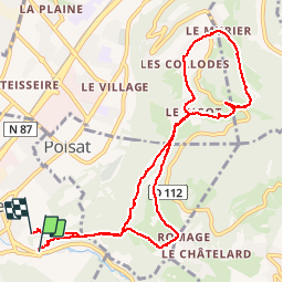
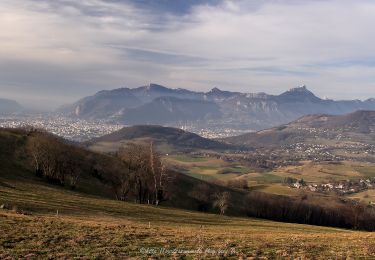
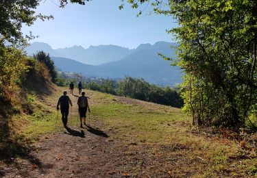
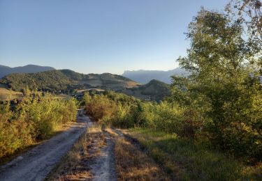
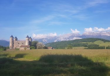
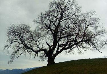
Trail Walking of 10.9 km to be discovered at Auvergne-Rhône-Alpes, Isère, Eybens. This trail is proposed by floup6138.
Description
départ Vélodrome arrivée piscine.
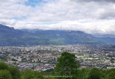
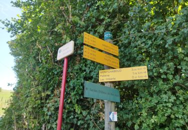
chemin bien balisé quelques beaux points de vue sur Grenoble.
cependant des passages pentus et les batons sont recommandés surtout après des périodes de fortes pluies.
Positioning
Country:
France
Region :
Auvergne-Rhône-Alpes
Department/Province :
Isère
Municipality :
Eybens
Location:
Unknown
Start:(Dec)
Start:(UTM)
716591 ; 5003022 (31T) N.
Comments
Trails nearby
![Trail Mountain bike Grenoble - Grande Traversée des PréAlpes à VTT : Grenoble - Sisteron - Digne les Bains - Photo](https://media.geolcdn.com/t/375/260/ext.jpg?maxdim=2&url=https%3A%2F%2Fservices.sitytrail.com%2FGeolivesWS%2FDownloadMedia.ashx%3FTrailID%3D102152%26Media%3D2542_2.jpg)
![Mountain bike Mountain bike](https://static1.geolcdn.com/sitytour/trail-icons/202.png)
Grande Traversée des PréAlpes à VTT : Grenoble - Sisteron - Digne les Bains
Mountain bike
Very difficult
(2)
Grenoble,
Auvergne-Rhône-Alpes,
Isère,
France
![](/images/other/stat-length.png)
375 km | 539 km-effort
48h 0min
![](https://static1.geolcdn.com/siteimages/upload/files/16400158638029165_repeat_loop_refresh_sync_direction_icon.png)
No
![Trail On foot Gières - De Gières au col du Gourlu - Photo](https://media.geolcdn.com/t/375/260/ext.jpg?maxdim=2&url=https%3A%2F%2Fmedia.geolcdn.com%2Ff%2Fb782ea79-2f14-452c-9af6-76dad2fec664.jpeg)
![On foot On foot](https://static1.geolcdn.com/sitytour/trail-icons/100.png)
De Gières au col du Gourlu
On foot
Easy
Gières,
Auvergne-Rhône-Alpes,
Isère,
France
![](/images/other/stat-length.png)
6.2 km | 10.5 km-effort
2h 22min
![](https://static1.geolcdn.com/siteimages/upload/files/16400158638029165_repeat_loop_refresh_sync_direction_icon.png)
No
![Trail Walking Gières - Boucle Mûrier - Venon depuis Gières - Photo](https://media.geolcdn.com/t/375/260/ext.jpg?maxdim=2&url=https%3A%2F%2Fmedia.geolcdn.com%2Ff%2Fc6968e08-c2d2-4d10-9d70-51d89710f0b1.jpg)
![Walking Walking](https://static1.geolcdn.com/sitytour/trail-icons/101.png)
Boucle Mûrier - Venon depuis Gières
Walking
Medium
Gières,
Auvergne-Rhône-Alpes,
Isère,
France
![](/images/other/stat-length.png)
17.9 km | 29 km-effort
4h 10min
![](https://static1.geolcdn.com/siteimages/upload/files/16400158638029165_repeat_loop_refresh_sync_direction_icon.png)
Yes
![Trail Nordic walking Jarrie - Mon chabou -haut jarret - Photo](https://media.geolcdn.com/t/375/260/ext.jpg?maxdim=2&url=https%3A%2F%2Fmedia.geolcdn.com%2Ff%2F8d9b08e7-4849-40d2-bae6-1be2c82dc5a3.jpg)
![Nordic walking Nordic walking](https://static1.geolcdn.com/sitytour/trail-icons/102.png)
Mon chabou -haut jarret
Nordic walking
Very easy
Jarrie,
Auvergne-Rhône-Alpes,
Isère,
France
![](/images/other/stat-length.png)
10.2 km | 14.6 km-effort
2h 21min
![](https://static1.geolcdn.com/siteimages/upload/files/16400158638029165_repeat_loop_refresh_sync_direction_icon.png)
Yes
![Trail Walking Brié-et-Angonnes - Brié - Montchabout - Sommet de Pravena - Photo](https://media.geolcdn.com/t/375/260/ext.jpg?maxdim=2&url=https%3A%2F%2Fmedia.geolcdn.com%2Ff%2F0f2df736-86ba-41cf-8335-b76275aca73b.jpg)
![Walking Walking](https://static1.geolcdn.com/sitytour/trail-icons/101.png)
Brié - Montchabout - Sommet de Pravena
Walking
Medium
Brié-et-Angonnes,
Auvergne-Rhône-Alpes,
Isère,
France
![](/images/other/stat-length.png)
14.5 km | 23 km-effort
4h 19min
![](https://static1.geolcdn.com/siteimages/upload/files/16400158638029165_repeat_loop_refresh_sync_direction_icon.png)
Yes
![Trail Walking Venon - Autour de Venon - Photo](https://media.geolcdn.com/t/375/260/ext.jpg?maxdim=2&url=https%3A%2F%2Fmedia.geolcdn.com%2Ff%2F86166516-4b24-4596-8646-daaf4d04dbc3.jpg)
![Walking Walking](https://static1.geolcdn.com/sitytour/trail-icons/101.png)
Autour de Venon
Walking
Easy
Venon,
Auvergne-Rhône-Alpes,
Isère,
France
![](/images/other/stat-length.png)
9.9 km | 14.9 km-effort
3h 23min
![](https://static1.geolcdn.com/siteimages/upload/files/16400158638029165_repeat_loop_refresh_sync_direction_icon.png)
Yes
![Trail Walking Brié-et-Angonnes - Brié- Table d'orientation - Photo](https://media.geolcdn.com/t/375/260/ext.jpg?maxdim=2&url=https%3A%2F%2Fmedia.geolcdn.com%2Ff%2F7bbbe70d-bffa-4966-9f56-9fa776cf97b0.jpg)
![Walking Walking](https://static1.geolcdn.com/sitytour/trail-icons/101.png)
Brié- Table d'orientation
Walking
Very easy
Brié-et-Angonnes,
Auvergne-Rhône-Alpes,
Isère,
France
![](/images/other/stat-length.png)
3.1 km | 4.3 km-effort
59min
![](https://static1.geolcdn.com/siteimages/upload/files/16400158638029165_repeat_loop_refresh_sync_direction_icon.png)
Yes
![Trail Nordic walking Jarrie - Château de Bon Repos, Bois de Bouchassey, Saut du Moine - Photo](https://media.geolcdn.com/t/375/260/ext.jpg?maxdim=2&url=https%3A%2F%2Fmedia.geolcdn.com%2Ff%2F6035c0cd-abfc-41ef-b589-8891c45ae620.jpg)
![Nordic walking Nordic walking](https://static1.geolcdn.com/sitytour/trail-icons/102.png)
Château de Bon Repos, Bois de Bouchassey, Saut du Moine
Nordic walking
Easy
Jarrie,
Auvergne-Rhône-Alpes,
Isère,
France
![](/images/other/stat-length.png)
9.6 km | 13.7 km-effort
2h 18min
![](https://static1.geolcdn.com/siteimages/upload/files/16400158638029165_repeat_loop_refresh_sync_direction_icon.png)
Yes
![Trail On foot Venon - Boucle De Panama - Photo](https://media.geolcdn.com/t/375/260/ext.jpg?maxdim=2&url=https%3A%2F%2Fmedia.geolcdn.com%2Ff%2F98c9c040-31fc-43e3-8f7d-d8e9c60a8343.jpeg)
![On foot On foot](https://static1.geolcdn.com/sitytour/trail-icons/100.png)
Boucle De Panama
On foot
Easy
Venon,
Auvergne-Rhône-Alpes,
Isère,
France
![](/images/other/stat-length.png)
4.2 km | 6.3 km-effort
1h 26min
![](https://static1.geolcdn.com/siteimages/upload/files/16400158638029165_repeat_loop_refresh_sync_direction_icon.png)
Yes