23 km | 36 km-effort
Randoguide
virginieHurpeau
User
Length
8.1 km
Max alt
1267 m
Uphill gradient
214 m
Km-Effort
11 km
Min alt
1145 m
Downhill gradient
214 m
Boucle
Yes
Creation date :
2014-12-10 00:00:00.0
Updated on :
2014-12-10 00:00:00.0
3h41
Difficulty : Medium
FREE GPS app for hiking
About
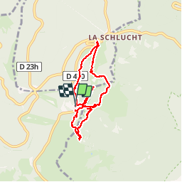
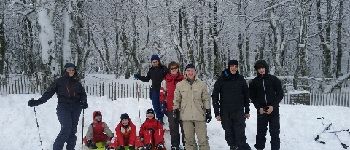
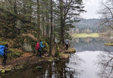
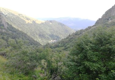
Trail Snowshoes of 8.1 km to be discovered at Grand Est, Vosges, Xonrupt-Longemer. This trail is proposed by virginieHurpeau.
Positioning
Country:
France
Region :
Grand Est
Department/Province :
Vosges
Municipality :
Xonrupt-Longemer
Location:
Unknown
Start:(Dec)
Start:(UTM)
352032 ; 5323970 (32U) N.
Comments
Trails nearby
2023-04-16 Marche Abri Lac de Blanchemer vers Lac de Lispach
Walking
Very difficult
(1)
La Bresse,
Grand Est,
Vosges,
France
8h 4min
No
Lac de Lispach et sentier Dielaine
Walking
Medium
(1)
La Bresse,
Grand Est,
Vosges,
France
9.7 km | 14.9 km-effort
2h 30min
Yes
Tour du belvedere avec le passage sur les crêtes
Walking
Very easy
(2)
Stosswihr,
Grand Est,
Haut-Rhin,
France
8.5 km | 0 m-effort
2h 28min
Yes
Kastelberg des pierres, des lacs, des panoramas magnifiques
Walking
Difficult
(1)
La Bresse,
Grand Est,
Vosges,
France
15.1 km | 26 km-effort
6h 11min
Yes
Totom 4 lacs
Other activity
Medium
(1)
Soultzeren,
Grand Est,
Haut-Rhin,
France
15.6 km | 26 km-effort
4h 37min
Yes
Les 5 lacs autour du Hohneck
Walking
Very difficult
(1)
La Bresse,
Grand Est,
Vosges,
France
21 km | 36 km-effort
7h 21min
Yes
Les Hirschsteine
Walking
Difficult
(1)
Le Valtin,
Grand Est,
Vosges,
France
16.1 km | 25 km-effort
6h 28min
Yes
La vallée de Belbriette - Ban-sur-Meurthe-Clefcy
Walking
Medium
(2)
Ban-sur-Meurthe-Clefcy,
Grand Est,
Vosges,
France
9.8 km | 12.6 km-effort
2h 30min
Yes
Du Hohneck au Kastelberg par les Spietzkoepfe et le Sentier des Névées
Walking
Very difficult
(3)
La Bresse,
Grand Est,
Vosges,
France
7.6 km | 13.7 km-effort
3h 30min
Yes